Rogarjev rovt - Hruška planina
Starting point: Rogarjev rovt (1175 m)
Starting point Lat/Lon: 46.464°N 14.0111°E 
Time of walking: 30 min
Difficulty: easy unmarked way
Difficulty of skiing: easily
Altitude difference: 203 m
Altitude difference (by path): 203 m
Map: Karavanke - osrednji del 1:50.000
Access to starting point:
From highway Ljubljana - Jesenice we go to the exit Lipce and we follow the road in the direction of Jesenice, where signs for Planina pod Golico point us on an ascending road (third traffic light crossroad from the center or the railway station). Steep road brings us to a crossroad, where we turn left over a bridge towards Plavški Rovt. When we get into a village, we follow the road further to a spot, where the asphalt ends. After the village, the road descends a little, we run into its right turn off, but we drive further in the direction of straight. When we get to a smaller hamlet, at the crossroad we notice a wooden signpost "Dovje 9 km". Here we turn sharply left and we continue on a winding forest road for 3 more km, whereupon we get to a larger meadow with holiday cottages on the left. Right, on a larger turn we notice a cart track which runs through a meadow, uphill towards the north. We park on an appropriate place nearby.
Path description:
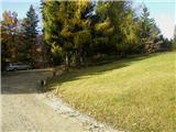
We start on the mentioned cart track similar to a road (almost unfit for driving with a personal car), uphill towards the north. It quickly brings us into the forest, where it starts quite steeply ascending. When a path turns a little to the right and splits, we continue on the right increasingly steep uphill. The path is getting more and more appearance of a settled forest road. After a few hairpin turns, the steepness gradually starts decreasing, eventually when on the right opens a view towards the saddle Rožca and Klek, the road finally flattens. After a short time the path again ascends a little, and we soon run into a fence with a gate. We enter on the mountain pasture, where at first we see Hruški Vrh, and the path through some turns, after crossing the stream and last shorter ascent brings us to the shepherd hut on Hruška planina. On the wall, in front of the entrance into the cottage, we will notice an inscription box.
Pictures:
 1
1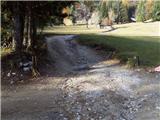 2
2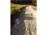 3
3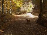 4
4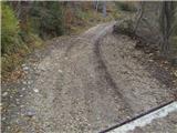 5
5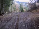 6
6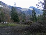 7
7 8
8 9
9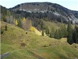 10
10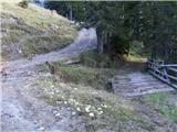 11
11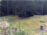 12
12 13
13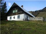 14
14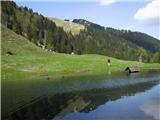 15
15