Sebenje - Sebenje (Pot treh zvonov)
Starting point: Sebenje (500 m)
| Latitude/Longitude: | 46,33040°N 14,29930°E |
| |
Route name: Pot treh zvonov
Walking time: 2 h 30 min
Difficulty: easy marked way
Elevation gain: 0 m
Elevation difference along the route: 150 m
Map: Karavanke - osrednji del 1:50.000
Recommended equipment (summer):
Recommended equipment (winter):
Views: 6.590
 | 1 person like this post |
Access to starting point:
A) From the Ljubljana-Jesenice highway, take the Naklo exit, then continue left in the direction of the Trnovc camp. Further on, drive through Žeje, Spodnje and Zgornje Duplje and past two turn-offs of the road to Žiganjo vas. A little further along the main road, notice the signs for Sebenje, which direct us right. A somewhat narrower road then takes us into the village, and from the intersection at the chapel we continue right and after a good 100 m of further driving arrive at the next intersection, where the described path begins. Park somewhere nearby, best on the parking lot of the Sebenje Ski Jumping Club.
B) From the Jesenice-Ljubljana highway, at the Podtabor junction, turn onto the Tržič exit, then drive along the main road towards Ljubelj. Before the Petrol gas station in Bistrica pri Tržiču, turn right, descend to the traffic-light intersection, where turn sharply right in the direction of Golnik. Further on, drive along the main road towards Kranj, and after the settlement Retnje soon go left in the direction of the Sebenje settlement. A somewhat narrower road then takes us into the village, and from the intersection at the chapel we continue right and after a good 100 m of further driving arrive at the next intersection, where the described path begins. Park somewhere nearby, best on the parking lot of the Sebenje Ski Jumping Club.
Route description:
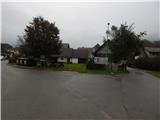
At the starting point there is an information board of the Pot treh zvonov path and directional arrows, which direct us onto a side road. The path first leads among houses, where at the first crossroad we go right, then behind a larger chapel houses gradually become sparser. We continue straight along the road, which loses its asphalt covering and a little further transitions into the forest. At the entrance to the forest, next to the trim course, there is the first bell, and we walk along the road, which first rises gently, then continues without major changes in altitude. After a while the road descends slightly and brings us from the forest onto extensive meadows south of the settlement Senično. Here at the crossroad we continue right, the path then leads past the paragliding landing site. The macadam road leads us for some time across extensive meadows, then we reach an asphalt road, which we follow to the left (right - hamlet Novake).
Immediately after the crossroad there is the second bell, the asphalt road brings us in a few minutes to the next crossroad, where we go right (left - Golnik). The path ahead leads past a few houses, at the crossroad where the asphalt ends we go right. When a little ahead we arrive at the edge of the forest, beside the regular signs for the Pot treh zvonov path, now for the first time we also notice signs for Žiganjo vas, to which we have less than an hour of walking.
We arrive at the mentioned village by ascending gently through the forest for quite some time, then a short steeper descent to the mentioned village follows. Through the village we follow the signs of the Pot treh zvonov path, and a few minutes further we arrive in Sebenje and a little further to the beginning and end of our path.
Description and pictures refer to the condition in 2017 (September).

Photos:
 1
1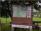 2
2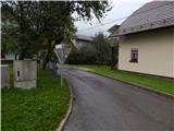 3
3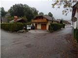 4
4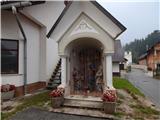 5
5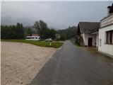 6
6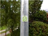 7
7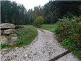 8
8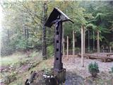 9
9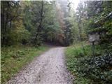 10
10 11
11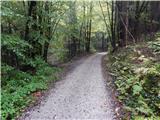 12
12 13
13 14
14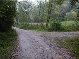 15
15 16
16 17
17 18
18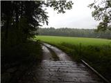 19
19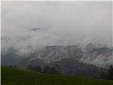 20
20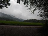 21
21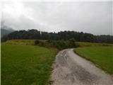 22
22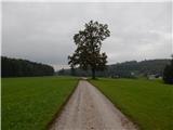 23
23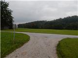 24
24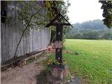 25
25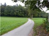 26
26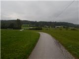 27
27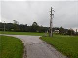 28
28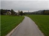 29
29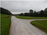 30
30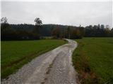 31
31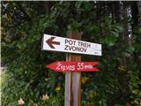 32
32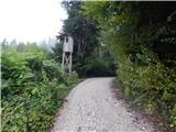 33
33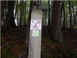 34
34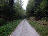 35
35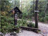 36
36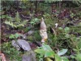 37
37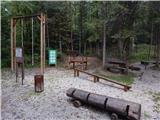 38
38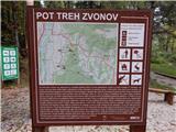 39
39 40
40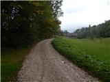 41
41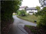 42
42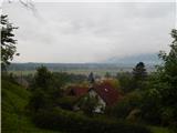 43
43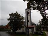 44
44 45
45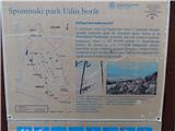 46
46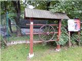 47
47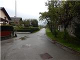 48
48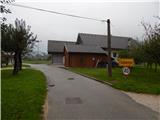 49
49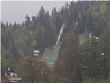 50
5051
Discussion about the trip Sebenje - Sebenje (Pot treh zvonov)
|
| MateZ9. 01. 2022 17:01:53 |
Nice path, not demanding at all, in snow a bit romantic and definitely worth visiting on a lazy day when one doesn't feel like going higher. Asphalt section not too long and not very busy. And we saw another ski jumping center ... I thought we knew them all. Praise to the club for the idea and good markings, maybe add a stamp later.
|
|
|
To post a comment you must log in:
If you do not yet have a username, you must first
register.