Selca - Miklavška gora (by road)
Starting point: Selca (430 m)
| Latitude/Longitude: | 46,22200°N 14,19340°E |
| |
Route name: by road
Walking time: 1 h 45 min
Difficulty: easy unmarked way
Elevation gain: 525 m
Elevation difference along the route: 525 m
Map: Škofjeloško in Cerkljansko hribovje 1:50.000
Recommended equipment (summer):
Recommended equipment (winter):
Views: 5.939
 | 3 people like this post |
Access to starting point:
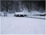
From Škofja Loka we drive towards Železniki or vice versa. Only about 500 meters after (or before, if we come from the direction of Železniki) village Selca we notice the sign with the caption "športni park Rovn" (sports park Rovn), which points us to the left (from Železniki right). We park on a parking lot near the mentioned sports park.
Route description:
From the parking lot, we at first walk to the hut of Kennel Club (it is situated on the left - eastern side of the park). Here we will notice a steep cart track which goes sharply right upwards (footpath on Miklavška gora), and we continue on the road which runs on the right bank of river Selščica and only a little further brings us to a smaller crossroad, where we continue right upwards on an asphalt road (and next to a crossroad we will also notice the sign on which the path on Miklavška gora is drawn).
The road which runs through the forest immediately starts ascending steeper and crosses at first quite steep slopes. Higher, the road passes out of the forest on panoramic partly grassy slopes and then through the village brings us to a less noticeable crossing, which is situated a little above the village Spodnja Golica. Here from the left side, the path from Dolenja vas joins, and we continue on the asphalt road which with nice views brings us to the village Zgornja Golica. In the middle of the mentioned village, we come to an unmarked crossroad, where we continue on the right road which only a little further brings us on a small saddle on which we leave the road and we continue right towards the chapel, which we clearly see by the edge of a meadow.
At the chapel, the road finally changes into a cart track which turns to the left and starts ascending steeper. Further, we are ascending on a cart track which in a semicircle bypasses the peak of Miklavška gora and only a little below the summit comes out of the forest on a pleasant grassy meadow. Only a 5-minute ascent follows on the more and more panoramic slope to the church of St. Miklavž.

Photos:
 1
1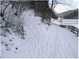 2
2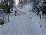 3
3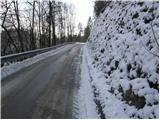 4
4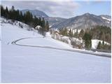 5
5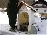 6
6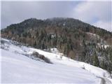 7
7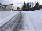 8
8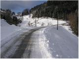 9
9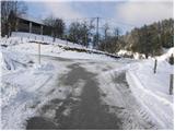 10
10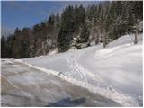 11
11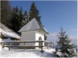 12
12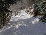 13
13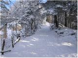 14
14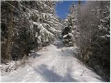 15
15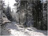 16
16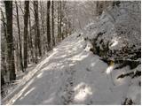 17
17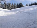 18
18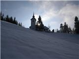 19
19 20
20
Discussion about the trip Selca - Miklavška gora (by road)
|
| grega_p20. 02. 2021 |
St. Nicholas was blowing today, but he didn't cover the sun with clouds, instead offered nice views around, especially on the snowy Ratitovec.
The ascent along the ruined road from the chapel is quite steep, 15-20min from the chapel.
|
|
|
To post a comment you must log in:
If you do not yet have a username, you must first
register.