Široko - Veliki vrh (above Lom) (via Kanalski Lom - on trail Lom is my home)
Starting point: Široko (750 m)
Starting point Lat/Lon: 46.13207°N 13.75932°E 
Path name: via Kanalski Lom - on trail Lom is my home
Time of walking: 2 h 40 min
Difficulty: easy marked way
Difficulty of skiing: no data
Altitude difference: 321 m
Altitude difference (by path): 530 m
Map:
Access to starting point:
The starting point is at Tourist farm Široko in Tolminski Lom. In detail are described accesses from the direction of Nova Gorica and Idrija, the access is possible also from the direction Tolmin and via plateau Banjška planota through Kanalski Lom.
A) From Nova Gorica, we follow the signs for Bovec and Tolmin, we drive through Kanal and then we pay attention to the turn-off for Most na Soči (in the direction of Idrija and Ljubljana). We continue driving through the village Kozaršče, in the center of Most na Soči at the crossroad we turn right in the direction of Lom (straight - direction Ljubljana, left - direction Tolmin). When we cross the bridge over the river Idrijca, we continue on a steep local road into a sharp right turn. The road is next 4 kilometers ascending and it brings us to a saddle, where a steep road towards Sveta Gora branches off to the left towards Tourist farm Široko. After a little less than two kilometers of further ascending, we get to the tourist farm, where we look for the parking spot.
B) From the direction Idrija we follow the signs for Tolmin. In the center of Most na Soči at the crossroad we turn sharply left in the direction of Lom (straight - direction Nova Gorica, right - direction Tolmin). When we cross the bridge over the river Idrijca, we continue on a steep local road into a sharp right turn. The road is next 4 kilometers ascending and it brings us to a saddle, where a steep road towards Sveta Gora branches off to the left towards Tourist farm Široko. After a little less than two kilometers of further ascending, we get to the tourist farm, where we look for the parking spot.
Path description:
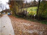
The path is undemanding and well-marked with signposts and blue-yellow blazes (hiking trail "Lom is my home"), but we still have to pay attention because of numerous crossroads and turn-offs. It runs on diverse grounding – cart tracks, forest paths, concrete and asphalt roads and footpaths. By the path there are several attractions, which are described on info signposts. The peak is very panoramic. When we park at the tourist farm, we can go to the vantage point above the farm, otherwise we look for the starting point, which is a little lower from the end of the asphalt road, below the restaurant garden. Here signpost points us to a cart track which is descending towards Mary's chapel. From the chapel we are for some time descending on a cart track, and then we get to a concrete road which runs through the hamlet. Outside the hamlet, immediately after the lonely house at the right turn at the concrete power line pole we turn from the road to the left downwards on a poorly visible cart track which leads through meadows. In the warmer part of the year the sheep can graze here, but we can open the fence. On the cart track, we get to a riverbed of the stream, which we have to cross (we don't turn immediately past the houses!), we then get to a concrete road which we follow right past two houses and marked trough to another hamlet, where a concrete road joins the asphalt local road. Here is the lowest point of the path and on a smaller building there is an information board. We can we walk straight to an interesting chapel just by the local road, otherwise we continue to the left past the field. Behind the last house in the hamlet, we turn to the left on a less steep road which runs towards the church, but before the slope, which leads to it, at the abandoned building we again turn left. When we come to the next houses, we follow the road on the slope to the left (straight there is a yard of the farm), which past the hayrack brings us to homestead Martinova domačija with an interesting arched pond. Here we go to the right and we continue on a cart track which brings us to the cemetery. To the right we can walk to the church, otherwise we continue on the road to the right past several houses and smithy Arnejeva kovačija with rocky roof tiles.
At the next crossroad on the top of the slope, we turn right and we follow the road to the first sharp right turn. Here we leave the asphalt and we go straight through the door on a cart track on a fenced pasture. At the trough for livestock, we turn from a wider path to the right narrower path which leads uphill through the pasture and which in the beginning of grazing season can be covered with higher grass. It is recommended, that we then stick more to the left, because the path there is better. Higher, the path vanishes a little, but we soon notice a smaller cottage and with a blue color colored door, through which we get to the mentioned cottage on Kal. A sign on the cottage point us to the left towards abyss Brezno v Špilah. We follow a gentle and wide forest road, ahead through the pasture, where we can on the right observe Močilo na Kalu, and then through the gate ahead through the forest. Higher the wide road ends, and we go ahead on a narrower forest cart track, but already after few steps we turn to the right. Further, the cart track in few turns steeply ascends to a crossroad with a wider forest cart track which gently crosses the forest. To the left or straight we can return back to the starting point in Široko, and towards Veliki vrh we continue sharply right. The path then leads us past the abyss Brezno v Špilah a little higher from the path which is settled for sightseeing. Further, the path after few turns narrows and ascends to the border stone. After the border stone, we turn right on again a little wider path. And in a dried spruce forest, just before the clearing, we leave the path and we turn right on a narrower footpath. It brings us on an indistinct ridge, which is gently rising towards Veliki vrh. After few minutes of walking by footpath we notice a preserved position from the 1st world war, then after a short descent follows only a short ascent to the top. Just below the summit we run into a bench and information board with theme of the 1st world war, and to the top we have only few meters of ascent. On the top there are also benches and miniature Aljaž turret with an inscription book (we can open it by lifting the cover). We can return on the same path and after abyss Brezno v Špilah past the vantage point Ledince we continue straight to Široko, where we come to in hour and a half. Or we can continue on the trail »Lom is my home« via Grudnica, which extends the path for 30 minutes compared to the first variant.
On the way: Razgledna točka Široko (755m)
Pictures:
 1
1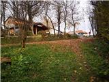 2
2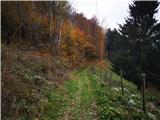 3
3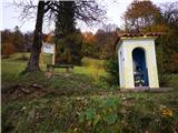 4
4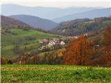 5
5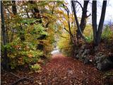 6
6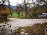 7
7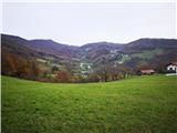 8
8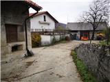 9
9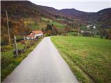 10
10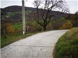 11
11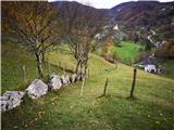 12
12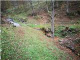 13
13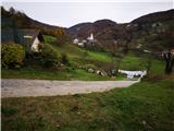 14
14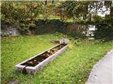 15
15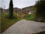 16
16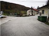 17
17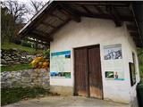 18
18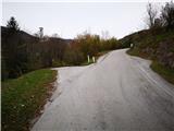 19
19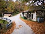 20
20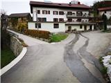 21
21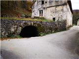 22
22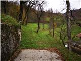 23
23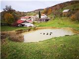 24
24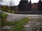 25
25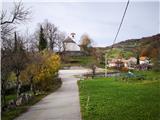 26
26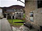 27
27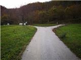 28
28 29
29 30
30 31
31 32
32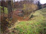 33
33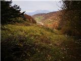 34
34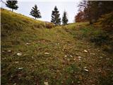 35
35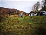 36
36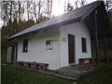 37
37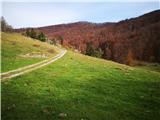 38
38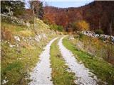 39
39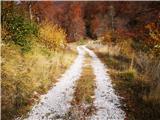 40
40 41
41 42
42 43
43 44
44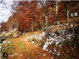 45
45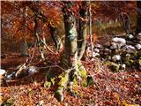 46
46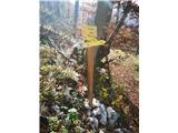 47
47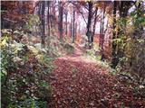 48
48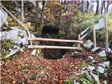 49
49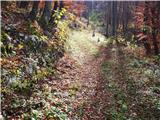 50
50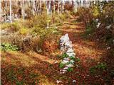 51
51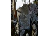 52
52 53
53 54
54 55
55 56
56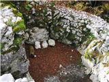 57
57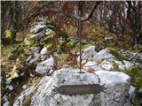 58
58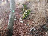 59
59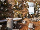 60
60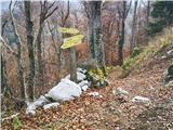 61
61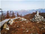 62
62 63
63