Slevo - Kamniški vrh (direct way)
Starting point: Slevo (650 m)
| Latitude/Longitude: | 46,27400°N 14,57090°E |
| |
Route name: direct way
Walking time: 1 h 30 min
Difficulty: difficult unmarked way
Elevation gain: 609 m
Elevation difference along the route: 609 m
Map: Kamniške in Savinjske Alpe 1:50.000
Recommended equipment (summer):
Recommended equipment (winter): ice axe, crampons
Views: 41.954
 | 6 people like this post |
Access to starting point:
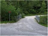
First, we drive to Kamnik, and then we continue driving towards Stahovica. Before we get to Stahovica, more precisely past the village Godič, we leave the main road and continue driving left in the direction of Županje Njive. At the next crossroad, we continue left in the direction of Bistričica, and we follow the road to the village Klemenčevo, where we turn right over a smaller bridge towards the village Slevo (by the crossroad or by the bridge are signs for Kamniški vrh and Krvavec). Further, we drive on an ascending road which then leads us through the village Slevo, and after approximately 1 km from the small bridge we get to a smaller quarry, by which we can park in an appropriate place. Locals prefer parking immediately after the small bridge over the Bistričica; this extends the path by approximately 15 minutes.
Route description:
If we've parked below at the bridge, we first walk to the quarry above the village Slevo, and from there at the crossing of cart tracks we continue on the left one, which the signs for Kamniški vrh and Krvavec also direct us to. Further, the cart track moderately ascends gentle grassy meadows. After approximately 15 minutes of walking from the quarry we get to a spot where a footpath from the valley also joins from the left, and at this spot we leave the marked path, which continues towards Krvavec and Kamniški vrh over the mountain pasture Osredek, and continue right on a well-beaten but unmarked footpath. The easy path then leads us over a gentle meadow, on which in a few minutes we get to a decaying shack.
Above the shack the slope gradually stands upright, and the path starts to ascend steeper and steeper. From the gentle grassy slopes we quickly get to the slope named Strme senožeti. We continue the ascent on a slightly vegetated slope, and the path leads us directly above a distinct gully, in the middle of which is a narrower scree (part of the descent is possible on the scree).
A pretty steep path, which in wet conditions is very dangerous for slipping, flattens after approximately 30 minutes, then quickly brings us to the saddle between Planjava on the left and Kamniški vrh on the right.
Here we return to the marked path, and we follow it right in the direction of Kamniški vrh (left: Planjava, mountain pasture Osredek, Krvavec and valley Korošica). From here follows approximately 15 minutes of moderate ascent, and the partly panoramic path brings us to the logbook box on Kamniški vrh.
From the top we can continue a few tens of meters further to the nearby bivouac.

Photos:
 1
1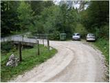 2
2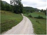 3
3 4
4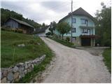 5
5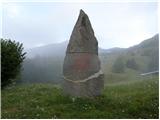 6
6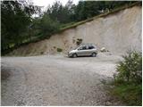 7
7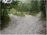 8
8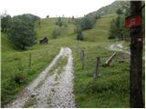 9
9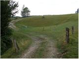 10
10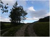 11
11 12
12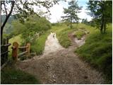 13
13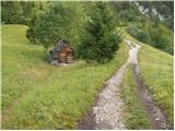 14
14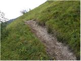 15
15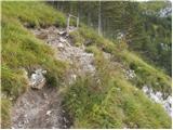 16
16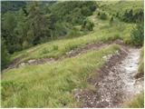 17
17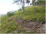 18
18 19
19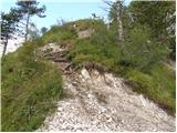 20
20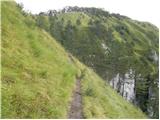 21
21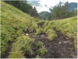 22
22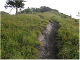 23
23 24
24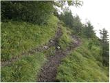 25
25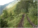 26
26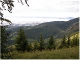 27
27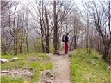 28
28 29
29
Discussion about the trip Slevo - Kamniški vrh (direct way)
|
| Gost16. 06. 2007 |
I have one comment on the above description of the path to Slevo - in Stahovica we turn left into the village of Kogejevo. The village of Klemenčevo is higher up at least 2 km. And in Bistričica you won't spot the church either, because dense trees cover it. Otherwise, the path from Slevo is nice, it ascends continuously, but when returning from Kamniški vrh on the other side (if we want to wolf down a sausage Otherwise, the path from Slevo is nice, it ascends continuously, but when returning from Kamniški vrh on the other side (if we want to wolf down a sausage  ) it's really very slippery - in good weather, I can't imagine what it's like in the rain. There are many various paths that eventually all lead back to Slevo. ) it's really very slippery - in good weather, I can't imagine what it's like in the rain. There are many various paths that eventually all lead back to Slevo.
|
|
|
|
| geppo23. 02. 2008 |
Today 23.2.2008 we visited this summit. The path is really very steep in the last part. We returned via planina Osredek. The descent is also very steep and can be quite dangerous in different weather conditions, as they were today ( dry, no snow and nice sunny ).Otherwise, a very nice trip and not too demanding - very interesting landscape! Parked at the bridge!
|
|
|
|
| fpetel128. 10. 2008 |
Very nice trip. The descent on the other side east of the summit past the bench seemed to me even a bit steeper and more slippery, but both can be quite dangerous in snow and wet.
|
|
|
|
| tejca12. 03. 2012 |
Very nice hike, only on the return, between the rocks I think the path could be a bit better secured and reinforced. It's quite dangerous.
|
|
|
|
| Batistuta15. 08. 2022 17:49:38 |
Today I walked this path, personally I would classify it as an extremely easy well-visible path. I see no reason for it to be a difficult path, I met many families with children, there is absolutely nothing demanding on the path. Unless of course you have no fitness .
|
|
|
To post a comment you must log in:
If you do not yet have a username, you must first
register.