Slovenji Plajberk / Windisch Bleiberg - Veliki Rob / Großer Rain (via Veronjak / Hausberg)
Starting point: Slovenji Plajberk / Windisch Bleiberg (948 m)
Starting point Lat/Lon: 46.4902°N 14.2393°E 
Path name: via Veronjak / Hausberg
Time of walking: 2 h 15 min
Difficulty: easy unmarked way
Difficulty of skiing: no data
Altitude difference: 516 m
Altitude difference (by path): 565 m
Map: Karavanke - osrednji del 1:50.000
Access to starting point:
Over the border crossing Ljubelj we drive to Austria, and after few kilometers we turn left towards the valley Poden / Bodental. Next follows some ascent, and then we get to the settlement Slovenji Plajberk / Windisch Bleiberg, where we park on a parking lot below the church.
Path description:
From the parking lot below the church we continue straight and we quickly get to the inn Gasthaus Kirchenwirt and Windisch Bleiberg, where before the inn marked path on Žingarica / Singerberg branches off to the right, after the inn and still before the end of the settlement, marked path branches off to the left towards the valley Poden / Bodental.
We continue left, we cross the bridge and we ascend to the near chapel. At the chapel, we continue straight (possible also sharply right, in this case higher we short time walk on the asphalt road) and we go past few houses to the nearby hayrack, where we leave the road.
We continue right, where on a nearby tree we notice a sign of the path 17. The path ahead leads us by the edge of the forest, higher also through a lane of a forest and then by the edge of a pasture to an asphalt road which we reach by the chapel. We cross the road towards the right (left settlement Žabnica / Bodental) and we continue in the direction of "Bodental, Sonnenhang 15 min."
Next follows a diagonal ascent through a lane of a forest, and we walk on the path number 2. A little further, the forest ends and with nice views on the main Karawanks we reach boarding house Lužekar / BergPension Lausegger.
Behind the inn there is a stable, above which we ascend on the asphalt road, and then we continue on a worse macadam road which ascends diagonally, and a little ahead it turns sharply left and with nice views and through a lane of a forest it brings us to the hunting observatory and fenced pasture. A little above the hunting observatory we continue in the forest, on a footpath in the direction of hiking path number 13, which continues without large changes in altitude, and most of the time it continues along the fence. And when we gradually go away from the pasture from the path number 13 slightly to the left path number 3 branches off, on which we continue walking.
Only a little further, we cross a cart track, and the path turns a little to the left and a little higher it joins the cart track, on which we for some time continue. When higher on an indistinct ridge we reach a grazing fence, we leave the cart track and we continue left in the forest, where we soon notice signs of the path number 3, and the path continues on a ridge and all the time runs left from the wire fence. Next follows a shorter descent, which brings us to small panoramic saddle, and then we start ascending through the forest, and the path in some parts is quite steep. Higher the forest gets thinner and with views on Karawanks we reach Veronjak.
From Veronjak we at first steeply descend on the southwestern ridge, after that steepness decreases and after a small saddle, where from the right a footpath from the nearby forest road joins, the path again starts ascending. A little further, we cross a cart track, and the path passes on overgrown clearing, from which a nice view opens up on the northern walls of Košuta. Higher, the path returns into the forest and continues on a ridge. When we eventually cross the next forest road, where from the left joins the path which doesn't lead over Veronjak, we continue straight and in few minutes of additional walking, we reach the peak of Veliki Rob.
Slovenji Plajberk / Windisch Bleiberg - Veronjak / Hausberg 1:25, Veronjak / Hausberg - Veliki Rob / Großer Rain 0:50.
Description refers to condition in October 2019, and pictures are from November 2018 and October 2019.
On the way: Lužekar / Lausegger (1085m), Veronjak / Hausberg (1348m)
Pictures:
 1
1 2
2 3
3 4
4 5
5 6
6 7
7 8
8 9
9 10
10 11
11 12
12 13
13 14
14 15
15 16
16 17
17 18
18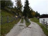 19
19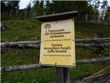 20
20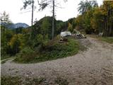 21
21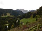 22
22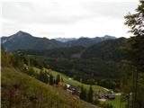 23
23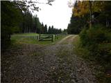 24
24 25
25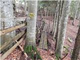 26
26 27
27 28
28 29
29 30
30 31
31 32
32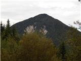 33
33 34
34 35
35 36
36 37
37 38
38 39
39 40
40 41
41 42
42 43
43 44
44 45
45 46
46 47
47 48
48 49
49 50
50 51
51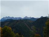 52
52 53
53 54
54 55
55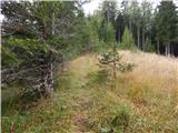 56
56 57
57 58
58 59
59 60
60 61
61 62
62 63
63