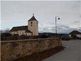
Šmartno na Pohorju - Majalova kapelica
Starting point: Šmartno na Pohorju (780 m)
Starting point Lat/Lon: 46.44504°N 15.54013°E 
Time of walking: 45 min
Difficulty: easy marked way
Difficulty of skiing: no data
Altitude difference: 43 m
Altitude difference (by path): 60 m
Map: Pohorje 1:50.000
Access to starting point:
We leave Štajerska highway at exit Slovenska Bistrica south or north (depending on which direction we come from), and then we drive into the center of Slovenska Bistrica, from where we go on the road in the direction of the settlement Šmartno na Pohorju. Next follows few kilometers of ascent, and we follow the road in the direction of the mentioned settlement. When we get to Šmartno na Pohorju, we park on a smaller settled parking lot at the cemetery and church of St. Martin.
Path description:
From the parking lot in few steps we walk to the main road which leads through the settlement, and we follow it to the right, where also the blazes point us to. For a short time, we walk through the center of the settlement, and then with nice views, we walk to a smaller crossroad, at a little bigger chapel.
Here we continue straight (right - Ruška koča na Arehu - path via Frajhajm) and few minutes further we get to the next marked crossroad, from which we also continue straight (left - Sveti Trije kralji) and we moderately ascend past individual houses and inn Dovnik. Next follows crossing of a lane of a forest and then we descend a little to a crossroad, where we continue right towards Areh and Bojtina.
After the crossroad, the road descends even a little more, and from there a marked path branches off right downwards towards Areh, and we continue on the road which is still moderately descending to the nearby crossroad. When we get to the crossroad we continue straight (right road leads forward towards Areh), where we go past the information board of Forest teaching trail, which is situated by the crossroad, and only a little further we cross also a smaller stream and behind it we continue on a slightly left road (on the right road we could also come to the homestead Majal), which a little ahead comes out of the forest. When we step out of the forest, on the right, on a smaller hill we already notice a chapel Majalova kapelica, and we continue on the road which through a narrower lane of a forest brings us to the homestead Majal.
Here we go right and by the homestead we walk to the nearby chapel.
Description and pictures refer to a condition in January 2022.
Pictures:
 1
1 2
2 3
3 4
4 5
5 6
6 7
7 8
8 9
9 10
10 11
11 12
12 13
13 14
14 15
15 16
16 17
17 18
18 19
19 20
20 21
21 22
22 23
23 24
24