Spodnja Lipnica (Kolnica) - Ažmanov rovt (upper part on the road)
Starting point: Spodnja Lipnica (Kolnica) (490 m)
Starting point Lat/Lon: 46.3206°N 14.1629°E 
Path name: upper part on the road
Time of walking: 2 h
Difficulty: easy marked way
Difficulty of skiing: no data
Altitude difference: 470 m
Altitude difference (by path): 520 m
Map: Karavanke - osrednji del 1:50.000
Access to starting point:
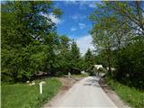
A) From highway Ljubljana - Jesenice we go to the exit Naklo, Podtabor or Brezje, and then we continue driving in the direction of Kropa. At the crossroad, where in the direction of straight road continues towards Kropa we turn right and further we drive through Kamna Gorica. Ahead we for some time still drive through the valley Lipniška dolina, and then we turn left in the direction of Spodnja Lipnica and hunting cottage Lovska koča na Taležu. Before hamlet Kolnica and still before we second time cross the stream Lipnica (first time we cross the stream at the end of Spodnja Lipnica), we park by the information board of Water learning trail Grabnarca.
B) From highway Jesenice - Ljubljana we go to the exit Lesce or Radovljica, and then we continue driving in the direction of Radovljica and later village Lancovo, Lipnica and Kamna Gorica. Further road over a bridge crosses the river Sava and on the other side it gradually starts ascending. The path ahead leads us through Lancovo, and then we descend into a valley Lipniška dolina, where we soon turn right into Spodnja Lipnica, from there we continue driving towards Talež. Before hamlet Kolnica and still before we second time cross the stream Lipnica (first time we cross the stream at the end of Spodnja Lipnica), we park by the information board of Water learning trail Grabnarca.
Path description:
From the starting point, we continue left on a bad road, and after few 10 strides from the crossing we go left and we continue walking on a wide ascending cart track. For some time we are ascending diagonally towards the left, where the path leads us past a smaller source, we then continue sharply right in the direction towards Razpok. A little further, the cart track again turns to the left, and at the next crossing we go once again right towards Razpok. Next follows some diagonal ascent towards the right, and the cart track changes into a forest footpath which is a little worse beaten, but it is quite easy followable, and higher by the path there are also few older blazes. During the ascent occasionally a view opens up a little towards the Karawanks and part of Kamnik Savinja Alps, and the path leads us also past a smaller religious symbol. The path which mostly runs through the forest, higher crosses a cart track, and then in few minutes of additional walking brings us to a macadam road, where we also step on the edge of Razpok, where a little further there are few cottages, from the edge of plateau, at one of the cottages, also a breathtaking view opens up on Gorenjska and the Alps.
From Razpok, where we step on a wider macadam road we go right and we continue walking on the macadam road which leads us by the edge of plateau. During a light descent occasionally a nice view opens up on Karawanks, and a little further also on Julian Alps, where we clearly see Triglav. The road further avoids edge of Jelovica a little to the left and it brings us on Ažmanov rovt, where there are some holiday cottages.
Kolnica - Razpok 1:30, Razpok - Ažmanov rovt 0:30.
Description and pictures refer to a condition in the year 2019 (May).
On the way: Razpok (1002m)
Pictures:
 1
1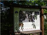 2
2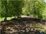 3
3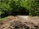 4
4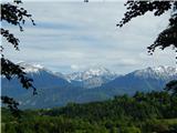 5
5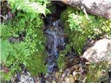 6
6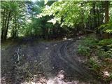 7
7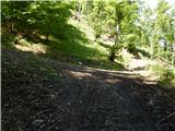 8
8 9
9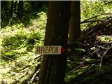 10
10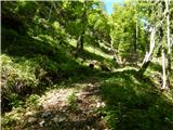 11
11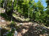 12
12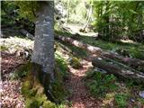 13
13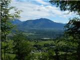 14
14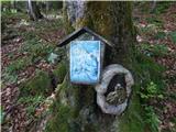 15
15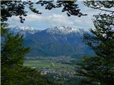 16
16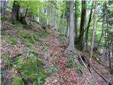 17
17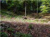 18
18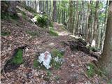 19
19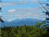 20
20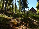 21
21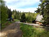 22
22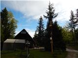 23
23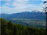 24
24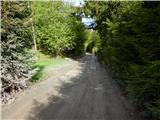 25
25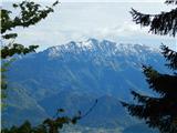 26
26 27
27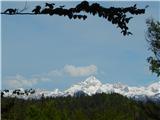 28
28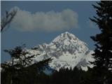 29
29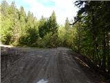 30
30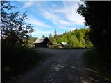 31
31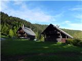 32
32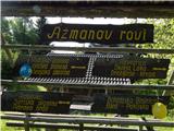 33
33