Srednja vas-Poljane - Church of the Holy Cross at Brezje above Srednja vas (on footpath)
Starting point: Srednja vas-Poljane (395 m)
Starting point Lat/Lon: 46.11357°N 14.16157°E 
Path name: on footpath
Time of walking: 25 min
Difficulty: easy unmarked way
Difficulty of skiing: no data
Altitude difference: 116 m
Altitude difference (by path): 116 m
Map: Škofjeloško in Cerkljansko hribovje 1:50.000
Access to starting point:
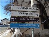
A) We drive to Škofja Loka, and then we continue driving towards Žiri. After Poljane we get to the settlement Srednja vas-Poljane (a road sign only has a caption Srednja vas), where in the middle of the settlement there is the beginning of the described path. At the starting point, there aren't any parking spots.
B) We drive into Gorenja vas in the valley Poljanska dolina, and then we continue driving towards Škofja Loka. We soon get to the settlement Srednja vas-Poljane, where at the crossroad in the middle of the settlement there is the beginning of the described path. At the starting point, there aren't any parking spots.
Path description:
From the main road signs for the church of the Holy Cross (Sveti Križ) point us on a side road which continues towards the north and leads us among houses. Only a little further, we go right, again in the direction of the church of the Holy Cross, and few steps ahead at the unmarked crossroad, slightly left. Next follows an ascent by a small stream and at a newer house, the road turns a little to the right and passes on the other side of the stream, from which we then go away. Next follows a walk through a narrow lane of a forest, and by the foot of the meadows, the road turns once again to the right and it ascends diagonally to a smaller hamlet, where it splits.
On the asphalt road leads a little shorter path which continues on the road, and at the yard by the religious symbol leads for few minutes longer footpath which leads through the forest.
We continue to the religious symbol, which is situated behind the yard, and then we continue on a cart track which passes into the forest. Next follows few minutes of a light diagonal ascent, and then we join the path from Dobje or Poljane.
Here we go left and we quickly leave the forest and then by the edge of the forest we ascend to a small saddle, where we join the path from Srednja vas, which leads past the parish house.
On the saddle, we go left and past the chapel we with views on surroundings ascend to the church of the Holy Cross.
Description and pictures refer to a condition in January 2021.
Pictures:
 1
1 2
2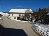 3
3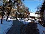 4
4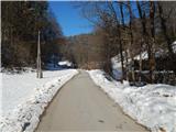 5
5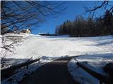 6
6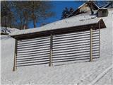 7
7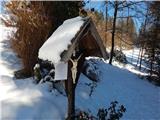 8
8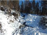 9
9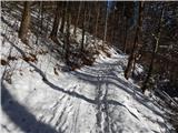 10
10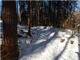 11
11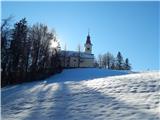 12
12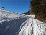 13
13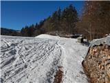 14
14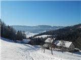 15
15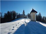 16
16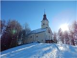 17
17