Steljnik - Koča pri Sveti Ani on Mala gora
Starting point: Steljnik (615 m)
| Latitude/Longitude: | 45,75010°N 14,76280°E |
| |
Walking time: 1 h
Difficulty: easy marked way
Elevation gain: 295 m
Elevation difference along the route: 295 m
Map:
Recommended equipment (summer):
Recommended equipment (winter):
Views: 7.481
 | 1 person like this post |
Access to starting point:
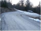
First, we drive to Ribnica (to here from Ljubljana or Kočevje) and then we continue driving past the company Inles, where we also cross a railway track. Only a little after the track we will notice the first signposts for Sveta Ana. Further, we ascend on a relatively nice macadam road, which brings us higher to the landfill, where there is a crossroads. We continue right (left - Sveta Ana from the farm Seljan) and we follow the road ahead past the landfill to the next crossroads, where we park.
Route description:
From the crossroad, we continue in the direction of Sveta Ana on the road which is ascending through the forest. After a good 5 minutes of walking, a road branches off to the right, which leads towards Črni vrh, and we continue straight, also on the road which is still ascending through the forest.
Only a few meters before the next crossroad, a marked footpath which leads towards Sveta Ana turns left into a dense forest and starts moderately ascending. After a short ascent, a light descent follows and the path gets completely close to the forest road which we recently left.
We continue in the direction of Sveta Ana on a cart track which is further ascending diagonally towards the west. Further, the path from the farm Seljan joins us from the left side, and we continue past the church on a panoramic grassy slope to the mountain hut.
Photos:
 1
1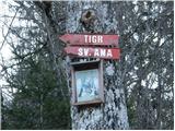 2
2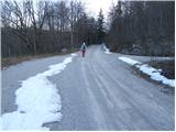 3
3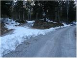 4
4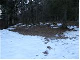 5
5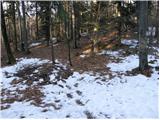 6
6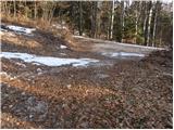 7
7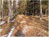 8
8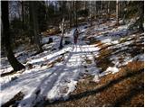 9
9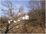 10
10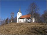 11
11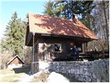 12
12
Discussion about the trip Steljnik - Koča pri Sveti Ani on Mala gora
To post a comment you must log in:
If you do not yet have a username, you must first
register.