Tolminske Ravne - Mahavšček (via Dobrenjščica)
Starting point: Tolminske Ravne (924 m)
| Latitude/Longitude: | 46,22940°N 13,77150°E |
| |
Route name: via Dobrenjščica
Walking time: 5 h 15 min
Difficulty: difficult marked way, easy pathless terrain
Elevation gain: 1084 m
Elevation difference along the route: 1300 m
Map: TNP 1:50.000
Recommended equipment (summer):
Recommended equipment (winter): ice axe, crampons
Views: 583
 | 1 person like this post |
Access to starting point:
We drive to Tolmin, then continue driving in the direction of Žabče and Zadlaz (the turn-off from the main road is located on the left bank of Tolminka). When we arrive in Žabče, at the smaller crossroads we continue slightly right in the direction of the settlement Zadlaz. In the settlement Zadlaz-Žabče the road temporarily descends, where over a bridge we cross Zadlaščica, then it starts ascending steeply again on a narrow but all the time asphalted road. After approximately 12 km from the main road we arrive at the marked parking lot in Tolminskih Ravnah, where we park.
Route description:
From the parking lot, we return a few steps back to the red mountain signposts, which we follow in the direction of the mountain hut Koča na planini Razor and mountain pasture Planina Kal. The path ahead first leads over a grazing fence, then we continue on a cart track which continues across a meadow, from which a nice view opens up on Tolminski Migovec. The cart track soon turns right and brings us to a stone enclosure, where it splits into two parts.
We continue on the left upper cart track in the direction of the mountain pasture Planina na Kalu (slightly right Koča na planini Razor), which then ascends gently. A little higher, at the older water reservoir we continue right, then we cross a gully. Soon we reach the next junction, where the path to Škrbina branches off to the right, and we continue on the left cart track following the signs for Planina Kal and Tolminski Migovec.
The old mule track continues for some time beside or slightly right of the nearby gully, then at a smaller cairn from the mule track a path branches off slightly to the left, which continues beside the gully and leads further towards the saddle between peak Javor on the left and Grušnica on the right, while we stick to the mule track.
Higher we reach the next marked junction, where another path to Planina Razor branches off to the right, and we continue left and for a short time continue in only a gentle ascent. One or two minutes further we leave the gentle path and continue slightly right in the direction of Planina na Kalu (straight we arrive at the aforementioned saddle, from which we can continue to Javor or to the village Čadrg, in between there is another branch towards Planina na Kalu). After a shorter somewhat steeper ascent we return to the mule track, where we also join the path from Čadrg.
We continue right and ascend along the mule track all the way to Planina na Kalu, where to the right of a small saddle some old cottages stand.
At the cottages, where another path from Planina Razor joins us, we ascend slightly and quickly reach a marked junction, where the path to Tolminski Migovec branches off to the right. We continue left in the direction of Prehodci and Krn, and further we walk on the mule track. The path becomes flatter and runs northwards, from the path we have a nice view towards the Tolminka valley. The path then brings us to steeper slopes on the southwest side of Tolminski Kuk, and at some points fixed safety gear assists us. The fixed safety gear ends and the path brings us to the chapel of the Mother of God Hud Klanec, beside which there is also a bench. From here there is also a wonderful view of the Tolminka valley and the peaks above the valley. At the chapel there is also a logbook box and a stamp.
From the chapel onwards the slope becomes somewhat less steep, and the path mostly gently descends and crosses slopes mostly covered with dwarf pines towards the northwest. Later the path begins to descend even more in longer zigzags (here at the first left hairpin turn an unmarked and quite overgrown old military path branches off to the left, which leads higher above the marked path and is about 45 minutes shorter since there is no need to descend about 200 elevation meters as in the subsequently described route, joining the described route at the upper part of the scree described later) and also leads us through a strip of forest. Just before Planina Dobrenjščica we reach a junction.
We continue straight on the marked path which bypasses the mentioned mountain pasture (left downhill Planina Dobrenjščica - 3 minutes) and further traverses the slope towards the northwest. Along the path we will soon notice a poorly visible little path leading left downhill to the spring Čaramonka (marked with the inscription »Voda 40 m«). From here we continue another good 100 meters along the path, then we will notice to the right uphill a narrow strip not overgrown with dwarf pines. Here we leave the marked path and head straight uphill right along the dwarf pines (the nearby mule track is overgrown). We then steeply ascend alongside the dwarf pines uphill until we reach a less trodden path, i.e., an abandoned military path. On the path we continue right and then begin to ascend in zigzags uphill. The path here is marked with a few cairns and brings us from the dwarf pines onto rocky slopes. The path becomes even less visible and turns slightly right towards the east. Just below the ridge we will spot the former defensive military barracks towards which we ascend. From here follows a short ascent to the saddle between peaks Kser and Vrh Škrli, where we join the marked path leading to Tolminski Kuk.
We do not follow the marked path in the direction of Kuk, but continue straight downhill, where after a few descent steps we reach a marked junction.
We continue left in the direction of Bogatin (right downhill Planina Govnjač) along an old military mule track which further crosses the slopes of Vrh Škrli. Somewhat further ahead the path brings us to the main ridge of the Bohinj-Tolmin mountains, and the path continues to ascend quite gently for some time. Higher up the ridge narrows somewhat, and the path begins to ascend more steeply towards Mahavšček, whose summit we reach after a few minutes of further walking.
Tolminske Ravne - Planina na Kalu 1:30, Planina na Kalu - Planina Dobrenjščica 1:30, Planina Dobrenjščica - Mahavšček 2:15.

Photos:
 1
1 2
2 3
3 4
4 5
5 6
6 7
7 8
8 9
9 10
10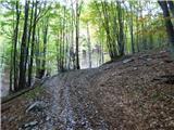 11
11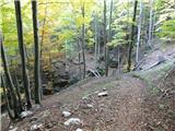 12
12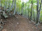 13
13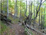 14
14 15
15 16
16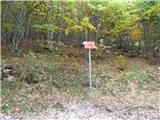 17
17 18
18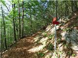 19
19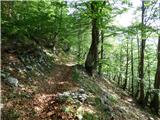 20
20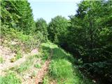 21
21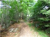 22
22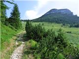 23
23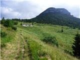 24
24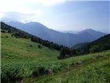 25
25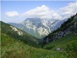 26
26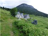 27
27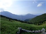 28
28 29
29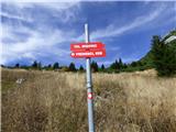 30
30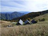 31
31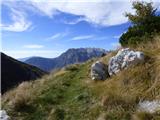 32
32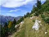 33
33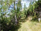 34
34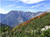 35
35 36
36 37
37 38
38 39
39 40
40 41
41 42
42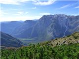 43
43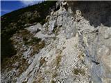 44
44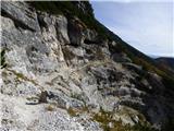 45
45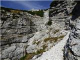 46
46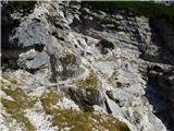 47
47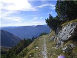 48
48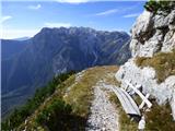 49
49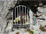 50
50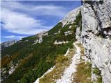 51
51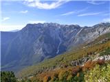 52
52 53
53 54
54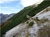 55
55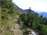 56
56 57
57 58
58 59
59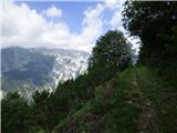 60
60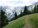 61
61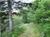 62
62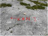 63
63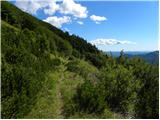 64
64 65
65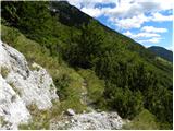 66
66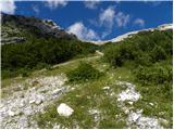 67
67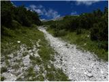 68
68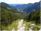 69
69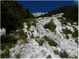 70
70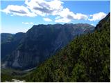 71
71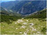 72
72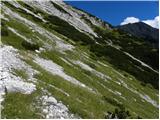 73
73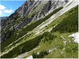 74
74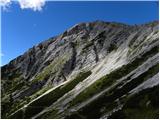 75
75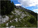 76
76 77
77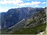 78
78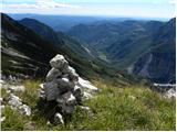 79
79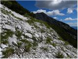 80
80 81
81 82
82 83
83 84
84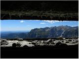 85
85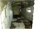 86
86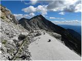 87
87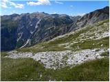 88
88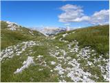 89
89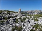 90
90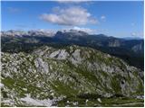 91
91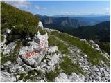 92
92 93
93 94
94 95
95 96
96 97
97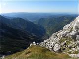 98
98 99
99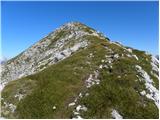 100
100 101
101
Discussion about the trip Tolminske Ravne - Mahavšček (via Dobrenjščica)
To post a comment you must log in:
If you do not yet have a username, you must first
register.