Topol - Goljek (on west ridge)
Starting point: Topol (650 m)
| Latitude/Longitude: | 46,09360°N 14,36950°E |
| |
Route name: on west ridge
Walking time: 30 min
Difficulty: easy marked way
Elevation gain: 159 m
Elevation difference along the route: 165 m
Map: Ljubljana - okolica 1:50.000
Recommended equipment (summer):
Recommended equipment (winter): crampons
Views: 2.475
 | 2 people like this post |
Access to starting point:
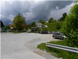
A) From Ljubljana, Kranj or Vodice we drive to Medvode, from there we continue driving towards Sora. At the intersection at the beginning of Sora, immediately behind the small bridge we turn left in the direction of Katarina and village Trnovec. Further, we drive through the valley of Ločnica towards Katarina (Topol). Higher, the road rises above the mentioned valley and brings us to the beginning of the village Topol, where we park on a large parking lot by the primary school.
B) First, we drive to Škofja Loka, from there we continue driving towards Sora. At the end of Sora we turn right in the direction of Katarina and village Trnovec. Further, we drive through the valley of Ločnica towards Katarina (Topol). Higher, the road rises above the mentioned valley and brings us to the beginning of the village Topol, where we park on a large parking lot by the primary school.
C) We leave Primorska highway at exit Brezovica, then we continue driving in the direction of Dobrova and Polhov Gradec. Further, we drive through the valley of Gradaščica, while we follow the main road towards Polhov Gradec to a smaller intersection, where a road towards villages Osredek, Topol (Katarina) and Belo branches off to the right (the turn-off from the main road is located a little before the beginning of the village Hrastenice). When we arrive in the village Topol, first a road towards the village Belo branches off sharply to the left, a little further on the signs for Medvode direct us slightly to the left, onto the road which gradually starts to descend. Before the road starts to descend more steeply towards the valley of Ločnica, we arrive at the primary school, where we park on a large parking lot.
Route description:
From the parking lot at the primary school we ascend on an asphalt road to the inn Dobnikar, from there we continue on the asphalt road that runs along some sort of ridge, then we arrive at the next intersection, where we continue slightly right in the direction of village Belo, Grmada and Tošč.
On the road we walk for approximately 10 minutes, then we leave the road and continue slightly right in the direction of Grmada. Further, we continue on an initially wide cart track which crosses the slopes without major changes in altitude. After a few minutes of further walking, a relatively steep footpath branches off to the left from the cart track, on which we continue the ascent. After a few minutes the steepness eases and the path brings us to a smaller saddle, where we continue sharply left, where on one of the trees we notice the sign Goljek, which directs us onto a less trodden path marked with black-yellow colour. We follow this always marked but locally harder-to-follow path all the way to the 809 m high summit, which we reach after a good 10 minutes of walking from the place where we left the wide path leading towards Tošč and Grmada.

Photos:
 1
1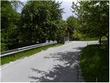 2
2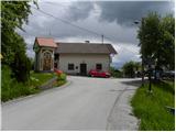 3
3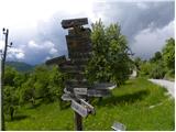 4
4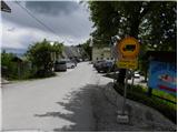 5
5 6
6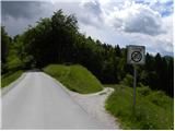 7
7 8
8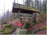 9
9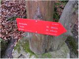 10
10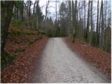 11
11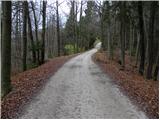 12
12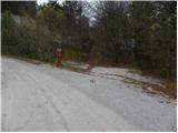 13
13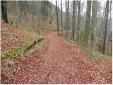 14
14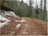 15
15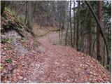 16
16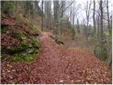 17
17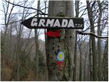 18
18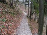 19
19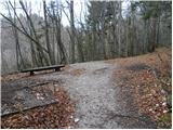 20
20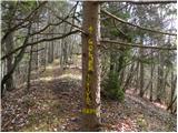 21
21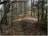 22
22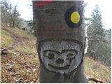 23
23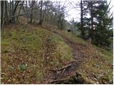 24
24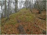 25
25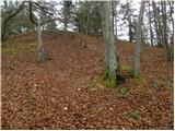 26
26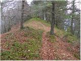 27
27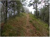 28
28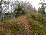 29
29 30
30
Discussion about the trip Topol - Goljek (on west ridge)
|
| svetilka14. 02. 2021 |
If you are only going to Goljek from Topol, it is worth at least making a loop back, or extending to Polhograjska Grmada (if there is time). The path is otherwise well-trodden and marked, but missing from most maps and phone apps.
|
|
|
To post a comment you must log in:
If you do not yet have a username, you must first
register.