Vent - Fineilspitze (običajna smer preko SV grebena)
Starting point: Vent (1895 m)
Starting point Lat/Lon: 46.8605°N 10.91494°E 
Path name: običajna smer preko SV grebena
Time of walking: 6 h 30 min
Difficulty: difficult marked way, very difficult unmarked way
Difficulty of skiing: no data
Altitude difference: 1619 m
Altitude difference (by path): 1619 m
Map: Ötztaler Alpen Weißkugel, 30/2 1:25.000
Access to starting point:
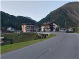
From Ljubljana, we drive on the highway past Salzburg in the direction towards München. At the multilevel junction Dreieck Inntal we go on the road A93 in the direction of Innsbruck/Kufstein/Brenner. When we return to Austria we continue on the highway A12 past Innsbruck, Telfs and Mötz, and then at exit 123 near the Ötztal Bahnhof we turn towards B186/B171/Ötztal/Haiming. The road B186, which runs to Ötztal valley, we follow past settlements Oetz, Längenfeld and the center of the valley, Sölden. Only few kilometers ahead from Sölden at village Zwieselstein we turn on a steep ascending, but comfortable asphalt road towards Vent. In the tourist settlement Vent we park on one of the numerous (payable) parking lots. Parking fee in Vent in the year 2020 was 5 euros/day.
Path description:
From one of the parking lots in Vent we go through the settlement to its southwestern edge, where we notice signs which over a small bridge lead in the direction towards Martin-Busch-Hütte and Similaunhütte. A considerably gentle path, which in the first part of the trip runs on the route of a worse macadam road, we follow to a smaller private cottage, soon behind which we go on a little narrower footpath towards the east, which leads us through a smaller canyon of river Niedertalbach. After approximately fifteen minutes of additional walking, we follow the footpath through an iron bridge to the junction with the mountain road. Barely ascending road, on which we will in the warm summer months often meet cyclists, past the turn below the far northern slopes of the mountain Hintere Schwärze we follow to the mountain hut Martin-Busch-Hütte.
The path between the huts Martin-Busch-Hütte and Similaunhütte mostly runs on a relatively gentle, open meadow slope below vastness of glaciers Marzellferner and Niederjochferner. Easy and to the summer heat exposed path at first leads past a crossing, where the direct approach towards Ötzi memorial branches off (this variant represents a shorter, easier, but less scenic approach towards the summit, which I definitely recommend at least when returning), and later it goes past a smaller glacial lakes and ascends a little steeper to the hut Similaunhütte. From Vent to the hut below Similaun there is around 4 hours of walking, and the entire path is well marked.
At the mountain hut following the signs towards Ötzi - Fundstelle and Fineilspitze we go towards the northwest and in zig-zags we ascend on a panoramic ridge, which connects massif Similaun and Fineilspitze. The ridge path which leads us by and over numerous large rocky plates, is mostly pretty wide and undemanding, and past few exposed and steeper spots we get help from reliable fixed safety gear.
After a little less than half an hour of walking from the hut, avoiding a sharp continuation, we with the help of steel cables descend below the ridge and in a gentle ascent on gravel terrain we continue towards the Ötzi memorial. Winding and not too steep path with the help of occasional blazes and individual cairns brings us to a larger year-round snow field, over which we walk to the memorial in the memory of finding a natural mummy Ötzi, which German hikers accidentally discovered right next to the monument.
From the memorial we continue towards the shoulder west from the saddle Hauslabjoch; it is also possible to continue more to the right (east) on a better marked path directly towards the mentioned saddle, but this extends the tour and demands a shorter passage of a glacier Hochjochferner.
Following the cairns and traces of predecessors we through crumbly gravel ascend directly towards the edge of the upper massif of Fineilspitze to a plain below the northeastern ridge of the mountain. Here we continue on a little harder visible, but obvious ascent route on the eastern broad ridge Fineilspitze; the terrain is in the first part of the final ascent in parts quite crumbly, but not exposed and only moderately steep, and at orientation we get help from individual cairns. Higher, we gradually pass on more demanding terrain, and when we cross crumbly rugged slope we need to use hands, but climbing remains inside the first grade of climbing. After passing the technically more demanding jump (I+) the terrain temporarily flattens, and the path after a shorter crossing below the secondary peak leads to the connecting ridge between the secondary peak and the main Fineilspitze.
After passing the exposed, but short crest we find ourselves just below the upper head of Fineilspitze. To the top we can get with a short, but exposed climbing on the upper part of rugged eastern wall (II) or, more recommended, to the highest point we continue directly on the ridge. From the saddle below the northeastern broad ridge of Finailspitze to the top there is a little less than 45 minutes of ascent.
The ascent on Fineilspitze was until recently considered as moderately demanding, entirely snow tour, which character in the past years drastically changed and serves as a direct indicator of the scale of climate change. Instead of snowy ridge in the final part in the summer-autumn days of high season most likely awaits a relatively strenuous ascending through quite crumbly terrain, which in larger part requires an easier climbing through in parts unreliable rugged crumbly slope. Even though technical difficulty isn't very high, the peak in the view of several factors in spite of immediate vicinity of popular Ötzi memorial is less visited than neighbouring Similaun - but more difficult accessibility to experienced mountaineer represent nobler destination; the summit for which at the peak of the high mountain season we usually don't need winter equipment.
For returning I recommend a shorter and more direct path towards Vent, which from Ötzi memorial follows a well-marked footpath which in a gentle descent safely takes us to a crossing between the huts Martin-Busch-Hütte and Similaunhütte, which slightly reduces the length and the difficulty of the tour.
On the way: Martin-Busch-Hütte (2501m), Similaunhütte (3019m), Ötzi - Fundstelle (3210m)
Pictures:
 1
1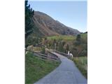 2
2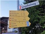 3
3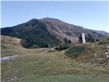 4
4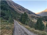 5
5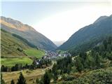 6
6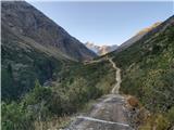 7
7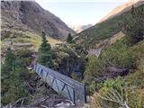 8
8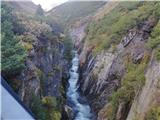 9
9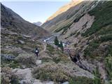 10
10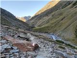 11
11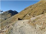 12
12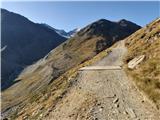 13
13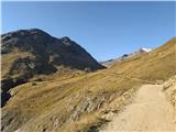 14
14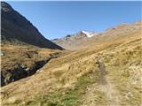 15
15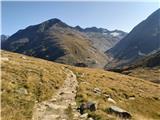 16
16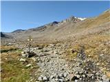 17
17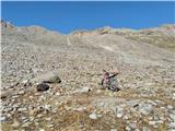 18
18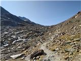 19
19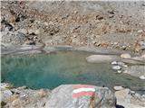 20
20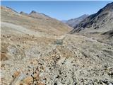 21
21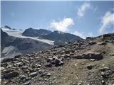 22
22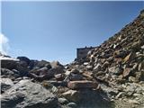 23
23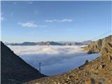 24
24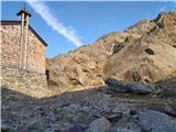 25
25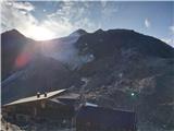 26
26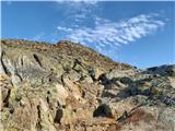 27
27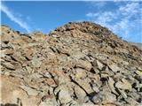 28
28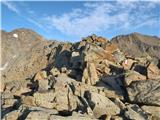 29
29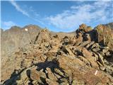 30
30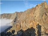 31
31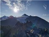 32
32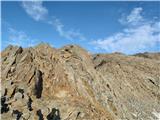 33
33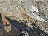 34
34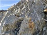 35
35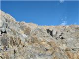 36
36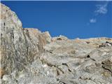 37
37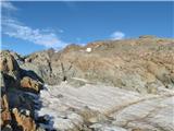 38
38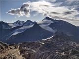 39
39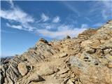 40
40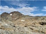 41
41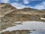 42
42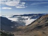 43
43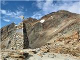 44
44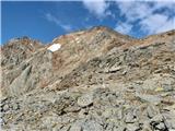 45
45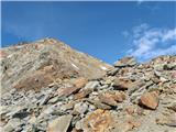 46
46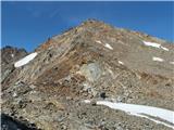 47
47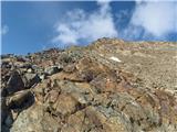 48
48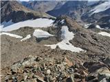 49
49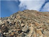 50
50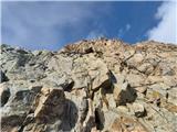 51
51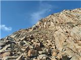 52
52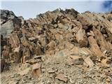 53
53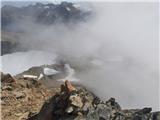 54
54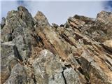 55
55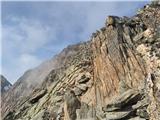 56
56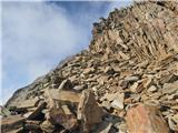 57
57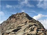 58
58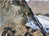 59
59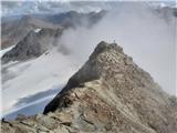 60
60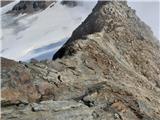 61
61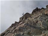 62
62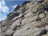 63
63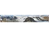 64
64