Vinišnik - Koča pod Kremžarjevim vrhom (over the peak)
Starting point: Vinišnik (550 m)
Route name: over the peak
Walking time: 1 h 40 min
Difficulty: easy marked way
Elevation gain: 552 m
Elevation difference along the route: 615 m
Map: Pohorje 1:50.000
Recommended equipment (summer):
Recommended equipment (winter):
Views: 2.540
 | 1 person like this post |
Access to starting point:
A) From Velenje or Dravograd we drive to Slovenj Gradec, and here in the roundabout, which is situated on the main road Dravograd - Velenje, we take the exit for Kope and Legen. The road then soon brings us to the next junction, where we turn right (in the direction of the ski centre Kope). In this direction we drive approximately 2.2 km to the next junction, where we turn left (in this direction there are signposts for a few paths and a marked path for Kremžarica). At the next junction after 500 m we again turn left (in the direction of the picnic area Vinišnik). We continue with a short uphill drive, we reach a macadam road and on the left side we notice a parking lot.
B) From the regional road Mislinja - Slovenj Gradec we drive to the settlement Šmartno pri Slovenj Gradcu and later Legen, we drive past the church of St. Jurij and then we turn right in the direction of the ski centre Kope. In this direction we continue approximately 300 m to the next junction, where we turn left (in this direction there are signposts for a few farms and a marked path for Kremžarca). At the next junction after 500 m we again turn left in the direction of the picnic area Vinišnik. We continue with a short uphill drive, we reach a macadam road and on the left side we notice a parking lot, which is intended for hikers to Kremžarjev vrh.
Route description:
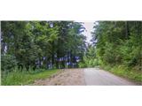
From the parking lot, we continue on the road which would lead to the picnic area Vinišnik. After a few minutes of walking on the road, the trail marking directs us to the right on a worse and steeper road, past smaller farms. The road slowly changes into a forest gully or cart track. In this part, the path which starts at the farm Orešnik joins us. In front of us is 40 minutes of uphill walking on a marked path which runs along a shady cart track and forest paths which cross the macadam road a few times. After the end of the cart track, we cross a junction of macadam roads where the "main road" leads to Sv. Barbara, and in the other direction to the valley or the mountain hut Koča pod Kremžarjevim vrhom. Our marked path continues on the other side of the road. In this part of the path, we can observe Slovenj Gradec and the peaks of the nearby mountains (Uršlja gora, Peca). After 15 minutes of walking on the cart track and along pastures past the farm Lampret we cross the road and come to a junction. We have the option to choose a shorter path below the summit or the path to the summit.
A few steps to the right from the farm Lampret, we climb over the upper road, where there is a marked path to the summit. The path to the summit will take us 35 minutes and leads us over shorter but steep ascents through the forest. The path through the forest slowly turns into a cart track which winds along the hillside meadow. From this meadow, a view slowly opens up from the summit of Peca and Uršlja gora to the Slovenj Gradec airport in the lowlands. A few steps into the forest, the path from Grmovškov dom on Kope joins us. We continue walking along the meadow keeping to the right path (Vrh - koča). Then we start descending beside Kremžarjev vrh towards the hut. (If we want to visit the summit, we descend in the direction of the hut and during the descent on the right side we notice a branch-off and markings which indicate the path to the summit, to the hut and to Vuzenica). If we continue descending, we descend to an indistinct ridge, where there is a semi-open glass chapel and a wish bell. A little further, we notice a marking which indicates the horizontal path or road which leads from the valley to the mountain hut Koča pod Kremžarjevim vrhom.

Photos:
 1
1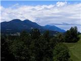 2
2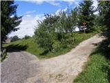 3
3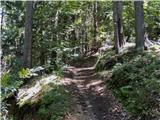 4
4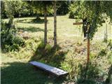 5
5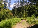 6
6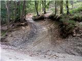 7
7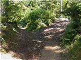 8
8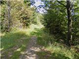 9
9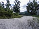 10
10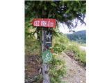 11
11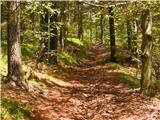 12
12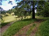 13
13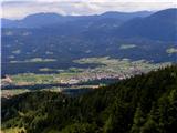 14
14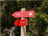 15
15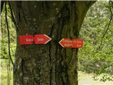 16
16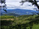 17
17 18
18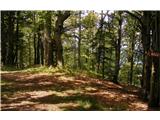 19
19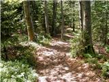 20
20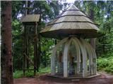 21
21 22
22
Discussion about the trip Vinišnik - Koča pod Kremžarjevim vrhom (over the peak)
To post a comment you must log in:
If you do not yet have a username, you must first
register.