Starting point: Vranček (950 m)
Starting point Lat/Lon: 46.4279°N 14.2726°E 
Time of walking: 2 h 5 min
Difficulty: easy marked way
Difficulty of skiing: no data
Altitude difference: 751 m
Altitude difference (by path): 751 m
Map: Karavanke - osrednji del, 1:50.000, PZS
Access to starting point:
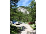
We drive towards the border crossing Ljubelj. After the end of last tunnel on the left side of the road is visible large scree. The road turns a little right, after that follows long left turn. In the middle of this turn worse forest road branches off to the right. At its very beginning is on the left side a road cottage, where they keep snow road poles, which they set in the winter. We can park on a small parking lot by the cottage, where there is space only for few cars, or we can drive for few ten meters on a forest path ahead and we will run into another smaller parking lot on the right side and few meters behind it one a little larger, just before the passage over a torrent.
Path description:
From the parking lot, we continue in the same direction, over a torrent on a bad forest road which higher changes into a cart track. In the lower part, the path is quite unpleasant because of walking on gravel and some quite steep sections. After about 20 minutes of walking from the parking lot we can cut part of this cart track with a shortcut, on which we turn left in sharp, steep right turn of cart track (footpath is well visible). After about 10 minutes of walking on this shortcut through the forest we again join the marked path. Here is also the path on a cart track already more pleasant, we walk through the forest and among clearings. From the meadow below cottage, which we already see above us, we go slightly right, we cross few meters wide muddy area, over which brings us a small bridge and in few minutes we get to cottages on the mountain pasture Korošica. At the mountain hut, we go slightly to the right upward on the pasture, which soon goes in thin forest. The path is at the beginning very poorly visible, but after few minutes, when we come on beginning of forest, we can without problems follow it and from here ahead is everywhere well visible and beaten and marked. It leads us over smaller and larger clearings, through a thin forest, higher through dwarf pines. By the path, we run into few wells, where we can get water. After approximately 30-40 minutes of walking from the mountain pasture Korošica we reach the border ridge and saddle. A nice view opens up on the Austrian side. We can go few ten meters to the right, towards the beginning of the path from the saddle Hajnževo sedlo on Veliki vrh in Košuta, from there is better view. On the left above us is ascending footpath which leads on Ljubeljska Baba (Košutica).
Pictures:
 1
1 2
2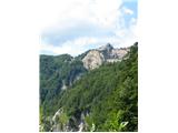 3
3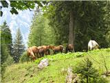 4
4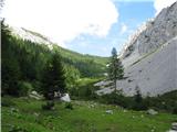 5
5 6
6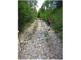 7
7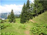 8
8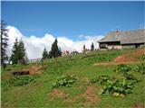 9
9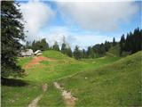 10
10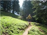 11
11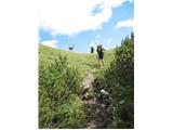 12
12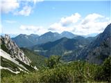 13
13 14
14 15
15 16
16 17
17