Zagrad - Grmada above Celje (steep path)
Starting point: Zagrad (240 m)
| Latitude/Longitude: | 46,21170°N 15,26260°E |
| |
Route name: steep path
Walking time: 1 h 15 min
Difficulty: partly demanding marked way
Elevation gain: 478 m
Elevation difference along the route: 478 m
Map:
Recommended equipment (summer):
Recommended equipment (winter): ice axe, crampons
Views: 17.211
 | 1 person like this post |
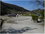
Access to starting point:
From the highway Ljubljana - Maribor, we take the exit Celje - center and continue driving in the direction of Laško and Zidani Most. The road ahead leads through the center of Celje, then brings us to a roundabout with a fountain. Here we continue "straight" (direction Laško and Zidani Most) and follow the road to the next traffic-light intersection, where we continue left, drive over the river Savinja and then at the intersection behind the bridge continue right. Further, we come to the underpass under the railway track and only a few meters ahead to the fire station in Zagrad, near which we park on a larger macadam parking lot.
To the starting point we can also come from Dolenjska and Zasavje. In this case, we first drive to Rimske Toplice and then through Laško to the starting point.
Route description:
On the eastern side of the parking lot, we notice the blazes, which point us to the path which at first ascends among houses, and then crosses an asphalt road. Further, we ascend only briefly through the forest and then join the previously mentioned road. The road, which further gently to moderately ascends, leads us across a panoramic grassy slope, from which a nice view opens up. Higher, the road ends, and we continue on a wide and well-maintained mountain path, which then leads us through an indistinct valley. Higher, we step on a macadam road and follow it with the exception of some shortcuts to a marked junction by which a religious symbol is situated.
Here we go left and continue the ascent on a steep path (straight - Grmada and Pečovniška koča gentle path), which at first still moderately ascends through the forest. The path, which further runs through the forest, gradually becomes increasingly steep. Higher, the path turns to the right and transitions to steep and mainly in wet dangerous-for-slipping slopes. At the top of the traverse ascent we arrive at a viewpoint, which is situated above a real precipice (carefully!). From the viewpoint, we continue on a marked path which continues along an increasingly narrow and steeper ridge. Just below the summit of Grmada, we come to probably the hardest part of the path. The path steeply ascends over rugged rock terrain, which in wet and snow is very dangerous for slipping. Further, the path flattens and after a few additional steps brings us to the summit of Grmada.
We can descend on the gentle path.

Photos:
 1
1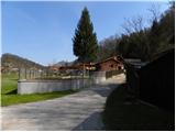 2
2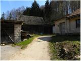 3
3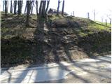 4
4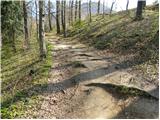 5
5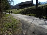 6
6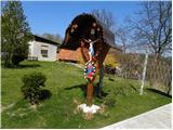 7
7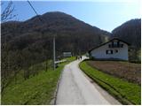 8
8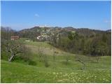 9
9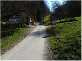 10
10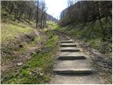 11
11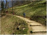 12
12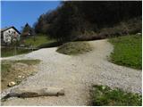 13
13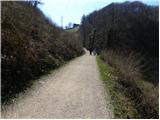 14
14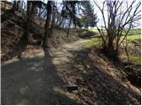 15
15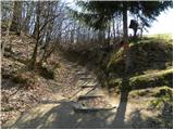 16
16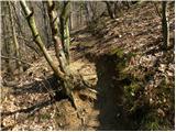 17
17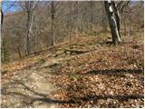 18
18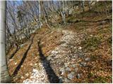 19
19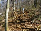 20
20 21
21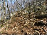 22
22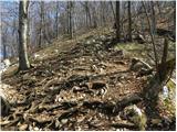 23
23 24
24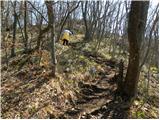 25
25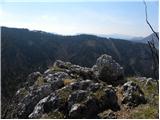 26
26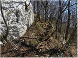 27
27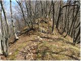 28
28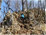 29
29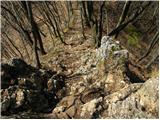 30
30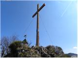 31
31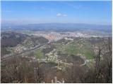 32
32
Discussion about the trip Zagrad - Grmada above Celje (steep path)
|
| dk3314. 02. 2021 |
Hello,
On pictures 22-23 there are now for some time additional handrails to help with easier ascent or descent (information for those who are not daily on this hillock). Regards.
|
|
|
|
| zokipoki15. 09. 2021 15:53:24 |
Today with dear via this path and back via Suhi potok. The steep path, which is now partially equipped with fixed cables, is super for children to get in touch with them. They are attached low. Both paths are bp..
|
|
|
|
| Marjana K30. 11. 2024 19:38:03 |
The fixed cables are great. Kids enjoy it. This way they get used to those in the high mountains.
|
|
|
To post a comment you must log in:
If you do not yet have a username, you must first
register.