Zgornja Polskava - Ruška koča na Arehu (through Polskavski vintgar)
Starting point: Zgornja Polskava (294 m)
| Latitude/Longitude: | 46,42700°N 15,61070°E |
| |
Route name: through Polskavski vintgar
Walking time: 5 h
Difficulty: easy marked way
Elevation gain: 952 m
Elevation difference along the route: 980 m
Map: Pohorje - izletniška karta 1:50.000
Recommended equipment (summer):
Recommended equipment (winter): ice axe, crampons
Views: 928
 | 1 person like this post |
Access to starting point:
a) Leave the Ljubljana - Maribor motorway at the Slovenska Bistrica north exit, then follow the signs for Slovenska Bistrica. When we reach the old Celje - Maribor road, go right and drive to the centre of the Zgornja Polskava settlement, where the described path begins near the fire station. Park on one of the parking lots in the settlement.
b) Leave the Maribor - Ljubljana motorway at the Fram exit and follow the signs for Fram, when we reach the old Maribor - Celje road follow it left, we drive to the centre of the Zgornja Polskava settlement, where the described path begins near the fire station. Park on one of the parking lots in the settlement.
Route description:
From the place where we parked, we first walk to the Zgornja Polskava fire station and continue along the side road that continues along the Polskava. The gentle road that leads us through the settlement forks at the gostilna Kalan.
We continue slightly right in the direction of the path through Polskavski vintgar or Ruška koča on Areh (left Kočno village and shorter path to Sv. Treh Kraljev), where we first go past a few houses, then the gentle road continues across meadows and through forest, at intersections we follow the blazes. When the asphalt ends the road becomes somewhat steeper and transitions into the narrower part of the gorge named Polskavski vintgar. Here we mostly ascend transversely through the forest, when the road turns from northeast toward southwest we soon notice a blaze on the right that directs us right downward onto the trail, along which we descend to the Šum waterfall.
From the waterfall we continue left and return to the road via another somewhat less steep path, along which we continue the mostly transverse ascent. After some time the road temporarily flattens completely and brings us via a bridge to the left bank of Velika Polskava, we however continue along the stream. A little further, behind the larger rock with a blaze, the path forks.
To the left branches the marked path toward Šmartno na Pohorju, we continue straight and continue walking along the wider macadam road.
A little further we temporarily leave the forest, from the intersection where the path to the farm branches right we continue straight.
The path further gradually transitions from the slope into the valley of Mala Polskava, where we arrive at a somewhat larger intersection, from which we also continue straight (here the Slovenska turnokolesarska pot continues left, to Areh it is possible to continue also along the left road).
Also at the two following intersections we go straight, the path gradually transitions from the road into a cart track, which ends behind the picnic area, or changes into a gully.
Behind the clearing at the end of the picnic area we cross the pasture fence, then continue the path across the currently abandoned pasture, where the path gets lost. We continue along the lower edge of the pasture near the stream, when later we cross the stream the trail leads us to a gully, from which, when the gully moves away from the stream, we go right onto the footpath. A transverse ascent toward the right follows along a less visible trail, where we carefully follow the blazes, higher we reach a wider cart track, which we temporarily leave since we continue along the marked shortcut. The wider cart track leads us through the forest for some more time, then rises somewhat more steeply and brings us to pastures, across which we ascend to the Jerebič farm.
From the intersection some 10 m behind the farm we go right, the Vošnik farm we bypass on the right side and immediately behind it arrive at the next intersection from which we go straight into the forest. Along the macadam road we walk only a short time since the blazes direct us slightly left onto the initially overgrown trail, which begins to ascend along the forested ridge. When we leave the forest we temporarily descend along the forest edge and past the bench back to the macadam road which we left a few minutes earlier. The path further ascends along the meadows to the Fric homestead - Spodnji Fregl, above the farm we go again into the forest onto the footpath, where at numerous junctions we follow the blazes. Higher we cross the wider asphalt road twice, when we reach it the third time we continue along it to the left. We also soon leave this road and go slightly left onto the marked path, which takes us along the left side of the church sv. Areha and past the mini golf course to the Ruška koča on Areh.
Starting point - Šum waterfall 1:15, Šum waterfall - Areh 3:45.
The description and photos refer to the condition of March 2024 and August 2025.

Photos:
 1
1 2
2 3
3 4
4 5
5 6
6 7
7 8
8 9
9 10
10 11
11 12
12 13
13 14
14 15
15 16
16 17
17 18
18 19
19 20
20 21
21 22
22 23
23 24
24 25
25 26
26 27
27 28
28 29
29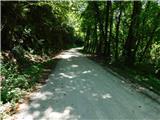 30
30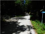 31
31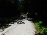 32
32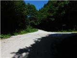 33
33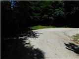 34
34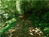 35
35 36
36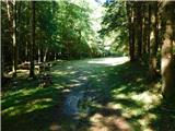 37
37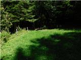 38
38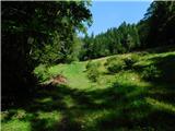 39
39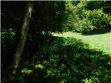 40
40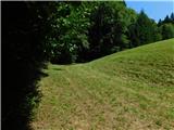 41
41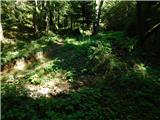 42
42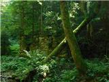 43
43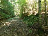 44
44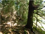 45
45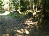 46
46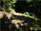 47
47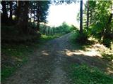 48
48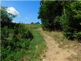 49
49 50
50 51
51 52
52 53
53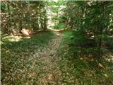 54
54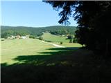 55
55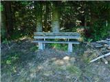 56
56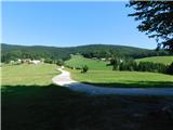 57
57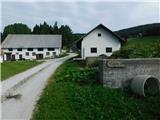 58
58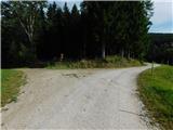 59
59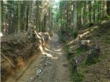 60
60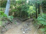 61
61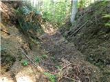 62
62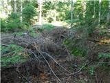 63
63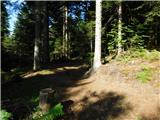 64
64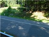 65
65 66
66 67
67 68
68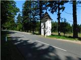 69
69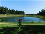 70
70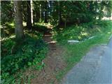 71
71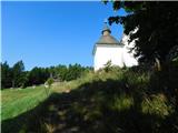 72
72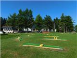 73
73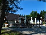 74
74
Discussion about the trip Zgornja Polskava - Ruška koča na Arehu (through Polskavski vintgar)
To post a comment you must log in:
If you do not yet have a username, you must first
register.