Zgornje Poljčane - Boč (via Baba)
Starting point: Zgornje Poljčane (360 m)
| Latitude/Longitude: | 46,29710°N 15,58340°E |
| |
Route name: via Baba
Walking time: 1 h 55 min
Difficulty: easy marked way
Elevation gain: 618 m
Elevation difference along the route: 625 m
Map: Posavsko hribovje (Boč - Bohor) 1:50.000
Recommended equipment (summer):
Recommended equipment (winter): ice axe, crampons
Views: 114.342
 | 8 people like this post |
Access to starting point:
From the Ljubljana - Maribor motorway, take the exit Slovenske Konjice and Poljčane. At the first intersection after leaving the motorway, continue left towards Poljčane (right Slovenske Konjice). The road then takes us through Dražo vas, Žiče and Loče. In the village of Loče, we arrive at a roundabout, where we continue "straight" towards Poljčane (the exit from the roundabout is not marked). A little further ahead, the road brings us to a larger intersection, where we continue right towards Zgornje Poljčane (left Poljčane). We then follow this road to the village, where a road sign for Boč directs us left uphill. Further on, we drive to the first hiking signposts next to which there is a parking lot where we park.
Route description:
From the starting point, head right onto the path with signs for the route via Baba (straight to Boč via Balunjača and Dom na Boču via Detičkova pot) and begin ascending through the forest. After a few minutes, cross the asphalt road leading towards Dom na Boču, then start ascending more steeply. This is followed by the ascent along the forested northern ridge of Baba; at 535 m above sea level, we reach the Baba rock, located along the marked path, from where a nice view opens towards the valley and Pohorje.
A little further on, the marked path turns slightly right (straight along a worse unmarked trail to the summit of Baba 594 m), a bit further it levels out and forks.
Continue slightly right (slightly left unmarked passage to Detičkova pot) and continue following the markers. A few more minutes of moderate ascent follow, and we reach a forest road, which we follow to the right (also here, if we continue left, we quickly join Detičkova pot); from it, we soon go left onto the hiking path (the forest road straight leads to the asphalt road), which ascends briefly, then traverses to the right through a younger forest without major elevation changes, from which some views still open.
A little further, the marked path also reaches the asphalt road; we follow it left and continue along a larger meadow to the mountain hut a few minutes away.
From the hut, continue straight and follow the signs to the summit of Boč. First across a pasture, in the forest the path quickly forks.
Continue right in the direction of Senčna pot (left path via Balunjača and climbing path), then soon go left onto the path that quickly ascends to the forested ridge, where the path from Makole, Brzike and Cerovec pod Bočem joins from the right.
Upon reaching the ridge, go left and first ascend moderately through the forest; soon we reach the windthrow area, where we ascend along a scenic clearing. For some time we ascend along the clearing, then temporarily return to the ridge, where the path turns left and a little further returns to the forest. In the forest, go right onto the slope across which we ascend transversely; higher up, we reach the main southeastern ridge of Boč, where the path turns left once more and then continues along the forested ridge to the viewpoint tower on Boč.
For the view, it is worth climbing the additional 20-meter-high viewpoint tower, from which an exceptional view opens in all directions.
Starting point - Dom na Boču 1:00, Dom na Boču - junction above Dreveniški preval 0:10, junction above Dreveniški preval - Boč 0:45.
Description and photos refer to the condition in December 2024 and April 2026.

Photos:
 1
1 2
2 3
3 4
4 5
5 6
6 7
7 8
8 9
9 10
10 11
11 12
12 13
13 14
14 15
15 16
16 17
17 18
18 19
19 20
20 21
21 22
22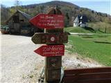 23
23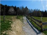 24
24 25
25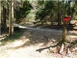 26
26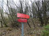 27
27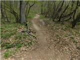 28
28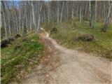 29
29 30
30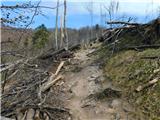 31
31 32
32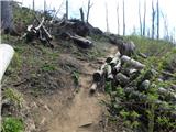 33
33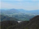 34
34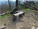 35
35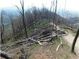 36
36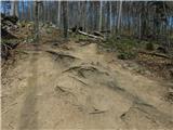 37
37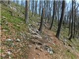 38
38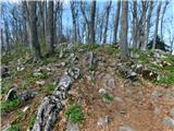 39
39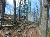 40
40 41
41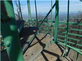 42
42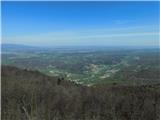 43
43
Discussion about the trip Zgornje Poljčane - Boč (via Baba)
|
| Stolar17. 09. 2009 |
Nice trip, suitable just for the days ahead of us.
|
|
|
|
| Luciano6728. 09. 2009 |
We walked the route together with my father-in-law on Saturday morning and I have to admit we were thrilled. I recommend it to everyone who wants to visit Boč, the ascent will be rewarded at the end with a wonderful view from the tower.
|
|
|
|
| Okmodko19. 04. 2010 |
I went, but it cut me so much in the back that I don't know if I'll go again. Anyway plenty of frost and that in February, but I didn't find any woman. So I'm staying in the village.
|
|
|
|
| klm11. 09. 2010 |
Today I ran to the top. The path is quite straight, already right at the start at the parking lot it starts steeply ascending. From the starting point to the top there is 640 m of ascent, which needs to be overcome in just 2.7 km - comparable to the ascent to Kamniški vrh!
Otherwise, the Poljčane PD has set up new signposts and markings. Both paths described in the forum intertwine with each other, and further on both have their own variations. If the visitor is early enough and as quiet as possible, they will have plenty of opportunities to surprise a herd of mouflons.
|
|
|
|
| Matjaz_652. 05. 2011 |
some of my photos ... with ascent over baba and balunjačo ... and descent along shady path and over baba
from the starting point we can actually ascend via the children's path ... which joins above the hut on the path over balunjačo ... or over baba to the hut ... and further over balunjačo or shady path 
|
|
|
|
| panda23. 05. 2011 |
Today after many years back on top of Boč. Start for two from the parking lot in Spodnje Poljčane at a fairly "late hour" i.e. 9 o'clock on the "over Baba" path. Short rest at the hut for sandwich and water from backpack, as the hut is unfortunately closed on Mondays. On the summit it was quite windy, views so-so. To the south Gorjanci, then Lisca, Kum, partial Kamnik range, Peca and in front of it Uršlja gora, Pohorje........ Descent the same way and then to the famous golden baked trout in the famous Indian valley just before the rain. All's well that ends well.
|
|
|
|
| Helena42. 08. 2017 |
Hike over Baba. At the beginning a bit steep, then nice path to the hut. From the hut onwards through the forest, also a bit steep but nice path. You get the stamp at the hut. Markings well indicated.
|
|
|
|
| jprim3. 08. 2017 |
Super, after a long time something new reported.
|
|
|
|
| Sandi7229. 12. 2024 12:32:07 |
Was up there today, the steepness doesn't let up to the top. From the transmitter to the tower it's icy and very slippery!
|
|
|
|
| jprim30. 12. 2024 12:52:33 |
I just say, where are those times when you were trudging more than half a meter deep on the ridge, winter, winter, real winter.
Another path that's not in the trail description.
LP!
|
|
|
To post a comment you must log in:
If you do not yet have a username, you must first
register.