Zgornje Poljčane - Source of Topli (Studeniški) potok
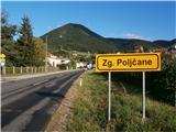
Starting point: Zgornje Poljčane (270 m)
Walking time: 45 min
Difficulty: easy marked way
Elevation gain: 25 m
Elevation difference along the route: 100 m
Map: Posavsko hribovje Boč - Bohor 1:50.000
Recommended equipment (summer):
Recommended equipment (winter):
Views: 2.430
 | 2 people like this post |
Access to starting point:
A) From the direction of Ljubljana we leave the highway in Slovenske Konjice and through Žič, Loč and Zbelovo drive to Poljčane. At the crossroad, we continue right in the direction of Zgornje Poljčane a few hundred meters, where in the center of the settlement we park; a suitable place is the parking spot by the cemetery.
B) From the direction of Maribor we leave the highway in Slovenska Bistrica, where signs point us to Poljčane. Through the center of the settlement Poljčane we continue in the direction of Zgornje Poljčane, where in the center of the settlement we park; a suitable place is the parking spot by the cemetery.
Route description:
After a short tour of the center of the settlement Zgornje Poljčane we continue across the stream Bela by the presbytery a little upwards on the road. We reach the entrance to the church left by the path, on the facade there is also a relief of two Romans. After the tour we continue left in the direction of the settlement Podboč on an asphalt connection, also Formilska kolesarska pot. We soon reach a pleasant, smaller settlement Podboč and left by the path the tree Černogova tisa and a well renovated by locals.
We continue right on the road upwards, now we also enter the landscape park Boč & Plešivec. The asphalt surface changes into a forest road. The view left is also a view lower to the surroundings of Poljčane and the bed of the flood-prone river Dravinja among fields and meadows. The road passes into the forest and we soon reach a grassy clearing, where the road flattens.
On the grassy clearing there is on the right a smaller storage with a field and on the left vineyards. We continue again through the forest and the road winds pleasantly left, right... At the end of the flat section sharply left downwards and descent on a narrower forest stony road, while to the right upwards there is continuation higher to Boč.
We continue downwards, the path descends pleasantly, it is well compacted and we soon reach the end of the path Izvir Toplega/Studeniškega potoka at 295 meters altitude. The path is very suitable also for a bicycle.
The length of the described path is around 3200 meters, 100 positive elevation meters and 75 negative elevation meters.

Photos:
 1
1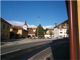 2
2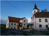 3
3 4
4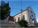 5
5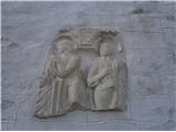 6
6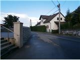 7
7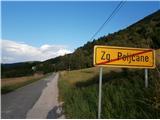 8
8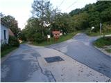 9
9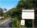 10
10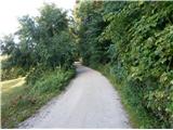 11
11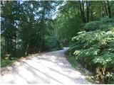 12
12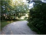 13
13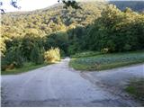 14
14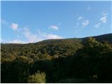 15
15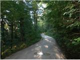 16
16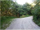 17
17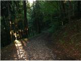 18
18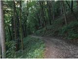 19
19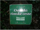 20
20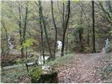 21
21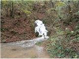 22
22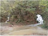 23
23
Discussion about the trip Zgornje Poljčane - Source of Topli (Studeniški) potok
|
| bruny28. 10. 2014 |
To the spring/sources there and back and it was already quite a short evening one. Starting point Zgornje Poljčane. Met no one. Easy path but recent rains have seriously damaged the descent towards Studenice and caution was definitely not superfluous.
Path route:Spring of the Toplega/Studeniški stream from Zgornje Poljčane.
|
|
|
|
| bruny3. 12. 2014 |
In the opposite direction of the description today in the evening hours. In a short circular hiking activity. Fog today, somewhere above 450 meters altitude and it was lightly raining. Today only the middle spring from picture 21 is "working". Water flow smaller than in picture 22. Yes, the stream bed measures a few hundred meters through the settlement Studenic. Soon it joins the Drava River...
Path track:Izvir Toplega/Studeniškega potoka,03.12.2014
|
|
|
|
| bruny17. 01. 2020 |
On the described path in the evening during a short activity...
|
|
|
To post a comment you must log in:
If you do not yet have a username, you must first
register.