Zidani Most (Sušin) - Veliko Kozje
Starting point: Zidani Most (Sušin) (201 m)
Starting point Lat/Lon: 46.0784°N 15.175°E 
Time of walking: 2 h 30 min
Difficulty: easy unmarked way
Difficulty of skiing: easily
Altitude difference: 792 m
Altitude difference (by path): 820 m
Map:
Access to starting point:
From Zasavje or Celje we drive to Zidani Most and follow the road ahead towards Radeče and Sevnica. Approximately 100 meters after the end of the municipality Laško (sign by the road) we turn left under the railway (underpass). Further, we drive on the road to one of the smaller parking lots by the road.
From Trebnje or Krško we drive to Sevnica and follow the road ahead towards Zidani Most. At the end of the municipality Radeče we turn into the underpass of the railway track (the underpass is located a good 100 meters before the confluence of Sava and Savinja). Further, follow the above description.
Path description:
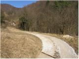
From a smaller parking lot we continue on the road along which we parked, ahead. The path at the beginning leads past a chapel, a spring, houses and a man-made pit full of litter. Further, the road, from which we occasionally get a view towards the Sava River, climbs quite steeply. Higher up, the road brings us to grassy slopes, where it turns right and after a further few minutes brings us to a smaller hamlet. The road, which passes the houses, brings us a little further to a crossroads, where we continue left uphill in the direction of "gojitev jelenov Žibert". The path soon brings us to a pasture fence along which we ascend to the Žibert farm.
At the farm, where the road ends, we notice a marker and it directs us onto a cart track that ascends along the fence. Behind the farm we come to a junction of two cart tracks. We continue on the left, worse one, which continues to ascend along the pasture fence. The cart track then turns slightly right and brings us out of the forest onto grassy slopes along which we ascend to Mrzla planina.
On Mrzla planina, where we again reach the road, we notice some houses behind which the road starts to descend. After a few minutes of descent we come to two successive crossroads, where both times we continue left (here the marked path from Radeče joins). The road then ascends and soon brings us to a marked trail junction. We continue left across the meadow in the direction of Veliko Kozje. The cart track along which we walk soon brings us into the forest, where the marked path from Zidani Most joins. From here to the summit we have another good 20 minutes of walking on a nice, moderately steep forest path.
On the way: Mrzla planina (825m)
Trip can be extended to: Lisca
Pictures:
 1
1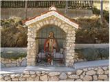 2
2 3
3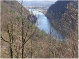 4
4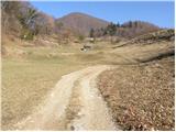 5
5 6
6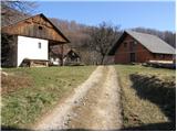 7
7 8
8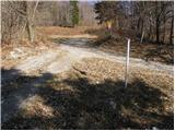 9
9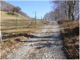 10
10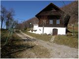 11
11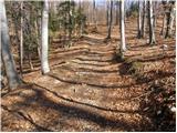 12
12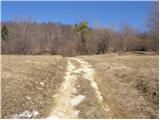 13
13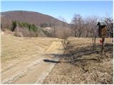 14
14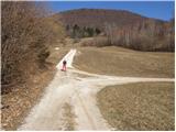 15
15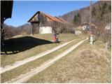 16
16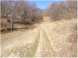 17
17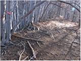 18
18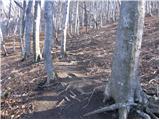 19
19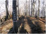 20
20 21
21