Zvodno - Grmada above Celje (via Hudičev graben)
Starting point: Zvodno (300 m)
| Latitude/Longitude: | 46,20790°N 15,28770°E |
| |
Route name: via Hudičev graben
Walking time: 1 h 45 min
Difficulty: difficult marked way
Elevation gain: 418 m
Elevation difference along the route: 450 m
Map:
Recommended equipment (summer): helmet
Recommended equipment (winter): helmet, self belay set, ice axe, crampons
Views: 32.222
 | 2 people like this post |
Access to starting point:
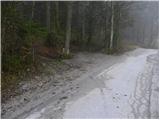
From the highway Ljubljana - Maribor, we take the exit Celje - center and continue driving in the direction of Laško and Zidani Most. The road leads through the center of Celje, then brings us to a roundabout with a fountain. Here we continue "straight" (direction Laško and Zidani Most) and follow the road to the next traffic-light intersection, where we continue left, drive across the river Savinja and then at the intersection behind the bridge continue right. Further, we reach the underpass under the railway track and only a few meters ahead to the fire station in Zagrad. We continue straight and follow the road through the village, which higher up brings us to a smaller intersection, where we notice signs for Suhi potok right, Hudičev graben straight. We continue straight and after a short ascent we get to the NOB monument, after which the road gradually flattens. Here we need to pay attention, because we will soon get to the beginning of the marked path which leads through Hudičev graben. We park a few tens of meters lower, on one of the parking spaces by the road (there aren't many).
To the starting point we can also come from Dolenjska and Zasavje. In this case, we first drive to Rimske Toplice and then through Laško to the starting point.
Route description:
From the starting point, we continue on the road a few more tens of meters and then signs for Hudičev graben point us right onto a footpath which first ascends gently along the fence. A little further, we come to a larger meadow, where the path gets lost a bit, but since we continue in the same direction, there are no major orientation problems. At the end of the meadow we step onto a wide cart track, which after a few steps brings us to Hudičev potok, where there is a marked junction.
We continue in the direction of Hudičev graben (left Srebotnik) and continue the ascent on the path which runs in and along the bed of Hudičev potok. The gorge soon narrows and pegs, staples and steel cables assist us. Further, with the help of numerous fixed aids we ascend right above the stream bed, on which we can observe numerous small waterfalls.
Higher the gorge widens, the path turns a little to the right, where it begins to ascend more steeply through the forest. If we set out on the path in the spring months, we can observe numerous patches of wild garlic during the ascent through the forest. After a few minutes' ascent, the path flattens and brings us to a wide cart track along which we continue. The path ahead, which runs along an ever-widening cart track on the south side, bypasses the little-known Bavč and shortly afterwards brings us to a junction, where the path through Suhi potok joins from the right.
We continue in the direction of Celjska koča and continue the ascent along a wide macadam road, from which a path to Tolsti vrh and Svetina soon branches off to the left. We continue along the road, following it only to a solitary farmstead. Here signs for Grmada direct us right onto the path which climbs between the residential house and the farm building. We continue the ascent along a gentle cart track which crosses a strip of forest and shortly afterwards brings us to Pečovniška koča.
From the hut we continue along a wide path, which initially ascends gently towards the summit of Grmada. After a good five minutes of walking the path narrows and climbs to the forepeak, from which the path descends slightly. There follows a few minutes' walk along the vegetated east ridge of Grmada, from which we occasionally get some views into the valley. The pleasant path then ascends steeply and after a few more minutes of walking brings us to the summit.

Photos:
 1
1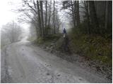 2
2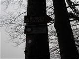 3
3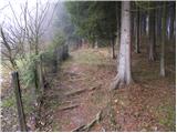 4
4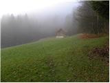 5
5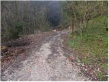 6
6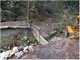 7
7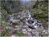 8
8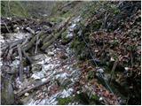 9
9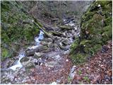 10
10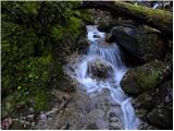 11
11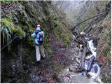 12
12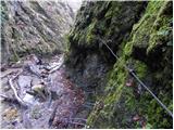 13
13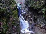 14
14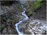 15
15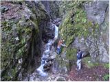 16
16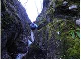 17
17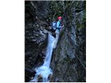 18
18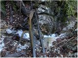 19
19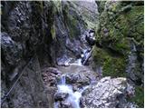 20
20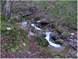 21
21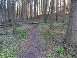 22
22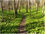 23
23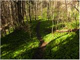 24
24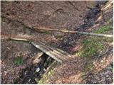 25
25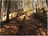 26
26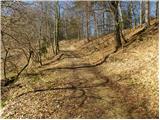 27
27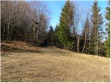 28
28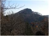 29
29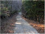 30
30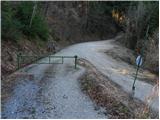 31
31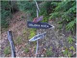 32
32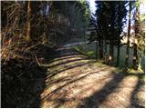 33
33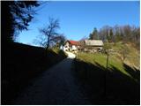 34
34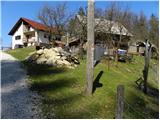 35
35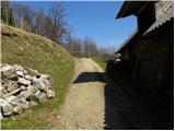 36
36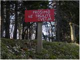 37
37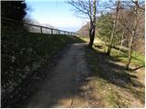 38
38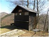 39
39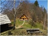 40
40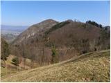 41
41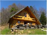 42
42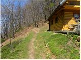 43
43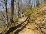 44
44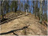 45
45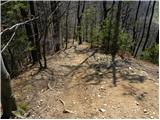 46
46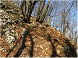 47
47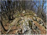 48
48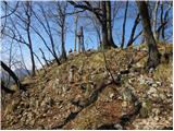 49
49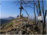 50
50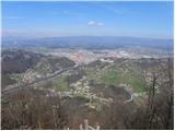 51
51
Discussion about the trip Zvodno - Grmada above Celje (via Hudičev graben)
|
| Stolar21. 12. 2010 |
How does this trail look in winter time, is it passable?
|
|
|
|
| geppo21. 12. 2010 |
In Hudičev graben, when it's cold, there's plenty of ice. Dangerous for slipping!
The rest is trodden and without problems.
|
|
|
|
| VanSims4. 04. 2011 |
The path through Hudičev graben is nice, wild and not so very dangerous. Of course with proper gear not like most in sneakers,... even children! For them maybe some self-belaying is recommended!
From the top of Grmada there is a nice view of Celje and surrounding mountains and Celjska koča.
|
|
|
|
| pohodnik3815. 04. 2013 |
Yesterday I headed to Grmada
VIDEO
pictures will come later.
Best regards! Tone
|
|
|
|
| pohodnik3817. 04. 2013 |
And a few more pictures to view the conditions, nothing more to add except that in Hudičev graben the cable is interrupted at two places but you can pass through... the path is not as easy as it seems. It didn't cause me problems but for others' information 
PICTURES AND DESCRIPTION
Best! Tone
|
|
|
|
| pohodnik387. 08. 2019 |
Yesterday did the mentioned path in wonderful but hot weather even though in the morning I was already in Logarska dolina on another tour but light rain drove me away. Otherwise you never know with today's strange weather what will happen.....
PHOTOS and personal impressions from the path
Regards! Tone
|
|
|
|
| alexandra127. 03. 2021 |
Visited on 02.03.2021. Parking here is really limited. Interesting trail that passes through the gorge itself quite quickly (in spring it's full of crocuses higher up - don't pick them, the plant is protected), so the part to Pečovniška koča drags a bit for me, but ok. Along the ridge past the forepeak to the top of Grmada. Celje at your feet. If you want to ring the bell, I inform you that due to the epidemic the rope has been removed(?). Well, at least that's what the hikers who were there at the time concluded. Ring with a stick or otherwise.
There are quite a lot of people here, too many for my taste, so it doesn't really pull me back. I return along the marked path left of Pečovniška koča, lower in the valley I leave the main path at the sign for Hudičev graben, i.e. right, straight to the car. The gorge wins.
|
|
|
|
| zdejan28. 03. 2021 |
New parking lot, large, at the fish farm.
|
|
|
|
| Savinja111. 08. 2024 14:35:40 |
We park opposite the Ferlič fish farm (Zvodno), where there is an asphalt parking lot. The path through Hudičev graben is somewhat damaged due to heavy rain, but it is throughout nicely passable and traceable. All fixed cables are tensioned, all steps are reliable. Great trip!
|
|
|
To post a comment you must log in:
If you do not yet have a username, you must first
register.