Axamer Lizum - Ampferstein (Lustige Bergler Steig)
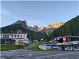
Starting point: Axamer Lizum (1564 m)
Starting point Lat/Lon: 47.19571°N 11.30269°E 
Path name: Lustige Bergler Steig
Time of walking: 2 h 40 min
Difficulty: very difficult marked way
Ferrata: B
Difficulty of skiing: very demanding
Altitude difference: 992 m
Altitude difference (by path): 992 m
Map: Innsbruck und Umgebung, 31/5 1:50.000
Access to starting point:
From Ljubljana, we drive on the highway past Salzburg in the direction towards München. At the multilevel junction Dreieck Inntal we go on the road A93 in the direction of Innsbruck/Kufstein/Brenner. When we return to Austria we continue to the junction with the exit Innsbruck-West. There we continue on Egger-Lienz-Straßein and we turn towards Axams in direction Axamer Lizum. We continue driving to Axams, where a signpost points us to an ascending but comfortable asphalt road which we follow to a free parking lot at the ski slope Axamer Lizum. From the center of Innsbruck to Axamer Lizum is approximately half an hour of driving.
Alternatively we can drive through northern Italy: in this case from the main Slovenia on the highway A2 we drive to one of the border crossings with Austria and we continue towards Lienz. Here we continue on the road 100 and past the passage Prato alla Drava we drive into Italy. In Italy we follow the road SS49 all the way to the juncture with highway A22 in the direction towards the mountain pass Brenner. After the mountain pass, we continue in the direction towards Innsbruck to the exit Innsbruck-Süd. At the junction, we go on the road B182 and we continue driving to Axams. From there we follow the upper description.
Path description:
From the parking lot, we go past the center of ski center Axamer Lizum on the macadam road and we go towards the gable of valley below the rocky peaks of Kalkkögel. Following the signposts for Marchreisenspitze after few minutes of walking on the road we go left on a narrower footpath which at first crosses the meadow. Soon the path turns to the right and starts lightly ascending through a thin forest on the southern slope of Schneiderspitze. A little higher, the forest gets thinner, and footpath horizontally crosses a grazing slope and ascends towards the saddle Halsl, on which there is a crossing of numerous paths, and also the alternative path on Marchreispitze joins, which to the saddle leads from the valley Stubaital. From the parking lot at Axamer Lizum to the saddle is a little more than hour of walking.
From Halsl we continue in the direction of Ampferstein and Marchreispenspitze or path "Lustige Bergler" - signpost warns, that it is appropriate only for experienced mountaineers. In the initial part, the path is in zig-zags moderately ascending on a grassy slope of unnamed hill in Kalkkögel, but it is still technically undemanding. After a good 30 minutes of walking from Halsl we get to a gully, which is falling deeply towards Axamer Lizum, and by its edge we ascend to a wide ridge one of the secondary peaks of Ampferstein. Further, the path for some time easily leads on panoramic grassy-scree terrain, until after approx. 45 minutes of walking from Halsl, we get to the foot of rocky massif of Ampferstein. Before the descent into a hollow, where there is the beginning of a secured part of the path on Ampferstein, we cross a slightly exposed passage above the steep gully, and then with the help of first fixed safety gear on the path (exceptions are some sort of narrow pipes) we descend to a plain in an extremely scenic environment. From the hollow, with the help of steel cables we ascend on a path which leads on an exposed ledge and continues on a steep slope, where we occasionally get help from fixed safety gear. A little later, the footpath passes into a continuously secured path, where with the help of steel cables it is ascending over steep rocky jumps. After a short crossing of an outside corner in the wall of Ampferstein follows almost vertical ascent over a rocky band, where we get help also from stemples. After that, the steepness decreases a little, and the secured path brings us to the top of the gully below the upper part of Ampferstein. To the top of Ampferstein we continue on the path which crosses steep grassy slopes high above Stubai valley. After approx. 15 minutes of additional walking, we get to a crossroad just below the top of Ampferstein, from where to the top with a large cross there is only few minutes of ascent.
The ascent on Ampferstein we usually do as part of the entire path "Lustige Bergler", which ends on the top of neighbouring Marchreispitze. The continuation of the path on a climbing path offers a logical addition to the trip; the only marked option for a descent is to return on the ascent route. In spite of that, that "Lustige Bergler Steig" is usually described as part of modern ferratas, its route and difficulty reminiscent more of very demanding secured paths in Slovenian high-mountains. On Austrian scale of secured paths it reaches relatively modest grade B, in spite of that it is recommended to use the self-belay set, and the helmet because of in parts very crumbly terrain in limestone mountain range is pretty much mandatory.
On the way: sedlo Halsl (1992m)
Pictures:
 1
1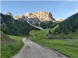 2
2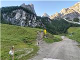 3
3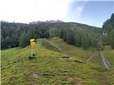 4
4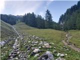 5
5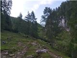 6
6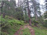 7
7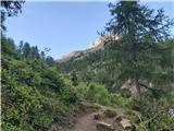 8
8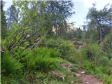 9
9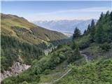 10
10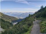 11
11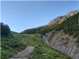 12
12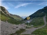 13
13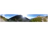 14
14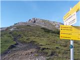 15
15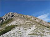 16
16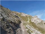 17
17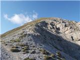 18
18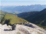 19
19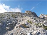 20
20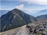 21
21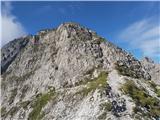 22
22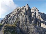 23
23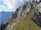 24
24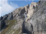 25
25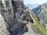 26
26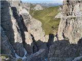 27
27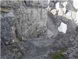 28
28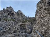 29
29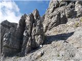 30
30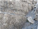 31
31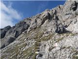 32
32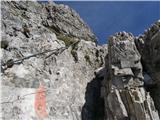 33
33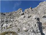 34
34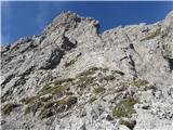 35
35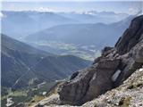 36
36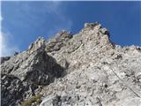 37
37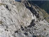 38
38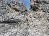 39
39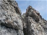 40
40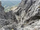 41
41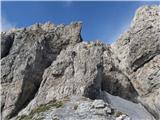 42
42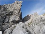 43
43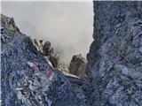 44
44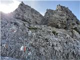 45
45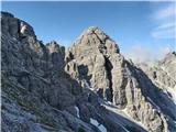 46
46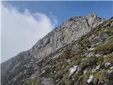 47
47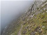 48
48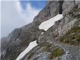 49
49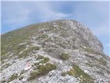 50
50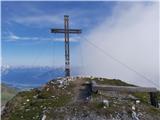 51
51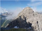 52
52