Bistriški jarek (border crossing Muta) - Bivak Piramida
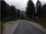
Starting point: Bistriški jarek (border crossing Muta) (460 m)
Starting point Lat/Lon: 46.6518°N 15.1209°E 
Time of walking: 4 h 10 min
Difficulty: easy marked way
Difficulty of skiing: no data
Altitude difference: 935 m
Altitude difference (by path): 1030 m
Map: Koroška 1:50.000
Access to starting point:
A) We drive to Dravograd, and then we continue driving towards Maribor. After the road sign 8.0 km, we need to pay attention, because a little behind the bus stop and the pedestrian crossing, we turn left into the settlement Gortina (the turn-off from the main road is not marked). Immediately when we leave the main road, we arrive in the settlement Gortina, and then we drive in the direction of Muta, turning left at the marked crossroad, where we notice signs for Bistriški jarek. The road then quickly brings us to Bistriški jarek, through which we gently ascend. Soon after the road sign 6 km, we come to a smaller crossroad, where before the bridge we park in an appropriate place.
B) First, we drive to Maribor, and then we follow the signs for Dravograd. When we are already crossing Mučka Bistrica, a little after the Tuš store we drive right in the direction of the settlement Muta 1. The path ahead brings us to Muta, where at crossroads we follow the priority road; from a somewhat larger crossroad we go left, so that we continue driving towards Gortina. A little after the settlement Muta ends, from the marked crossroad we drive right in the direction of Bistriški jarek. The road then quickly brings us to Bistriški jarek, through which we gently ascend. Soon after the road sign 6 km, we come to a smaller crossroad, where before the bridge we park in an appropriate place.
Path description:
From the starting point over the bridge we cross Mučka Bistrica, then right behind the bridge we continue left, where at first we walk along the river. Before the abandoned Lipnik mill the path turns right and starts to ascend on a cart track. Higher we reach the pastures of the nearby farm, and a well-marked cart track brings us to the farm Lipnik, which we bypass on the right side. Behind the house we step onto a macadam road, which we follow to the right; at the nearby crossroad we go sharply left towards Pernice. The path ahead leads us along a wider macadam road, where we also go past individual farms, and at crossroads we follow the blazes. With nice views we then reach a marked junction, where the signs for Pernice direct us slightly right onto a cart track that ascends transversely, and higher turns right. After crossing the meadow the path for some time runs along the edge of the forest, then, when it already turns left, it enters the forest. We continue through the forest; higher we cross the road twice in a row, and after a shorter transverse ascent to the right we also cross a spring.
Before the Porčnik homestead the path turns left, then ascends to a somewhat poorly marked junction at Razpotnikovo, where we continue on the left cart track. The cart track returns to the forest and brings us to the altitude mark 1000 m.
The cart track here flattens and at the church of St. Simon and Jude Thaddeus brings us to an asphalt road, along which past the NOB monument we continue to the logbook box, which is located at the former Planinsko zavetišče pri Knezu on Pernice.
Behind the former shelter we arrive at a crossroad and junction, and we continue along the macadam road in the direction of Ojstrica (right path to Košenjak past St. Urban). The road we continue on bypasses on the right side Dom krajanov Pernice and the sports field, and further leads us through the forest and past individual farms, from which a nice view opens up on the grassy slopes. At junctions we continue straight in the direction of Ojstrica or Pot orjaških lip, and after some time the path also leads us past a chapel and NOB monument.
At the first crossroad after the Lunčko farm, which we reach after approximately 15 minutes of walking from the mentioned farm (the Lunčko farm is located at the chapel and NOB monument), a forest road branches off to the right towards St. Urban and the Bogatec farm, and we from here continue on the wider macadam road leading towards Ojstrica. Next follows the crossing of Potoški graben, then before the Lonhtar farm we continue right onto the marked path towards Košenjak.
The path ahead leads us along a wider newer cart track, along which we ascend quite steeply, then we go left onto the marked path, which higher returns to the wider cart track. There follow some more junctions where we follow the blazes, then through a somewhat sparser forest we reach the hunting hut Bivak Piramida.
Bistriški jarek - Pernice 1:50, Pernice - Bivak Piramida 2:20.
Description and pictures refer to the condition in 2018 (November).
Pictures:
 1
1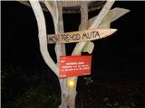 2
2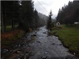 3
3 4
4 5
5 6
6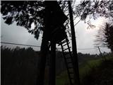 7
7 8
8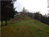 9
9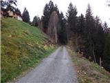 10
10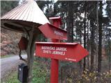 11
11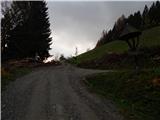 12
12 13
13 14
14 15
15 16
16 17
17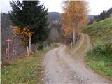 18
18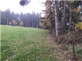 19
19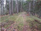 20
20 21
21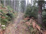 22
22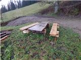 23
23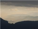 24
24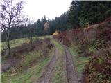 25
25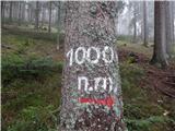 26
26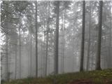 27
27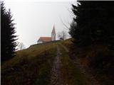 28
28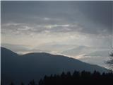 29
29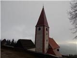 30
30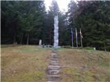 31
31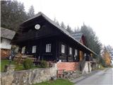 32
32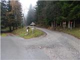 33
33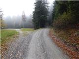 34
34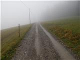 35
35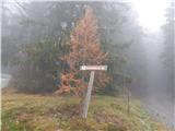 36
36 37
37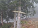 38
38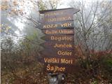 39
39 40
40 41
41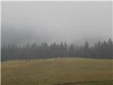 42
42 43
43 44
44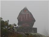 45
45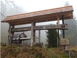 46
46 47
47 48
48 49
49 50
50 51
51 52
52 53
53 54
54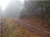 55
55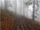 56
56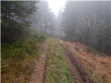 57
57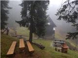 58
58 59
59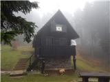 60
60