Bohinjska Bistrica - Krevl (via Planina za Črno goro)
Starting point: Bohinjska Bistrica (530 m)
Starting point Lat/Lon: 46.2702°N 13.9568°E 
Path name: via Planina za Črno goro
Time of walking: 2 h 55 min
Difficulty: easy marked way
Difficulty of skiing: no data
Altitude difference: 985 m
Altitude difference (by path): 1015 m
Map: TNP 1:50.000
Access to starting point:
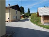
A) First, we drive to Bled, then continue driving towards Bohinj. When we arrive in Bohinjska Bistrica, from the roundabout we continue in the direction of Soriška planina and Tolmin, then we arrive at Jelovška cesta, where at house number 10 the described path begins. We park somewhere nearby, best at the foot of the former ski slope Kobla.
B) From Železniki or Petrovo Brdo we drive to Bohinjska Bistrica, where on Jelovška cesta at house number 10 the described path begins. We park somewhere nearby, best at the foot of the former ski slope Kobla.
C) We can also reach the starting point by train.
Path description:
From Jelovška cesta 10 we continue towards the southwest, where already after a few meters we notice the mountain signposts for Črna prst. From the houses the path passes onto a cart track, along which in a few minutes we ascend to the military cemetery from the First World War Rebro. The marked path bypasses the cemetery on the right side, then leads us across a vast meadow, where a few minutes further we join a somewhat wider cart track. We continue slightly left, then a few tens of meters further we cross a macadam road, where the initially distinct cart track gradually begins to ascend. Higher, at the cart track junction we choose the right branch, along which there are old signposts for Črna prst, from it somewhat higher we go slightly right again onto a footpath, which begins to ascend more steeply. All the time we ascend along fairly rare signposts, then on a smaller mowed meadow we reach a cart track, which we follow to the left, along it in a few steps we reach a wider macadam road.
When we reach the road we continue left downhill following the signs for Črna prst (right old path to Orožnova koča), a few tens of steps lower at the marked junction we turn right in the direction of Črna prst, Planina za Črno goro and Orožnova koča. The path ahead bypasses a private house on the right side (formerly Planinski dom dr. Janeza Mencingerja), then a little further joins a cart track, along which we continue the ascent. A little higher, at the junction we continue right, then the path continues through the forest. A little further the path leads us past a log cabin and a cross, then we already arrive at a marked junction, where we continue left (right Orožnova koča).
Further on, the cart track turns into a footpath, which a little higher brings us to a forest road, which we follow to the right. We walk a few steps along the road, then the signs for Črna prst direct us left onto a steep path. We continue the ascent along an initially relatively steep path, which further leads us past artificially made channels intended for water drainage (the channel was built to prevent water ingress into the Bohinj tunnel). Higher, the path temporarily flattens completely, then moderately ascends to the Planina za Črno goro.
When we step onto the mountain pasture, the marked path turns left, then semicircularly around the channel bypasses the mountain pasture. On the other side of the mountain pasture we continue left and begin to moderately ascend through initially sparse forest. After a few minutes of further walking the path enters the forest, which brings us to a marked junction, where we continue straight in the direction of Porezen (sharply right Črna prst).
The path ahead moderately ascends for a few more minutes, then brings us to a small saddle Na Kalu.
Here a unmarked shepherd's path branches off to the right, which crosses the southern slopes of the lower Bohinj mountains, while we continue slightly left and ascend to the edge of the ski slope Kobla. When we reach the edge of the ski slope we continue right, then ascend right below the summit of Krevl. Right below the summit the marked path turns left, while on the right side we find a less trodden path, along which in a few steps we ascend to the panoramic summit.
Bohinjska Bistrica - Planina za Črno goro 2:15, Planina za Črno goro - Krevl 40 minutes.
Pictures:
 1
1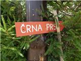 2
2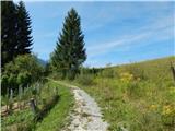 3
3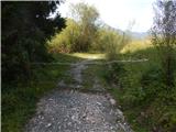 4
4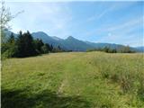 5
5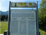 6
6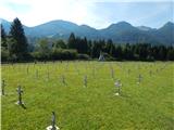 7
7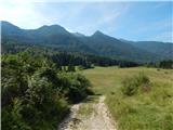 8
8 9
9 10
10 11
11 12
12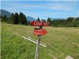 13
13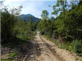 14
14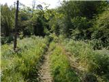 15
15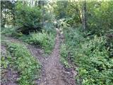 16
16 17
17 18
18 19
19 20
20 21
21 22
22 23
23 24
24 25
25 26
26 27
27 28
28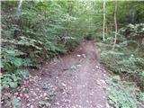 29
29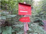 30
30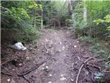 31
31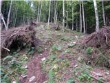 32
32 33
33 34
34 35
35 36
36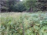 37
37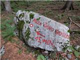 38
38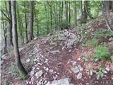 39
39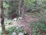 40
40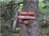 41
41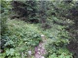 42
42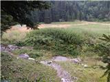 43
43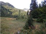 44
44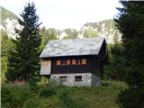 45
45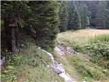 46
46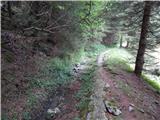 47
47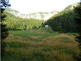 48
48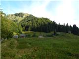 49
49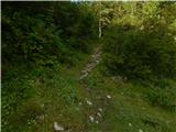 50
50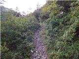 51
51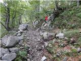 52
52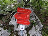 53
53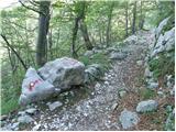 54
54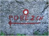 55
55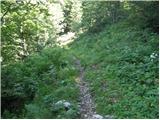 56
56 57
57 58
58 59
59 60
60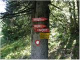 61
61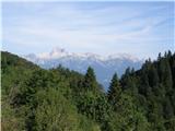 62
62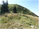 63
63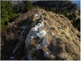 64
64 65
65