Starting point: Bohinjsko sedlo (1277 m)
Starting point Lat/Lon: 46.2409°N 14.0101°E 
Time of walking: 2 h 35 min
Difficulty: easy marked way
Difficulty of skiing: no data
Altitude difference: 221 m
Altitude difference (by path): 525 m
Map: Škofjeloško in Cerkljansko hribovje 1:50.000
Access to starting point:
A) From highway Ljubljana - Jesenice we go to the exit Lesce and follow the road towards Bled and forward towards Bohinjska Bistrica. From Bohinjska Bistrica we continue left in the direction of Tolmin and Soriška planina. We follow this road to a large parking lot near the ski center Soriška planina.
B) From Železniki we drive towards Podbrdo or vice versa, but only to a spot, where signs for Soriška planina point us on an ascending road. We follow this road to a large parking lot by the foot of the ski slope Soriška planina.
Path description:
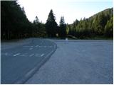
From the parking lot, we continue towards the west on a gentle macadam road in the direction of the mountain hut Litostrojska koča on Soriška planina. Further, the road moderately ascends and it quickly brings us to the mentioned mountain hut.
From the mountain hut, we continue straight on a marked path in the direction of Lajnar, Možic and Šavnik. The path is at first for some time ascending parallel with a ski lift, and then splits into two parts. We continue on the right path, by which we notice a sign Možic (straight Lajnar), and which gradually starts ascending steeper. Higher, we cross a lane of a low forest and then we gradually get to a smaller valley. From the small valley we go slightly to the right, and then on the path which ascends diagonally through a grassy slope, in few minutes we walk to an old Italian border building.
From the border building, by which there is also a nicely settled smaller shepherd hut, in few steps we ascend on a grassy ridge, where the path from Lajnar and Petrovo Brdo joins. Here we continue at first to the right, and after few steps left downwards (sharply left peak Slatna 3 minutes). Next follows a short descent and the path brings us to the next crossing, where we again continue slightly left (straight Možic 10 minutes). We continue in the direction of Šavnik and Črna prst, and the path quickly descends into the forest. Next follows a short a little steeper descent through the forest and then the path flattens and brings us into a grassy small valley named Na Poljani. Here we continue left (right downwards mountain pasture Planina za Šavnikom) and through a meadow we ascend to a smaller saddle between Slatna on the left and Šavnik on the right.
From the saddle, from which the path to Šavnik branches off to the right, we continue straight and then immediately left in the forest through which we start descending. During the descent, we can on the right side notice an old military bunker, and we follow the path from which occasionally a view opens up a little towards Porezen and Baška grapa to a saddle Vrh Bače.
From the saddle, we continue at first right, and then at the marked crossing by the end of the road, we go left into the forest. Next follows few minutes of ascent through the forest and then the path flattens and it brings us to the cottage of GRS (mountain rescue service). Further follows a short descent, and the path from the slopes of Šance, gradually passes on less vegetated slopes of Kobla. Here we at first ascend through a thin forest and then the path brings us on a slightly exposed ridge, on which we start ascending steeply (in wet on some spots, it is dangerous for slipping). Higher the ridge flattens, and the path turns to the right, and after a minute of additional walking brings us on an indistinct peak of Kobla.
Pictures:
 1
1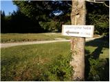 2
2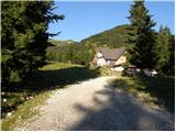 3
3 4
4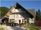 5
5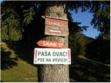 6
6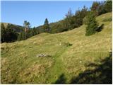 7
7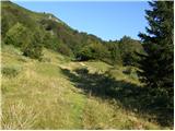 8
8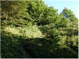 9
9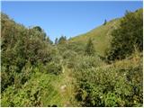 10
10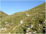 11
11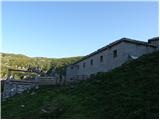 12
12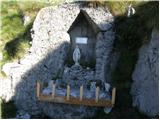 13
13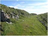 14
14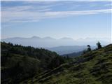 15
15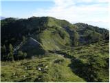 16
16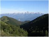 17
17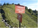 18
18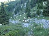 19
19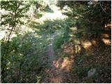 20
20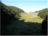 21
21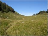 22
22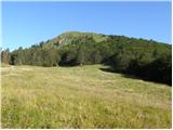 23
23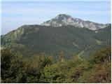 24
24 25
25 26
26 27
27 28
28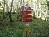 29
29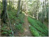 30
30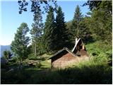 31
31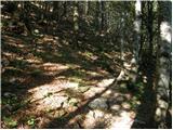 32
32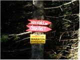 33
33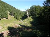 34
34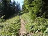 35
35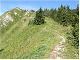 36
36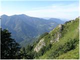 37
37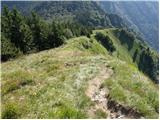 38
38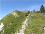 39
39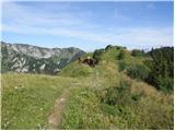 40
40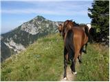 41
41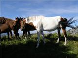 42
42 43
43