Fuciade, Passo San Pellegrino - Cima Ombrettola
Starting point: Fuciade, Passo San Pellegrino (1900 m)
Time of walking: 4 h
Difficulty: partly demanding marked way
Difficulty of skiing: no data
Altitude difference: 1031 m
Altitude difference (by path): 1031 m
Map: Tabacco 1:25000 (Marmolada)
Access to starting point:
Highway between Trst and Venice we leave in Portogruaro and we follow the highway in the direction of Pordenone, Conegliano and Belluno, where we leave the highway and we continue through Belluno, Ponte nelle Alpi, Agordo, Falcade, direction Passo san Pellegrino. About kilometer before we come on the mountain pass, we turn at the signpost for Baita Flora Alpina right towards grazing mountain pasture Malga Boer (1808 meters) and cirque Fuciade. After about a kilometer of steep road past the mountain pasture we park on a marked parking lot by the bridge over Rio Cigole. The road goes further to holiday cottages, cattle pen and mountain hut Fuciade, but a sign prohibits further driving.
It is also possible to go on foot from the very mountain pass past the hotel Miralago.
Second possible access is through Karawanks – Spittal – Lienz – Cortina d'Ampezzo – Falzarego – Alleghe – Falcade – Passo san Pellegrino.
Path description:
From the parking lot, we continue on gentle, at first asphalt cart track over nice pastures in the direction of the wall above the valley Val Cigolè, above which reign peaks Cima Uomo, Punta Cigolè, and Sasso di Valfredda, past idyllic cottages to the mountain hut / hotel Rifugio Fuciade, 1974 meters (20 minutes). At the crossing behind the mountain hut, we leave a wide mule track and then over pastures we follow the path number 607. Comfortable, even zig-zags offers views on distant Pale di San Martino and on the nearby towers of Cima Tascia and Torre Enrica. On the top of grassy ridge we enter on a wide scree in Val Cirelle, over which runs comfortable footpath from numerous zig-zags, but below very vertical walls. At the signpost for Cima Uomo valley continues straight, and we turn sharply right and we follow comfortable zig-zags on huge scree on the mountain pass Cirelle (2683 meters, from the mountain hut 2 hours and a half to 3 hours). On the mountain pass a view opens up into the upper part of valleys Contrin and on elegant pyramid Sasso Vernale (3054 meters), which reigns above a little lower ridge of Ombretta, and behind it wide south wall of Marmolada.
From the mountain pass are possible easy half an hour tours on unmarked, but well visible paths, on left eastern peak Cima Cadine (2885 meters), and on the right Punta Cigolè (2815 meters). We see also our destination right from pyramidal Sasso Vernale.
The path from the mountain pass few meters follows signs for mountain hut Rifugio Contrin, and then we go on with red dots marked footpath 612 towards the mountain hut Falier (a sign on rock). The footpath few times ascends and descends on slopes of Punta Cigolè and Cima Ombrettola. Below the notch Forcela del Bachet we cross some snow tongues, which stay late in the summer, and on a crumbly gravel, almost lunar terrain in steeper ascent we reach small ridge above the mountain pass Passo Ombretta, 2864 meters, (1 hour from the mountain pass Cirelle), from which we look into a valley Vallon d'Ombrettola below the mighty walls, which are proudly displayed by Sasso di Valfredda, Formenton, Monte la Banca, Fop, Civetta and Pelmo.
On the mountain pass, we leave the path and we just go across or on one of several footpaths we go towards 15 minutes distant, from this side rounded, and from other precipitous panoramic summit.
Even nicer is access direct on the ridge from the notch Forcela del Bachet, which is a little steeper pathless terrain, on which we are looking for easiest passages, at first on few meters lower secondary peak and ahead on the main peak.
On the way: koča Rifugio Fuciade (1974m), Prelaz Passo Cirelle (2683m), Punta Cigole (2815m), vrh Cima Cadina (2885m), Škrbina Forcela del Bachet (2736m), vrh Bachet (2800m)
Pictures:
 1
1 2
2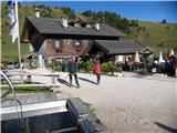 3
3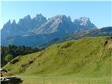 4
4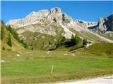 5
5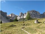 6
6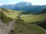 7
7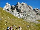 8
8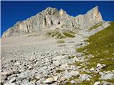 9
9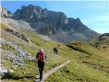 10
10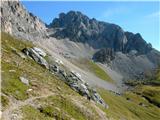 11
11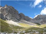 12
12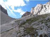 13
13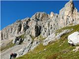 14
14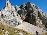 15
15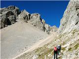 16
16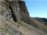 17
17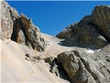 18
18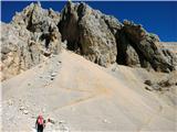 19
19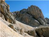 20
20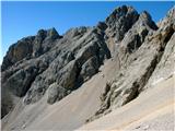 21
21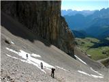 22
22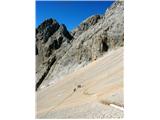 23
23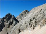 24
24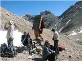 25
25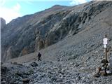 26
26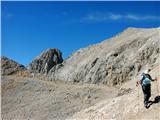 27
27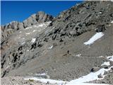 28
28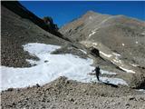 29
29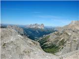 30
30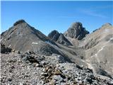 31
31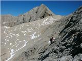 32
32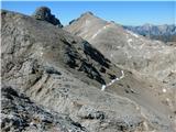 33
33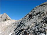 34
34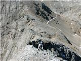 35
35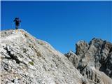 36
36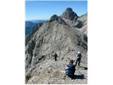 37
37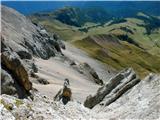 38
38 39
39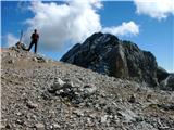 40
40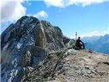 41
41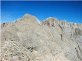 42
42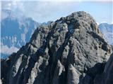 43
43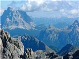 44
44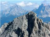 45
45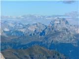 46
46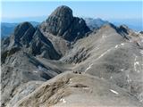 47
47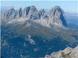 48
48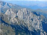 49
49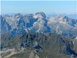 50
50