Gößgraben - Hochalmspitze (Detmolder Grat)
Starting point: Gößgraben (1600 m)
Starting point Lat/Lon: 46.9804°N 13.3351°E 
Path name: Detmolder Grat
Time of walking: 5 h 30 min
Difficulty: very difficult marked way
Difficulty of skiing: no data
Altitude difference: 1760 m
Altitude difference (by path): 1770 m
Map:
Access to starting point:
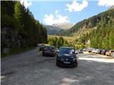
From the Karawanks Tunnel, we follow the highway towards Salzburg to exit Gmünd. Further, we then follow the signs for valley Maltatal. The road, that runs through the mentioned valley we follow to the settlement Koschach. When on the right we notice the waterfall Fallbach (highest waterfall in Koroška) we will soon come to a crossroad where we go left over a bridge, which crosses a river Malta. Only a little after this we again turn left on a narrower road steep upwards into a valley Gossgraben (signs for mountain hut Gießener Hütte). We follow the road all the way to a large parking lot below dam Goskarspeicher. The last few kilometers of the road are opened only in the summer months when the mountain hut Gießener Hütte is open (from the beginning of July to the end of September).
Path description:
From the parking lot, we continue on the asphalt road which is closed for traffic. After few minutes of the ascent, we come to a crossroad where we continue right on a macadam road where a sign with the caption »Gießener Hütte« points us to. Left is only a short ascent to the lake Gößkarspeicher.
At the crossing, we also enter into national park High Tauern (Nationalpark Hohe Tauern). The road is all the time ascending and increasingly beautiful views start to open up towards the mountain group Reißeck. At the ascent we also few times cross a grazing fence, because by the road in the summer months also livestock is grazing. Further, we can all the time walk on the road or we go on marked shortcuts. Forest is becoming thinner and in the last part of the path towards the mountain hut, we walk by rocky terrain. Here also a nice view opens up towards the summit Hochalmspitze and on numerous streams, which run down the slope. We still continue on the road and we soon come to the hut Gießener Hütte.
From the mountain hut, we continue on a footpath which immediately above the mountain hut brings us to a crossing. Left leads the path towards the notch Mallnitzer Scharte and mountain hut Arthur von Schmid Haus, and we continue slightly right following the signs »Hochalmspitze«. A little after that easy path on the nearby peak Winterleitenkopf branches off to the right.
The path further mostly runs on rocky plates, which are at first nicely arranged so that ascent doesn't cause problems. Here we enter into the main area of national park High Tauern and after a short ascent, we come to another crossing.
To the right leads the path on the eastern ridge on Hochalmspitze, and we continue left on the path 519 named Schwarzenburger Weg. From the crossing, the path for some time crosses slopes towards the west and in doing so it crosses few streams. Later it turns a little to the right and starts ascending slightly steeper. The path which runs mostly on rocky plates then brings us to a marked crossing.
Left leads the path towards the summit Schneewinkel Spitze and forward towards Säuleck, and we continue right towards the notch Lassacher Winklscharte. The path from a crossing runs towards the north and is all the time ascending on rocky terrain. Soon from the path again a view opens up towards the summit Hochalmspitze. After that, the path turns slightly to the left and follows the last ascent to the notch Lassacher Winklscharte. On the path towards the notch also in late summer, some snow fields are still possible, which are not too steep or they can be bypassed.
On the notch where there is a crossing, we continue right following the signs »Hochalmspitze, Detmolder Grat«. The path from the notch at first crosses a slope to the right and then it starts ascending steeper. Here we are ascending on granite plates and footpath isn't visible. Therefore while walking we have to pay attention to blazes, we also have to be careful because some plates are not stable. The path here runs towards the northeast and it brings us to the edge of a glacier. Blazes then point us to the left slightly away from the glacier and then follows an ascent towards the ridge. When we reach the ridge, we continue right and we are then ascending on a ridge above the glacier. On the ridge then follows a very short descent, which brings us in a smaller notch Obere Winkelscharte. Here for a short time, we still continue on the ridge and then the path turns right towards the edge of the glacier. Next follows a short crossing above the edge of a glacier where also in the late summer can still be snow. In this case, we will need winter equipment. After a short crossing, we come to a steel cable with the help of which we then ascend steep left upwards towards the ridge. In case if a steel cable is still covered with snow we then continue with the crossing of the glacier and we join the ridge a little later where the slope is less steep. The first steel cable by which we are ascending from the edge of the glacier is very rarely attached on the iron spike, therefore a little more caution is needed. The fall would be very long in spite of using self belaying. When we get closer to the ridge path becomes better secured. The path further mostly in a gentle ascent crosses exposed slope by the ridge and then it brings us on a ridge where a view opens up on the northern side.
We quickly leave the ridge and we again continue on the right side. At first, we even slightly descend and then the path becomes demanding and few times very steeply ascends by the steel cable towards the ridge (difficulty to C). After that, the path for some time runs on a well-secured ridge and in the last part, we again avoid the ridge on the right side. Further for quite some time, we are steeply ascending by the steel cable (difficulty to C). Such a path then runs all the way to the top where a breathtaking view opens up on all sides.
We can descend on the ascent route or on the eastern ridge towards the tower Steinerne Mandln and from there over glacier Trippkees back towards the mountain hut Gießener Hütte. On the descent over a glacier, we will urgently need winter equipment. Before we decide for a descent on this path we should know the current conditions on the glacier.
Pictures:
 1
1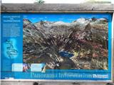 2
2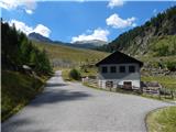 3
3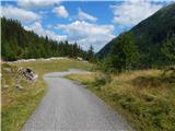 4
4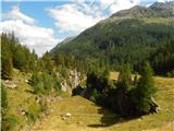 5
5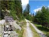 6
6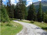 7
7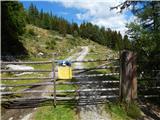 8
8 9
9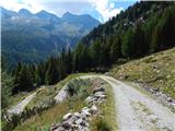 10
10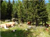 11
11 12
12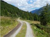 13
13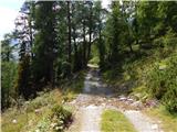 14
14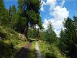 15
15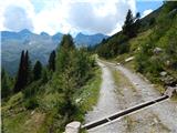 16
16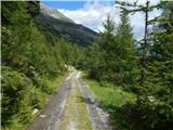 17
17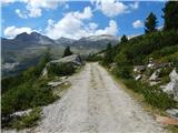 18
18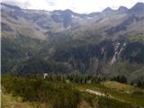 19
19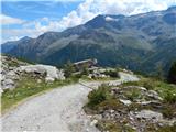 20
20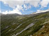 21
21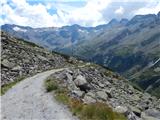 22
22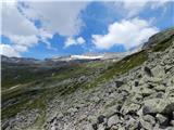 23
23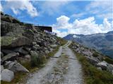 24
24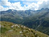 25
25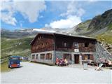 26
26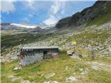 27
27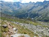 28
28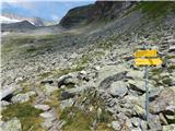 29
29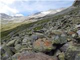 30
30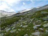 31
31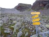 32
32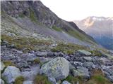 33
33 34
34 35
35 36
36 37
37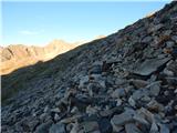 38
38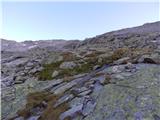 39
39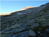 40
40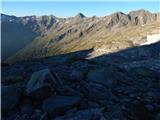 41
41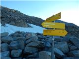 42
42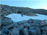 43
43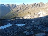 44
44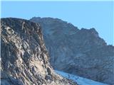 45
45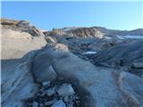 46
46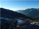 47
47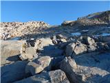 48
48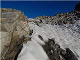 49
49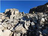 50
50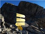 51
51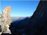 52
52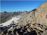 53
53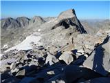 54
54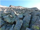 55
55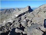 56
56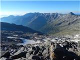 57
57 58
58 59
59 60
60 61
61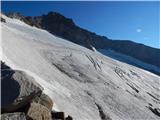 62
62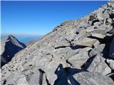 63
63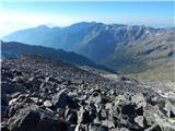 64
64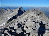 65
65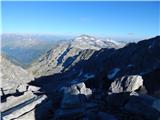 66
66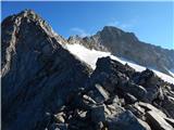 67
67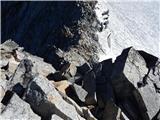 68
68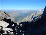 69
69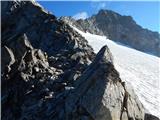 70
70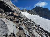 71
71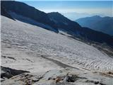 72
72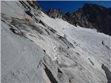 73
73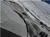 74
74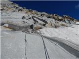 75
75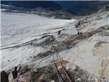 76
76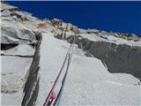 77
77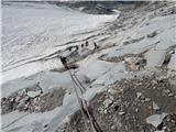 78
78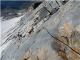 79
79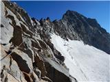 80
80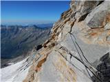 81
81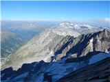 82
82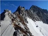 83
83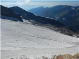 84
84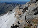 85
85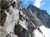 86
86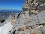 87
87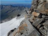 88
88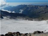 89
89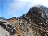 90
90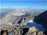 91
91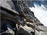 92
92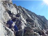 93
93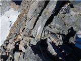 94
94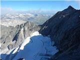 95
95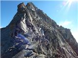 96
96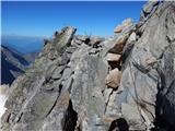 97
97 98
98 99
99 100
100 101
101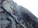 102
102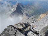 103
103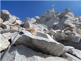 104
104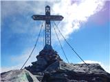 105
105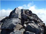 106
106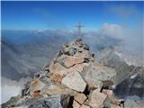 107
107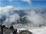 108
108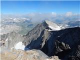 109
109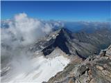 110
110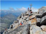 111
111