Ribiška koča Šoštanj - Šoštanj (path Trška pot around Šoštanj)
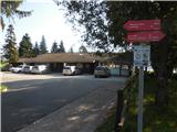
Starting point: Ribiška koča Šoštanj (358 m)
Starting point Lat/Lon: 46.3772°N 15.0529°E 
Path name: path Trška pot around Šoštanj
Time of walking: 3 h 30 min
Difficulty: easy marked way
Difficulty of skiing: no data
Altitude difference: 0 m
Altitude difference (by path): 315 m
Map: Šaleška dolina z okolico 1:50.000
Access to starting point:
A) From the direction of Maribor we drive on the highway to exit Arja vas, where we continue right in the direction of Velenje or Slovenj Gradec. We drive through Velika Pirešica, Črnova and Vinska Gora to Velenje, where we continue straight past the factory Gorenje in the direction of Šoštanj. A little after Velenje at the roundabout, we turn in the direction of Šoštanj, at thermoelectric plant we turn on the bridge and drive through the center of Šoštanj. At Kajuhov dom, we turn right across the railway track and then immediately behind the railway track again right, and we follow the road. At Tresimirjev park, we turn again right and we follow the road to the end, when we go on a large parking lot in front the cottage Ribiška koča.
B) From the direction Ljubljana we drive on the highway to exit Šentrupert, where we already see signs for Topolšica. Then we drive through Preserje, Male Braslovče and Letuš towards Šmartno ob Paki. From here we continue to the village Gorenje, where we turn right on the main road towards Velenje. A little before Velenje at the roundabout, we turn in the direction of Šoštanj, at thermoelectric plant we turn on the bridge and drive through the center of Šoštanj. At Kajuhov dom, we turn right across the railway track and then immediately behind the railway track again right, and we follow the road. At Tresimirjev park, we turn again right and we follow the road to the end, when we go on a large parking lot in front the cottage Ribiška koča.
Path description:
In 1994, PD Šoštanj marked a path along the medieval borders of the town Šoštanj and named it the Trška Path around Šoštanj. The path is an easy circular trail, approximately 13 kilometers long, suitable for families, as it can be completed in sections and allows a return to Šoštanj. For the entire trail, we need 3 to 4 hours. The path has 5 control points and is marked along its entire route with the Knafelc blaze. In the ribiški cottage, we can obtain a free trail logbook with a brief description and a map of the path.
We start at the ribiški cottage in Šoštanj, where the first control point of the path is located. From the cottage, we continue toward Družmirsko jezero (on the signpost Trška Path – Vrhovnik). From the path, a view opens up to the ruins of Pusti grad, which we will visit later. Initially, we walk for some time along the lake’s embankment, but soon descend to the Velenje–Šoštanj walking-cycling path, which previously ran parallel. We continue eastward in the direction of Velenje. To the right, we are accompanied by the imposing structures of Termoelektrarna Šoštanj, the Celje–Velenje railway line, and the river Paka. After just under a kilometer, we reach a fence near the ash depot, where we leave the walking-cycling path and continue right, under the coal and ash transport system of TEŠ. Here, we cross an industrial area and the railway track, so a bit of caution is advisable. We continue through a small industrial zone to the main Velenje–Šoštanj road, crossing the river Paka beforehand. We cross the road and continue right, walking approximately 100 meters alongside it. Along the path, we can stop at Tresimirjev well, but the water in the well is not potable! Soon, a footpath branches off from the main road into the forest, which we follow. When the steepness of the footpath eases, we reach a crossroad where we could continue straight toward Gora Oljka, but we turn right back into a steep slope. Soon, we reach a steep asphalt road, which we ascend to the last house. From the path, a beautiful view opens up to the Šaleška lakes (Družmirsko, Velenjsko, Škalsko), Velenje, and to a lesser extent, the degraded subsidence area, coal depot, and mining structures of Premogovnik Velenje. In the distance, we can admire the peaks of Pohorje, and closer, Paški Kozjak and Radojč. The path continues through the forest, past a newer holiday cottage, to the first house on the opposite side of the forest. Through the forest, we can observe the impressive cooling towers of Termoelektrarna Šoštanj. The path then continues along an asphalt road on the ridge, where, on the left, we observe individual farms in the neighboring village Lokovica and the peak of Gora Oljka with the church of sv. Križ. Soon, the asphalt road begins to descend, and we return to the "Šoštanjsko" side of the hill, where we are greeted again by views of TEŠ and power lines. For a more scenic view in the distance, the peaks of Smrekovec and Uršlja gora stand out, while closer by are sv. Križ above Bele Vode, Lomek (Lom) above Topolšica, farms in the villages Bele Vode, Topolšica, Zavodnje, Ravne, and Razbor, and the town center of Šoštanj. We continue following the descending asphalt road to a crossroad above which stands Oražnov cross. If we wish to end the hike, we can descend along the road to the center of Šoštanj (20 minutes) or continue straight on a footpath into the forest. We follow the path to a grazing fence below the Vrhovnik farm, which we need to cross. At the farm is the second control point of the path. We continue along the descending asphalt road to a crossroad of four roads, beside which stands a large, beautifully renovated chapel. We continue left along the very steep, descending asphalt road Talcev toward Šoštanj (on the signpost Trška Path – Pušnik). At a very sharp turn, we turn left, descend slightly, and soon turn right onto a forest path, which soon leads us to the ruins of Pusti grad. Here, we can also end the path and descend to Šoštanj (10 minutes) or continue along the Trška Path straight past Pusti grad. I recommend a stop at Pusti grad, which offers a very beautiful view of the town Šoštanj and its surroundings. Continuing, we ascend past individual rocks through the forest to a large meadow. Here, we continue for some time alongside it, then soon turn right into the forest. At the junction, we must be slightly cautious, as it is somewhat poorly visible but marked (white arrow). We continue along a footpath that winds through the forest to a pasture above the Pušnik farm, from which a beautiful view opens up to the neighboring villages Skorno, Florjan, and Topolšica, and the peaks Smrekovec and Uršlja gora. We descend along the pasture, where a box with a stamp awaits us on a hayrack. We continue along the macadam road downward to a left turn-off marked with the signpost Trška Path – Falent. We continue along a steep forest road, from which a very steep footpath soon branches off to the right, leading us after a few hundred meters to the river Paka. Here, we continue right through the yard of a house and to the main asphalt road. If we wish to end the path, we can continue straight along the road to Šoštanj (15 minutes) or turn right, crossing the river Paka and the railway track, to a crossroad below the parish church of sv. Mihael. If we wish, we can continue left toward Rotovnikova jama (10 minutes), which, unfortunately, has been closed to visitors for several years and cannot be viewed, but it is a control point of the path. We continue right (Trška Path – Falent). At the crossroad with a planted linden tree, we turn right through the settlement Florjan to the bridge over the stream Toplica. If we wish to end the path, we can turn right and continue along the cycling path toward Šoštanj (15 minutes) or follow the Trška Path left along the road toward Topolšica. At the roundabout, we continue straight, proceeding along the asphalt road to a left turn-off onto a forest road. We follow the forest road, which in parts becomes a footpath and winds through the forest. The path leads us past the interesting building villa Široko and continues through the forest to a small pond. Here, we continue left along the macadam road downward, soon emerging from the forest to the football field NK Usnjar. At this point, we can also end the path and head past the football field toward Šoštanj. The Trška Path continues, turning left through a small swamp by the stream Bečovnica, continuing alongside fields to Falent, where the next control point is located, unfortunately without a stamp in the box. From Falent, we continue right along the asphalt road, turning left at the Šoštanj sign, or we can continue straight toward the center of Šoštanj and end the path. If we choose to continue the path, we turn left and soon right, continuing along the road among houses and then soon into the forest. After a short ascent through the forest, we reach a meadow above the town Šoštanj, which locals call Gorice (once covered with mighty vineyards). We continue right alongside the meadow; the left path leads to the ruins of Forhtenek castle, located high in the hamlet Pristava above Ravne near Šoštanj. From the path, beautiful views open up to Smrekovec, sv. Križ above Bele Vode, Lomek (Lom) above Topolšica, and Uršlja gora. At the top of Gorice, the path passes a large cross and a memorial erected in memory of the postwar massacres at Gorice in 1945. When we reach the asphalt road, we only need to descend to the center of the town Šoštanj, with a beautiful view opening up to the town center of Šoštanj, surrounding villages, Pusti grad, and the Šoštanj mansion. At the crossroad, we turn left toward the lake, then right again at the gardens, continuing past apartment blocks to Tresimirjev park with a children’s playground. Here, we turn right, and we are already back at the starting point at the cottage Ribiška koča in Šoštanj.
On the way: Ribiška koča Šoštanj (358m), Družmirsko jezero (358m), Termoelektrarna Šoštanj (358m), Premogovnik Velenje (400m), Pusti grad (grad Šoštanj) (497m), Rotovnikova jama (362m), Župnijska cerkev sv. Mihaela (360m), Vila Široko (440m)
Pictures:
 1
1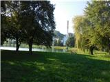 2
2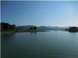 3
3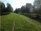 4
4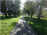 5
5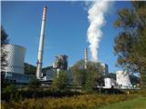 6
6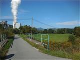 7
7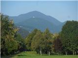 8
8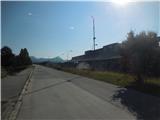 9
9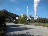 10
10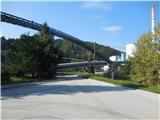 11
11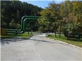 12
12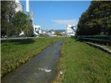 13
13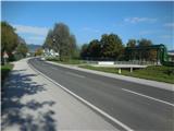 14
14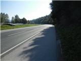 15
15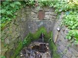 16
16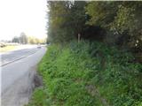 17
17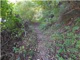 18
18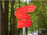 19
19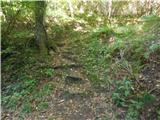 20
20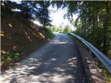 21
21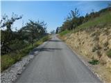 22
22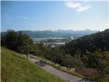 23
23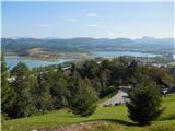 24
24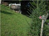 25
25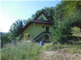 26
26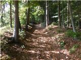 27
27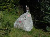 28
28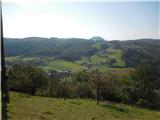 29
29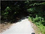 30
30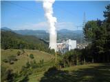 31
31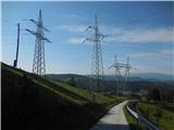 32
32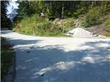 33
33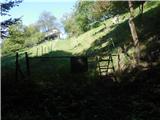 34
34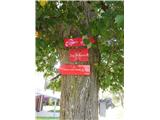 35
35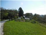 36
36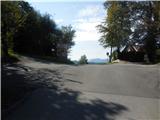 37
37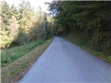 38
38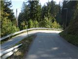 39
39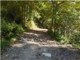 40
40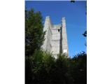 41
41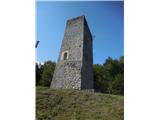 42
42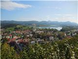 43
43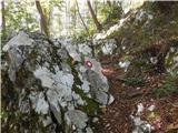 44
44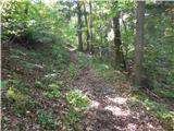 45
45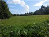 46
46 47
47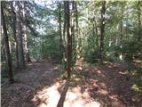 48
48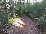 49
49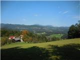 50
50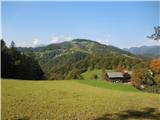 51
51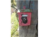 52
52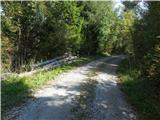 53
53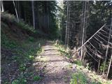 54
54 55
55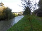 56
56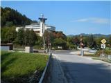 57
57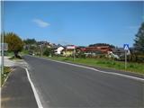 58
58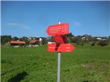 59
59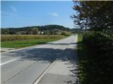 60
60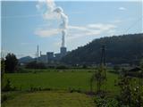 61
61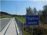 62
62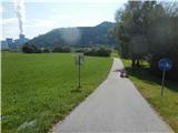 63
63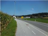 64
64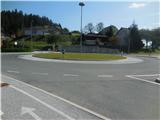 65
65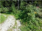 66
66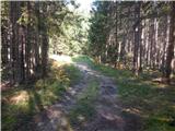 67
67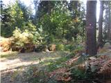 68
68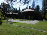 69
69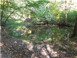 70
70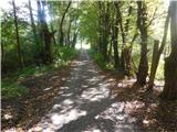 71
71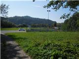 72
72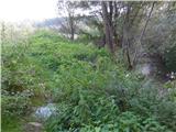 73
73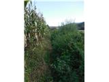 74
74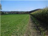 75
75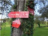 76
76 77
77 78
78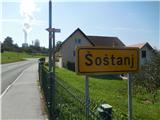 79
79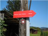 80
80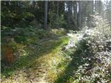 81
81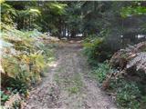 82
82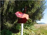 83
83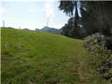 84
84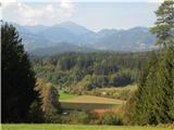 85
85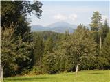 86
86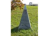 87
87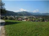 88
88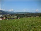 89
89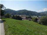 90
90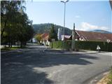 91
91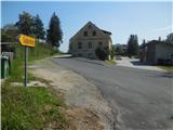 92
92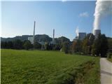 93
93