Rifugio Dibona - Rifugio Pomedes (Via ferrata Astaldi)
Starting point: Rifugio Dibona (2083 m)
Starting point Lat/Lon: 46.5326°N 12.0703°E 
Path name: Via ferrata Astaldi
Time of walking: 50 min
Difficulty: difficult marked way
Difficulty of skiing: no data
Altitude difference: 120 m
Altitude difference (by path): 130 m
Map:
Access to starting point:
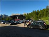
First, we drive to Cortina d'Ampezzo (to here possible over a border crossing Rateče or Predel to Trbiž / Tarvisio and then on a highway in the direction of Videm / Udine to exit Tolmezzo. From Tolmezzo we follow the road in the direction of village Ampezzo and mountain pass Passo Mauria. The road then descends and it brings us to a crossroad, where we continue left (possible also right) in the direction of Cortina d'Ampezzo. At all next crossroads, we follow the signs for Cortina d'Ampezzo. Or from Primorska side, where we drive on a highway in the direction of Trst / Trieste. Further, we drive on Italian highway in the direction of Padova, but only to a highway junction, where we continue in the direction of Veneto and Belluno. Near Belluno the highway ends, and at the next crossroads we continue in the direction of Cortina d'Ampezzo and then we follow the signs for Alpine mountain pass Passo di Falzarego. This ascending road we then follow to the spot, where the road in the direction of the mountain hut rifugio Dibona branches off to the right (turn off is at an altitude approx 1700 meters). At first asphalt road higher brings us on a crossroad, where we continue on the left bottom road (right mountain hut Duca d'Aosta) and we follow it to the parking lot behind the mountain hut Dibona.
Path description:
From the parking lot, we continue on a macadam road past a gate. We follow this road to a crossroad with signposts, where we go right on a wide mule track following the signs »Rif. Camillo Giussani«. A wide path is then slowly ascending and at the left turn brings us to a marked crossing.
Ahead upwards runs the path towards the mountain hut Camillo Giussani, and we go right towards the mountain hut Pomedes. The path at first crosses scree below the steep walls towards the east and it quickly brings us to the beginning of the secured path Via ferrata Astaldi. The secured path on ledges crosses the south wall of the peak Punta Anna. The path is well secured with a steel cable and technically isn't too demanding. The secured path soon ends and from the right joins easier path (number 421) from the mountain hut Dibona. Next follows an ascent by dwarf pines and a panoramic path soon brings us to the mountain hut Pomedes.
Pictures:
 1
1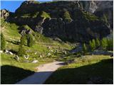 2
2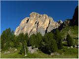 3
3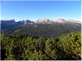 4
4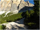 5
5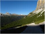 6
6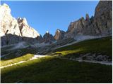 7
7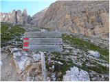 8
8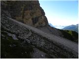 9
9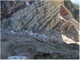 10
10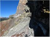 11
11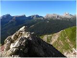 12
12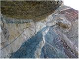 13
13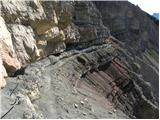 14
14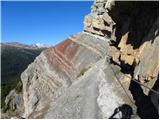 15
15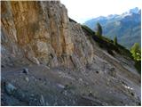 16
16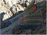 17
17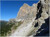 18
18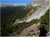 19
19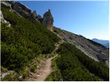 20
20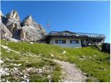 21
21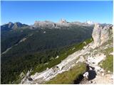 22
22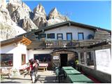 23
23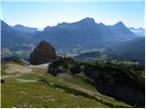 24
24