Starting point: Šentjur (280 m)
Starting point Lat/Lon: 46.2026°N 15.3932°E 
Time of walking: 45 min
Difficulty: easy marked way
Difficulty of skiing: easily
Altitude difference: 288 m
Altitude difference (by path): 288 m
Map:
Access to starting point:
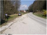
From highway Ljubljana - Maribor we go to the exit Dramlje and we follow the road ahead in the direction of Šentjur. In Šentjur, at the traffic light we continue straight through the underpass under the railway track and we follow the road ahead in the direction of Šentrupert. Only a little after the sign end of Šentjur, on the right side of the road, we notice a parking lot and signposts for Resevna.
Path description:
From the parking lot, we return along the road approximately 100 meters back towards Šentjur, where at the bus stop we notice hiking signposts for Rifnik. A marked footpath point us on stairs, which are ascending through a meadow upwards. Further, the path crosses a short stretch of forest and then leads us onto an asphalt road, which we follow for some time to a crossroad, where we continue straight uphill on a rougher road towards Rifnik (left, ruins of Rifnik castle, 5 minutes). The worse road, then changes into a cart track which we follow in the direction of archaeological site Rifnik. A little higher, the cart track turns into a footpath which for a short time steeply ascends and then quickly brings us to the top of Rifnik.
On the way: Grad Rifnik (Reicheneck) (450m)
Pictures:
 1
1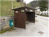 2
2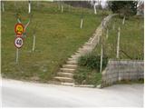 3
3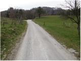 4
4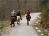 5
5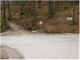 6
6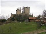 7
7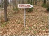 8
8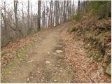 9
9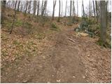 10
10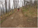 11
11 12
12