Štore - Veliki Bojanski vrh (via Kompole and Šentjanž)
Starting point: Štore (240 m)
Starting point Lat/Lon: 46.2213°N 15.3215°E 
Path name: via Kompole and Šentjanž
Time of walking: 1 h 50 min
Difficulty: easy marked way, easy unmarked way
Difficulty of skiing: no data
Altitude difference: 387 m
Altitude difference (by path): 474 m
Map: Celjska kotlina, 1:50000
Access to starting point:
Štore is a settlement southeast of Celje, by the Voglajna River, on the eastern edge of the Celjska kotlina basin. In the past, the Laška vas – Pečovje mine was important for development, which, beside the Bojanski potok stream and the southern railway, was fundamental for ironworks in Štore. Štore is accessible both with the help of Slovenian Railways and also by road from the highway from the direction of Celje or Dramlje. Near the renovated railway station Štore there are enough parking spaces available, where there is also the beginning of the marked mountain path.
Path description:
The larger part of our trip leads from the starting point along the marked mountain path Štore - Kompole - Dom na Svetini, which is maintained by PD Železar Štore. At the starting point there is a signpost for Resevna, which first directs us along the asphalt road towards the bridge over the Voglajna River, after the bridge the next signpost directs us to the left in the opposite direction of the flow of the Voglajna. Before the first residential house we leave the asphalt road and bypass the house on the left and follow the mountain path directly along the Voglajna all the way to the settlement Opoka, where we step back onto the asphalt surface. At the next bridge we arrive at a junction, where we no longer head towards Resevna, but continue sharply to the right into the forest on a narrower forest path, partly the road to Kompole or Sv. Lovrenc, according to the signpost to Svetina. The signs along the blazes from the junction onwards indicate that we are also walking on the path of the XIV. Division. After a few hundred meters we leave the forest. We continue in a moderate ascent past the equestrian ranch, the sports field Kompole and the inn Špulcer. A gentle descent follows and soon we reach the center of the settlement Kompole with the church of Sv. Lovrenc and the branch school. As we continue downhill, a nice view opens up on Turn and Babni vrh. Along the meadow cart track we ascend to the second hill between the residential house on the left and the farm building on the right, then along the asphalt surface to the junction by an interesting chapel. We continue left along the asphalt road slightly downhill, then towards the homestead again uphill along the left side of the stable back onto the forest path. The path continues along the trickling stream to the pasture, where we then head uphill along the pasture cart track to the chapel. We continue to the right past three or four homesteads uphill along the asphalt surface. Higher up, according to the signpost to Svetina, we leave the road and continue sharply to the left onto the forest path, which we follow along the blazes all the way to the exit onto the meadow/pasture area. The path turns into a cart track and below the chapel through the expansive yard of the homestead (formerly an inn) we reach the asphalt road Štore - Svetina. We turn right downhill and walk along the road for approximately two hundred meters to the branch-off to the left uphill onto the meadow path. Soon we step back onto the asphalt surface, which quickly turns into a forest road. After a few hundred meters the signs and blazes direct us sharply to the left uphill into the forest, but here we leave the marked path and continue straight along the forest road for approx. 1 km all the way to the hamlet Zaroviše on the saddle below Mali and Veliki Bojanski vrh, which are located on the right. We are at the junction of two mountain paths that lead from Žlajfa and Bojanski graben and continue towards Dom na Svetini higher on the left. We, however, walk along the forest road for another approx. 200 meters ahead in the direction of Bojanski graben, just before the forest below Veliki Bojanski vrh we take it to the right and continue along the edge of the forest across the meadow uphill in the northern direction, across the saddle and further along the ridge towards the summit itself. When we enter the forest, an unmarked smaller path leads us to the vegetated summit. Not far from the summit, a few steps towards the west, a nice view opens up on Tolsti vrh, Srebotnik and Bavč.
Pictures:
 1
1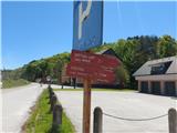 2
2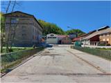 3
3 4
4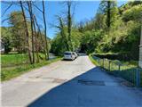 5
5 6
6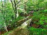 7
7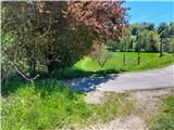 8
8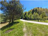 9
9 10
10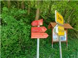 11
11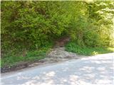 12
12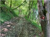 13
13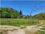 14
14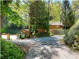 15
15 16
16 17
17 18
18 19
19 20
20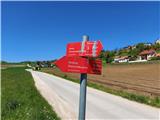 21
21 22
22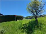 23
23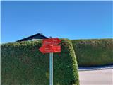 24
24 25
25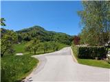 26
26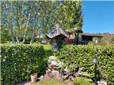 27
27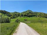 28
28 29
29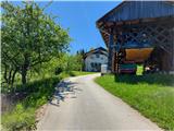 30
30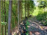 31
31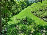 32
32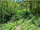 33
33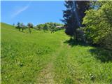 34
34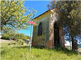 35
35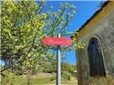 36
36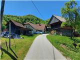 37
37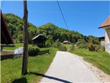 38
38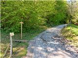 39
39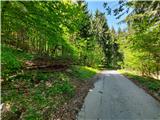 40
40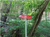 41
41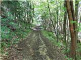 42
42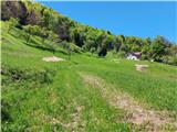 43
43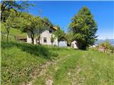 44
44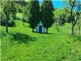 45
45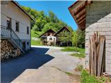 46
46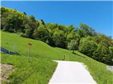 47
47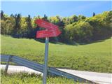 48
48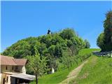 49
49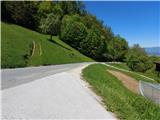 50
50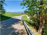 51
51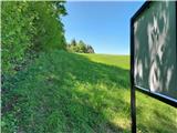 52
52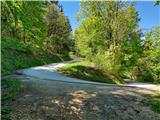 53
53 54
54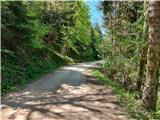 55
55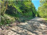 56
56 57
57 58
58 59
59 60
60 61
61 62
62 63
63 64
64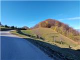 65
65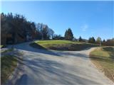 66
66 67
67 68
68 69
69 70
70 71
71 72
72 73
73