Zvodno - Babni vrh (via Bojanski graben)
Starting point: Zvodno (300 m)
Starting point Lat/Lon: 46.20666°N 15.29126°E 
Path name: via Bojanski graben
Time of walking: 1 h 30 min
Difficulty: easy marked way, easy unmarked way
Difficulty of skiing: no data
Altitude difference: 453 m
Altitude difference (by path): 473 m
Map: Celjska kotlina, 1:50000
Access to starting point:
From the Ljubljana–Maribor highway, take the Celje-center exit and continue driving toward Laško and Zidani Most. The road leads us through the center of Celje, then before the Savinja brings us to a roundabout with a fountain. Here we continue "straight" over the first bridge (direction Laško and Zidani Most) and follow the road to the next traffic-light intersection, where we continue left over the second bridge across the Savinja. Immediately behind the bridge at the intersection, we continue right. After approx. 500 meters, we arrive at the underpass under the railway track (on the right side a large parking lot and starting point in Zagrad), drive through it, and continue straight past the fire station in Zagrad. We follow the road through the village, which higher up in Zvodno brings us to a smaller intersection at the bus stop, where we notice signs and signposts for Grmada right, Hudičev graben straight, parking lot 1.2 km straight. We continue straight toward the new parking lot (2020), and the road gradually flattens and narrows. The new parking lot—our starting point—is located right by the road before the fish farm. Here we can park and set off on the hike along paths that lead either through Bojanski graben, or past Marija, or through Hudičev graben, or through Suhi potok. We can also reach the starting point from Dolenjska and Zasavje. In this case, we first drive to Rimske Toplice and then through Laško to the above-described second bridge, from where we continue according to the description.
Path description:
From the starting point, signposts for Hudičev graben direct us first along the road past the supporting wall back toward Celje, already after a few steps sharply left onto a cart track that leads into the forest. We follow the cart track for about 100 meters to the junction just before Hudičev graben, where we leave the path into the gorge of Hudičev potok and continue left toward Pečovje or Marija or Bojanski graben. We follow the marked forest path all the way to the next junction at the edge of the forest, where we join right onto the Celje Mountain Trail (CPP) along the forest road coming from the direction of Celje. Already after about 100 meters, we reach a new junction, where we leave the forest road and continue left downhill along the cart track in the direction of Štore or Bojanski graben. When we descend all the way to Bojanski graben, at the junction we continue sharply right along Bojanski potok. We follow the marked path in the narrow gorge by the stream, but only to the next junction, where the path branches left. We follow the blazes, leave the gorge of Bojanski potok, and continue in a steeper ascent. Soon after emerging from the forest, we join left onto the forest road that leads with a gentle incline to Zaroviše. After a few steps, we reach the saddle on the south side of Veliki and Mali Bojanski vrh, where the path from Žlajfa joins from the left.
We continue sharply right on asphalt, through a short section in the forest and through the yard of a homestead between the tower silo, house, and stable. Next follows continuation straight uphill toward the south in the pasture-meadow area, after approx. 140 meters we turn left onto the cart track branch-off, leave the marked path toward Svetina, and head toward the distant forest to the east. As an orientation point for the branch-off, we notice the concrete well located left by the path. Soon we leave the meadow and enter the forest. The path alternately runs for some time through the forest, and for some time also through the meadow at the edge of the forest. When we come among the houses, soon after a short section on macadam we encounter the signpost for the XIV. Division trail. Here we continue left, but only a few steps to the edge of the forest, where we continue right right along the edge of the forest on a pleasant clearing, where nice views open up onto the surrounding peaks. At the end of the clearing, we turn slightly left onto the path into the forest, which soon joins the cart track coming from the right side. We continue along the cart track, where soon a view opens toward the eastern hills, right here a little before the forest we leave the cart track and head onto the narrow path that leads slightly right uphill toward the summit. A few more steps along the moderately gentle ridge and we are on Babni vrh.
Pictures:
 1
1 2
2 3
3 4
4 5
5 6
6 7
7 8
8 9
9 10
10 11
11 12
12 13
13 14
14 15
15 16
16 17
17 18
18 19
19 20
20 21
21 22
22 23
23 24
24 25
25 26
26 27
27 28
28 29
29 30
30 31
31 32
32 33
33 34
34 35
35 36
36 37
37 38
38 39
39 40
40 41
41 42
42 43
43 44
44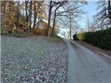 45
45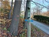 46
46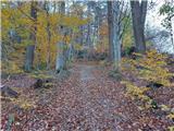 47
47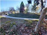 48
48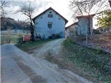 49
49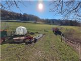 50
50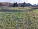 51
51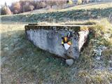 52
52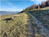 53
53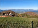 54
54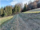 55
55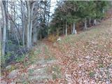 56
56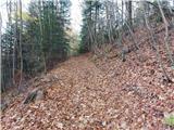 57
57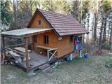 58
58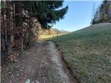 59
59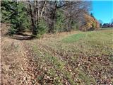 60
60 61
61 62
62 63
63 64
64 65
65 66
66 67
67 68
68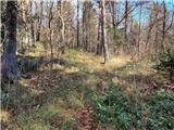 69
69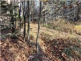 70
70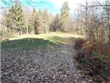 71
71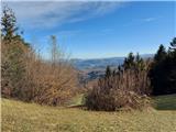 72
72 73
73 74
74 75
75 76
76 77
77