Zvodno - Srebotnik (via Hudičev graben)
Starting point: Zvodno (300 m)
Starting point Lat/Lon: 46.20666°N 15.29126°E 
Path name: via Hudičev graben
Time of walking: 1 h
Difficulty: difficult marked way
Difficulty of skiing: no data
Altitude difference: 400 m
Altitude difference (by path): 400 m
Map: Celjska kotlina, 1:50000
Access to starting point:
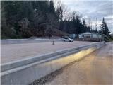
From highway Ljubljana - Maribor, we go to the exit Celje - center and we continue driving in the direction Laško and Zidani Most. The road leads us through the center of Celje, and then before Savinja brings us to a roundabout with a fountain. Here we continue "straight" over the first bridge (direction Laško and Zidani Most) and we follow the road to the next traffic light crossroad, where we continue left over the second bridge over Savinja. Immediately behind the bridge at the crossroad we continue right. After approx 500 meters we get to the underpass under the railway track (on the right side there is a large parking lot and the starting point in Zagrad), we go through it and we continue straight past the fire station in Zagrad. We follow the road through the village, and higher in Zvodno it brings us to a smaller crossroad at the bus stop, where we notice signposts for Grmada right, Hudičev graben straight, parking lot 1.2 km straight. We continue straight towards the new parking lot (2020), and the road gradually flattens and narrows. New parking lot - our starting point is located just by the road before the fish farm. Here we can park and we go on a trip on paths, which lead past Marija, or through Hudičev graben, or through Suhi potok. To the starting point, we can also come from Dolenjska and Zasavje. In this case, we at first drive to Rimske Toplice and then through Laško to the above described second bridge, from where we continue in accordance with the description.
Path description:
From the starting point signs for Hudičev graben at first point us few steps on the road back in the direction of Celje, and then sharply left towards the south on a cart track into the forest, which is gently ascending. The cart track after few steps brings us to the beginning of Hudičev graben, where there is the marked first crossing. Today we continue straight in the direction of Hudičev graben (left - Srebotnik through the village Pečovje) and we continue the ascent on the path which runs on and by the riverbed of the stream Hudičev potok. The path is all the time marked. The gorge soon narrows and we get help from iron spikes, stemples and steel cables. Ahead with the help of numerous fixed safety gear we are ascending right above the riverbed of the stream, on which we can notice numerous waterfalls. Higher, where the gorge widens and the fixed safety gear end, we get to the next crossing. If we turn a little to the right, we can get to Bavč, Grmada, cottage Pečovniška koča..., but today we will go to the left steeply upwards in the direction of western ridge of Srebotnik. After the initial steepness we get to a crossing of paths on a panoramic ridge, where there is a view towards the castle Stari grad. If we would continue on an unmarked path straight, we could bypass Srebotnik on its northern side, and we will continue on a marked path right on the western ridge of Srebotnik steeply upwards in the direction of east. After the initial very steep ascent, the path after some time flattens a little and then we get to the next crossing, where from the right joins the path from the south approach on Srebotnik. The latter path is also part of Celje mountain trail. We continue straight upwards further on the ridge. Only about 200 meters is to the top, in the last part of the path the steepness again increases, and the path below the summit there is secured with a steel cable. On the top we get to a breathtaking view practically on all sides, Slovenian flag, inscription book, bench and a stamp. Few steps towards the southwest it is possible to get also to exposed part of panoramic cliff.
Pictures:
 1
1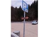 2
2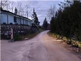 3
3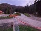 4
4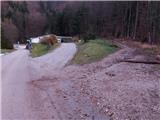 5
5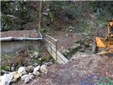 6
6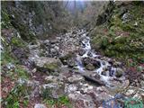 7
7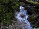 8
8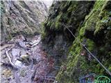 9
9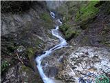 10
10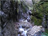 11
11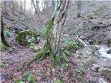 12
12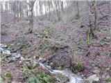 13
13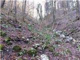 14
14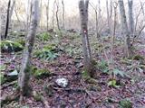 15
15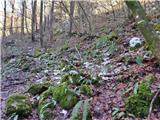 16
16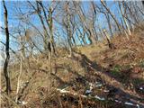 17
17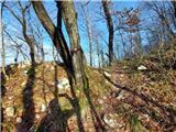 18
18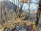 19
19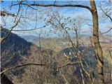 20
20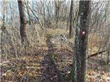 21
21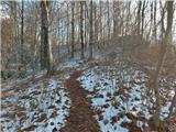 22
22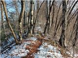 23
23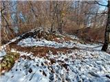 24
24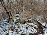 25
25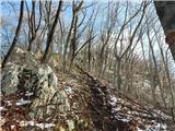 26
26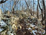 27
27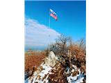 28
28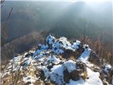 29
29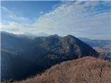 30
30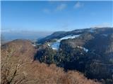 31
31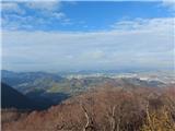 32
32