Hike.uno
Hike.uno
Login
Login
Username:
Password:
Login
Not registered yet? Registration.
Forgot password?
      
List of forums / Italy / Carnic Alps / Creta di Collina and Creta della Chianevate

Creta di Collina and Creta della Chianevate

Print
IgorZlodej2. 09. 2010 20:34:52
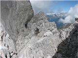
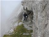
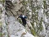
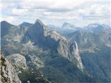
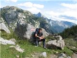
After Tuesday's visit to the Carnic Alps, when I watched the Coglians group, I quickly realized that there was significantly less snow there than in the Julian Alps. So today my buddy and I went on the tour completely carefree. The early morning was so nice that our wishes were almost too big, but in the end we drove to Plöckenpass, which was still deserted when we arrived. We stepped into the cold morning on path 146 and soon reached the sun, which appeared from behind Pal Piccolo. On the flat area under the mighty Collina, cows were grazing peacefully, while we went past the ruins of a former military object along the old mule track to Cresta Verde. Just below the entry into the eastern slopes of Collina, we stopped for a moment, then continued; at first it's mostly grade I climbing, the second part is normal walking on a marked pathless terrain. With nice views of the queen of the Hohe Tauern and many of her neighbors, we reached the summit, had a snack, then descended a few meters and headed from the ruins along the old military path, which is marked with ordinary Italian markers, which I hope won't mislead anyone, namely if anything, there should be red dots there. The path is not marked on the map, nor is it secured, although it used to be, as evidenced by the bolts with rings, but that's from very old military times. In places it's quite exposed, the final gully that leads to the top is somewhat difficult and exposed in the lower part. There we ran into three Italians and quickly realized we had a mutual acquaintance Benita from Reana del Rojale, who unfortunately passed away 4 years ago. Because of the fog that persisted on the southern slopes, there were no special views, so we returned below Collina and descended on the path that is secured with a cable in the lower part and joins lower down the path coming from the Marinelli hut. A short descent more and the nice loop is closed, followed by descent back to Plöckenpass, then we drove to the frequently visited Valentin Alm, where over beer and cream strudel we admired the wall above which we stood just a few hours ago.
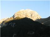
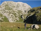
Creta di Collina and Creta della Chianevate mighty Collina from the village Timau1
Creta di Collina and Creta della Chianevate level area below the eastern slope of Collina2
Creta di Collina and Creta della Chianevate just below Cresta Verde3
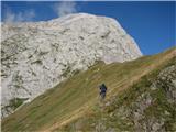
Creta di Collina and Creta della Chianevate first have to cross steep grass4
Creta di Collina and Creta della Chianevate 5
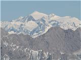
Creta di Collina and Creta della Chianevate Hochalmspitze6
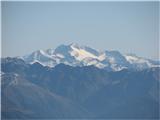
Creta di Collina and Creta della Chianevate Eiskar, the only glacier in the Carnic Alps, larger every year7
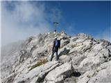
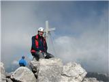
Creta di Collina and Creta della Chianevate at the top of Collina8
Creta di Collina and Creta della Chianevate characteristic little bridge on the path to Chianevate9
Creta di Collina and Creta della Chianevate magnificent wall of Chianevate10
Creta di Collina and Creta della Chianevate and view on Venediger11
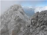
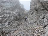
Creta di Collina and Creta della Chianevate final gully12
Creta di Collina and Creta della Chianevate 13
Creta di Collina and Creta della Chianevate return below Collina14
Creta di Collina and Creta della Chianevate descent15
Creta di Collina and Creta della Chianevate only familiar and already visited peaks16
Creta di Collina and Creta della Chianevate 17
Creta di Collina and Creta della Chianevate inn at Valentin Alm18
(+1)like
sabina.718. 08. 2011 20:57:17
At six in the morning accompanied by the moon and still shy sun we were already on path 146. To the top of this barren mountain we went the same way as Igor described. I just need to add that now the path along Cresta Verde is well marked with red dots and climbing is occasionally grade II. Whoever has a rope can also belay on new bolts. Good exercise for beginners. After this entry climbing section the path to the top drags a bit partly on grassy slopes partly on rocks. Interesting is the last part when you look 1,000 meters below at Eiskar glacier. At the top we met one Austrian who was in a hurry to another nearby peak, which we gave up as soon as we saw the initial unsecured and exposed section. 1,300 meters of elevation gain was enough for us and we preferred to descend via the easy but scenic ferrata Lo Stivale, which means Boot. At the cows we dipped our feet a bit in the cold spring and then headed to Plöckenpass, which was quite full of tourists and hikers in the afternoon. nasmeh
Creta Verde1
Here easier climbing begins.2
There is quite a lot of edelweiss.3
The path is well marked.4
In this part you need to scramble a bit up to grade 2.5
 In this part belaying is possible, of course if you have a rope with you.6
There are bolts on the rocks.7
This part drags a bit.8
The summit is close.9
Summit10
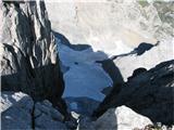
View towards the glacier, steep drop.11
The path to Cjanevate did not convince us.12
Return to the valley via the path Lo Stivale.13
14
The path is partially secured.15
A few more rocks.16
So the difficulties are behind us.17
View back....there the traversed via ferrata is hidden.18
Flowering cotton-grasses.19
The cows are having a great time.20
Creta di Collina 2.689 m.21
like
jaz25. 08. 2011 22:10:22
Some beautiful day. Regards!
Creta di Collina1
Cresta Verde2
the sun peeked out from behind Creta di Colinette3
black mulberry4
good view5
upwards through the grasses6
a bit to the right7
towards the summit area8
Creta della Chianevate9
Eiskar glacier10
cross on the summit11
along the path further12
steps13
Creta di Collina14
the path is visible15
little bridge16
towards the summit17
gully18
cross on the top19
view into the ravine20
Monte Coglians21
on the path back22
23
here I descended24
downhill towards the starting point25
like
sabina.719. 08. 2012 21:52:32
After one year we returned, again past Cresta Verde to the top of Creta di Collina, then we climbed to the nearby, less known, less visited, more solitary Creta della Chianevate, which is the second highest peak in the region, only a few meters lower than nearby Coglians. The path is well visible, occasionally need to scramble a bit, the last gully is not as steep as it looks from afar, but caution is needed. On top met an Italian alpinist and mountain rescuer who soloed the Grohmann route on the north side above Eiskar glacier, and also a friendly and knowledgeable couple from Jesenice. These two peaks are often in fog and this time too, although not constantly. Worth returning!nasmeh
Towards the summit of Creta di Collina1
View of the glacier2
At the first cross3
Towards Creta di Cjanevate4
On the path5
Still through this gully and then ...............6
we are at the second cross7
Caution required on descent8
Besides rocks there are also many varied flowers .........9
(+2)like
pikpok25. 10. 2015 09:34:27
Yesterday (24/10) heading to Chianevate. Path to Creta di Collina doesn't pose special difficulties (except a couple meters before the cross where you need to be very careful on 2m narrow ridge with drop on both sides), the ridge path to Chianevate though in my opinion due to snow is not passable, or at least not for my technical abilities, so this peak will wait till next season.
1
2
3
4
5
6
7
8
9
10
11
12
13
(+1)like
bagi7. 09. 2017 14:57:44
From Crete di Collinette (2238 m) you can continue without special difficulties to the two neighboring higher peaks in the ridge … Creta di Collina (2689 m) and further to Creta della Chianevate (2769 m). The route is partly marked with blazes, partly with dots, occasional scrambling reaches poor II. The whole traverse is exposed in some parts.

Continuation to Creta di Collina :

We reached Collinette via ferrata and descended from the top to saddle Cresta Verde. The path to Collina runs exactly along the top of the saddle and you need to turn onto it as soon as possible. At the foot of Collina the walk ends. Narrow path marked with dots runs for a long time on exposed slope and occasionally requires some scrambling. Higher the steepness eases and no more such exposure. Summit part is varied and accessible without difficulties.

Continuation to Creta della Chianevate :

This was the biggest surprise and the nicest part of the day nasmeh. Old military path routed in wild terrain. So wild that sometimes you don't know where the path continues. But nevertheless it picturesquely delivers you to the proud mountain, the second largest in Carnic Alps. You reach this path when you cross the top of Creta di Collina and after less than 10 min descent you spot marks leading right along carved ledge. Access to Creta della Chianevate and return is on the same path. Nowhere secured, but also nowhere particularly exposed.

For ascent, whole ridge traverse and descent we needed about 11 hours and did about 2200m elevation. Route is well marked except at the junction to Cresta Verde saddle. Altogether not for everyone, but who does the ferrata won't have problems further nasmeh.

Link to the whole route ... https://photos.google.com/share/AF1QipMyEEDt0gs7pvwPaVQn7hShiGHJJ2Kcu8Bd3gTQwma38qacTzevdQnUhUYEUKvGGQ?key=eTk2RWJEZVBHNVI0OEZSdXhpb3YxdE9oUVFNRkZB ...


Cresta Verde saddle. Almost immediately you need to climb to the grassy ridge, otherwise the gullied path leads you into the valley.1
On the ridge are remains of a military observation post and that should be the reference point for continuing the traverse.2
From there from the saddle a path leads into the steep slope.3
Up there we have to go. In reality it's not as scary as it looks on the photo :)4
This is a fairly realistic photo of the incline and exposure that has to be crossed.5
Creta Collinetta with its 2238 m becomes a real Tom Thumb compared to Collina on the ascent.6
Finally we crawl to the ridge.7
Remains of the Eisklar glacier.8
This is the summit.9
So that we know where we crawled to :)10
Creta di Collina11
We continue to our next goal ... Creta della Chianevate12
A marked old military path leads to it.13
Remains of safeguards from other times.14
The mulatiera shows a century since it was made, but it is mostly easy to follow.15
Passages upon passages open up. The path is varied, something new behind every bend.16
The passages are extremely inventive, even when you ask where it will go next.17
Natural window, below of course remains of the military observation post.18
The surroundings are wild and you simply can't believe where they built paths everywhere.19
Here and there you need to pull a bit, but nothing serious.20
towards the summit21
Again one of the places where you wonder where it will go next ....22
Just before the summit dome you descend into the gully, then up the chute towards the top23
Here and there on the ascent carved steps assist24
just below the summit25
Creta della Chianevate26
Our team, the only registered representatives of Slovenia in a couple of years. Although the path and summit are wonderful, they do not have many visitors27
Return is along the same path28
Section of the path that some sources describe as narrow, exposed ridge. Far from it :)29
When we meet caverns and carved ledges, behind the edge the path splits. The lower leads back to the valley30
Descent to the valley31
Since we overnighted in Marinelli hut, a bit lower we took the picturesque right path. To Plockenpass it would take exactly as much time as to the hut32
This path too was a military mule track33
We were up there, thunderstorm brewing in the background34
Carnia is a geological fault and thus besides white limestone there are also lots of green hillocks from older rocks35
Marinelli hut just before the rain36
Right side of the Crete map first day, left side Hohe Warte via Weg der 26 second day37
(+7)like
Rok10. 07. 2018 19:04:27
Today I went over the Cresta Verde saddle to Creta di Collina (Kollinkofel) and further to Creta della Chianevate (Kellerspitzen). The path to Creta di Collina is as the predecessors have already written, to Creta della Chianevate they have installed cables. As far as it was visible, they haven't quite finished the works yet. At the junction a bit below the top of Creta di Collina there is also a small bivouac.
Morning.1
Creta di Collina.2
More demanding traverse.3
Creta di Collina.4
Creta di Collina.5
New fixed cables.6
Path to Creta della Chianevate.7
Path to Creta della Chianevate.8
Bivouac.9
Creta della Chianevate.10
(+3)like
LEA ŠTUMBERGER15. 07. 2019 20:24:59
To Creta di Collina on Sunday, 14.7.


TRIP DESCRIPTION HERE nasmeh
1
2
3
4
5
6
7
8
9
10
11
12
13
(+3)like
palček plezalček9. 08. 2020 22:03:33
Karnic crests: Collinetta (Frischenkofel), Collina (Kollinkofel), Chianevate (Kellerspitzen) and one that isn't a creta actually: Krone (Eastern Kellerspitze).
From the Monte Croce Carnico pass I took the path leading through a 185 m long tunnel (it was wet and slippery, especially in the lower part). I saw daylight again 100 m higher. I continued a bit on the path, then on my own among boulders, where I even found a red dot waiting on a rock forgotten by the world. Then I climbed the secured path Senza Confini. Such beautiful 'plates' (especially those D sections), it hurt me that they didn't leave them unsecured, it would be a great route. At the top of Collinetta it was already quite warm, but continuing towards Cresta Verde it started to blow pleasantly. The ascent to Collina was enlivened by a marmot scurrying nimbly among the rocks. From the top of Collina, the 2226 m high Collinetta looked like a little one. I descended towards SW, where at a suitable spot - there's a cairn above it in the descent direction - I turned past the bivouac towards Chianevate. Already a few meters before the bivouac I got a cold shower, as I spotted a sign on the wall warning that it's a via ferrata where the use of a via ferrata set is mandatory. The little thorny one, which isn't visited by many people, isn't fully equipped with cables yet, so let the cable enthusiasts not be misled by the sign. CAI has already installed bolts and strung cables on some sections, but before the mountain completely loses the charm of its difficult access beauty, they still need to complete quite a few sections. If you want to catch it in the approximate form left by WWI, you need to hurry. When returning from its western and also highest summit (for which Paul Grohmann in the 1860s claimed it was the highest in the Karnics, while Giovanni Marinelli and Arturo Ferrucci favored Coglians), I climbed two more eastern summits in its ridge. I didn't find a name for one, the other is Krone. I descended on the varied path 171 and continued to the starting point on 146.
Beautiful and little visited hills.
It keeps turning1
in the trench2
Peek at the plain3
Towards the entrance to the ferrata4
Slabs for :)5
Good rock, beautiful scenery6
End of the fixed cables - harness in the backpack, poles in hand7
8
Soft summits from Crostis to Crasuline9
Creta di Collinetta10
Cresta Verde and Creta di Collina11
Towards Collina12
View back at the smaller sister13
A little more upwards14
View northwards, where the glacier still persists15
North side of Collina16
On the summit17
Below the cairn on the right18
We will have to go far to the west19
Part of the approach to Chianevate20
Why is this necessary? :(21
Stairway to heaven22
Summits along the ridge all the way to the last, highest one23
Vallone della Chianevate, concluded by Cima di Mezzo24
This hill also bears its cross25
Descent...26
...and continuation towards the pass27
(+4)like
funnyboy8. 09. 2023 20:37:37
(+1)like
bagi10. 09. 2026 16:12:55
We drove to Plöcken Pass, a pass over 200 km from central Slovenia. In Italian it is called Passo di Monte Croce Carnico. We have already hiked a lot there and wanted to repeat the via ferrata Senza Confini on Cellon. But it did not go exactly according to plan. The warning from 2023 about the path closure is still present, only it mentions only the via ferrata Steinberger weg. In reality the path is closed already before the entrance to the military tunnels through which we planned to go. Hmm … so on the Austrian side it does not work, time for plan B zavijanje z očmi.

We returned to the pass and on the Italian side headed towards Kollinkofl, or rather Crete di Collina. We approached the mountain via the Cresta Verda saddle, which means the harder access variant. Only the direction is marked, but without any protections or aids. We would call this pure natur nasmeh. The short introduction at the end of the saddle was still quite decent, almost with hands in pockets, then the rocky slope quickly stood upright. So about a hundred meters of ascent, technically up to grade two, but with a lot of air under the feet.

Hands and feet were fully occupied, also the head, so there was no real desire for photos in this area. Especially difficult are the traverses on centimeter ledges, while under the feet is a direct shortcut to the last parcel. At least three crossings are annoying, one especially. Here smooth rock does not offer real holds, only a few tufts of grass. Here one would help oneself even with teeth, if there was something to bite into velik nasmeh. The step from ledge to ledge is namely long and despite several attempts there was no real feeling of reliability. So before the crossing we climbed slightly upwards and a good meter higher carefully returned to the planned route.

Higher up the terrain flattens a little, enough to breathe easier. But the difficulties were not over yet, only the feeling of safety was a shade greater. So the meters of ascent slowly accumulated and after a good 600 meters of ascent from the Cresta Verda saddle we finally saw the summit. A long rest followed, then the descent via the normal route into the valley. This one is also quite concrete for the altitude, but below we spiced it up with a longer walk past the renovated Casera Plotta pasture and the ruined Casere Val di Collina. We had not walked here yet, so it was all the more interesting nasmeh. The last bit of the path ran along the well-trodden 148 and we were quickly back at the starting point.

Coordinates of the starting point (Plöcken Pass): 46.6022803N, 12.9438692E
We park at Plöcken Pass, which is still almost empty this early1
On the galleries we spot the sign for our route2
Ventilator at the saddle. It obviously works well because it's blowing nicely :)3
Here we go for the third time …4
But we haven't seen any skull markers yet. Steinberger weg is closed5
Unfortunately it's not quite like that. Access through the military tunnels is also closed, only nowhere does it say so6
Plan B. We return to the saddle and set off on the Italian side towards Cresta Verde saddle7
The path is of course military, like so much else in the near and far surroundings8
In the background our final destination Creta di Collina, from here still very friendly9
Right …10
The day is not the nicest, but the wind has said goodbye and the clouds are just right11
We'll be returning over there12
Turnoff for the via ferrata *Senza confini* from the Italian side. No prohibition here13
The small group of Austrians speeds up every time they approach them14
That takes its toll :) Just a little higher they completely collapse15
Steadily we ascend along 14716
These beauties are everywhere :)17
We approach the saddle. There are more and more objects from the First World War18
There is a sea of caverns … 19
Observation lines are also something completely normal20
Cresta Verde, with the wall in the background that we have to climb21
View back to the saddle. In the background the ill-fated Cellon22
Entry into the route for Kollinkofel. Official markings end here23
This is the steep slope we have to climb. Only red dots show the way24
In many places there is also an arrow so we do not accidentally stray into even more difficult terrain25
Good 100 m higher the terrain levels out, to put it mildly :)26
But the difficulties are far from over. This here is *a piece of cake*, just enough that I grabbed the camera again :)27
The summit slope really levels out safely now28
Just below the summit there is another annoying passage29
View down to the Eiskar glacier, or what is left of it30
Creta di Collina. We are alone at the summit31
Another German name besides Kollinkofel …32
After a longer pause we start descending to the other side33
View back to the summit and the base below it34
Here runs the *normal route*. Compared to the ascent it feels like a highway :)35
Here the supply of soldiers on the mountain took place36
Hmm, it seems we are going down :)37
Indeed. The skillfully laid mule track is equipped with cables in many places38
In many places not, although it would not be wrong39
Signs at the entrance, for us the exit40
We continue along 14941
This won't be good. A few thick raindrops surprise us unpleasantly42
Towards Marinelliju it has completely clouded over. They are renovating the hut, but the deceitful warden has lost the contract43
The heavenly floodgates open. Let it pour right there in the valley :)44
Super, the sun shines above us :)45
We really can't hurry, the terrain is karstified in many places46
Casera Plotta. We are here for the first time47
The mountain pasture is renovated and has a trough with running water48
Even a shelter is here …49
Extremely well maintained, nothing to say50
Bravo, nice weather is returning :)51
Just in case, the rain jackets stay outside52
Another beautiful mountain pasture, but we are not going to it53
Beautiful path, but the landscape is already completely autumnal54
Huge, but dilapidated mountain pasture Casera Val di Collina55
So, only 148 left to process :)56
I don't know what happened to this boulder, but there are numerous drill marks on it57
He, he, a riddle for connoisseurs :) It's definitely a Mercedes, in my opinion an electric C or CLA58
We have walked a lot again :) We have covered 15 km and 1600 meters of elevation, some very demanding59
(+6)like
bbugari111. 09. 2026 11:26:33
You never forget, huh (fig. 43)? velik nasmeh
So is Marinelli closed now?
Or is it possible to get there by car in the opposite direction, from the bend on the main road up to Casere Val di Collina?
(+1)like
bagi11. 09. 2026 11:46:00
No, you don't forget obvious frauds despite an immediate complaint nasmeh. Of course we were far from the only ones, as far as I could find out. The hut is currently closed due to renovation and they don't offer anything, at the same time they're already looking for a new manager.
(+1)like
lino12. 09. 2026 19:13:40

Another exceptionally demanding tour, reserved only for real alpinists and very nicely described. Good luck further on! nasmeh
like
mirank12. 09. 2026 21:59:21
what do I know, there we were 3 years ago and paid 13 eur for a little beer, 4 coffees and a glass of iced tea, which seemed little to me compared to 10 for two coffees and one fruit juice on K pods. But they ripped us off on pl Moraretzavijanje z očmi
like
You must log in to post a comment:
Username:
Password:
Login
If you do not yet have a username, you must first register.
         
Copyright © 2026 Hike.uno, Terms of use, Privacy and cookies