| IgorZlodej9. 01. 2012 16:55:57 |
The starting point is Comeglians, then we drove up the hill to the village Tualis (around 800 m a.s.l.) and further along the road as far as it went, with the car up to around 1100 m a.s.l.; there was still around 7.5 km of road to the Chiadins pasture waiting for us. The first few hundred meters we carried the skis, then we walked with them. On the road there was enough snow; it had been driven on by off-road vehicles, and we also saw tracks of snowshoers. There were no more bike tracks from around 1300 m onwards, meaning there was already around 40 cm of snow. Up to here and a bit further, a nice spruce forest accompanied us, which slightly limited the views, but higher up they opened to unimaginable dimensions. No wonder there is a sign every km saying it is a panoramic path. At the highest point of the road, 1982 m high (the road is asphalted and open to public traffic in summer, also a unique bike path), there followed a slight short descent. There we had a little snack and put on crampons, as the slopes were quite windblown. With a lot of snow tracking along path 151 we found nice passages between windblown grasses, so we climbed on skis to the cross on top. The view was of course phenomenal, so we took quite a few photos and gazed at the beautiful Carnic mountains, especially nice was the view of the Coglians group, which towered before us like on a platter. There followed preparation for skiing, which I did right from the cross, my buddy somewhat lower. To the road it was one of the strangest ski descents we did in our not short touring career, but the continuation along the road was not bad at all and surprisingly all the way to the car. The road has almost even gradient between 9.9% and 13.5% all the time. Monte Crostis is the junction of several paths, but with skis best accessible via the described road. If there is more snow, other variants are possible; this time unfortunately not. It is also one of the more dangerous mountains. As the hut keeper of the Brazza hut above Pecol told me years ago, it has taken quite a few lives, similar to our Krn, the reason being slips on icy slopes. Currently ascent without skis or snowshoes is not possible, and just by the way, this year we were the first to sign in on top.
 1 1 2 2 3 3 4 4 5 5 6 6") 7 7 8 8 9 9 10 10 11 11 12 12 13 13 14 14 15 15 16 16 17 17 18 18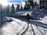 19 19 20 20
| (+3) |  | |
|
|