|
| bruny9. 09. 2012 21:53:58 |
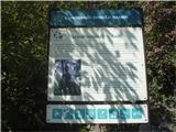
On Bohor 09.09.2012 with mountain bike on ,,triangular circular,, route between Lesično, Planina pri Sevnici and Kozje from one of the eastern starting points - Lesično, which I presume is the hardest. Already after a good kilometer you're put in the hardest variant along the hiking trail of the 14th Division before the so-called ,,Bohor wall,, when you know you'll have to overcome 240 elevation meters in 850 meters...but somehow you push through with the bike through the forest, past the solitary farmhouse that holds the stamp higher up... That's really for  good spirits and a pleasant introduction, so that Bohor doesn't scare you off with the bike right at the start. Continuing also somewhat towards the northern starting point Planina pri Sevnici but not too far - to the old sawmill on Bohor and then continuing to the four main peaks - Veliki Javornik 1024 m.a.s.l., Veliki Koprivnik 984, Debeli vrh 921 and Oslica 860. I did the descent back to the valley to Kozje and rode to some more peaks - Vrh 782, Zajčja gorca 676, Pokojni vrh 711, Raskože 650 and finally found the 674 meters high Žličar - partially circled it by the farmhouse where the info board is, and finally climbed up to it with the bike for the final ,,peak bagging,, of the nine Bohor peaks nicely in the direction from west to east and the heights also drop accordingly. Turned off Garmin in Kozje and returned to Lesično by road. Pleasant day in the eastern part of Bohor, quite hot and a bit wet - muddy grounds between the nine Bohor peaks. 35.46 km/1495 elevation meters. good spirits and a pleasant introduction, so that Bohor doesn't scare you off with the bike right at the start. Continuing also somewhat towards the northern starting point Planina pri Sevnici but not too far - to the old sawmill on Bohor and then continuing to the four main peaks - Veliki Javornik 1024 m.a.s.l., Veliki Koprivnik 984, Debeli vrh 921 and Oslica 860. I did the descent back to the valley to Kozje and rode to some more peaks - Vrh 782, Zajčja gorca 676, Pokojni vrh 711, Raskože 650 and finally found the 674 meters high Žličar - partially circled it by the farmhouse where the info board is, and finally climbed up to it with the bike for the final ,,peak bagging,, of the nine Bohor peaks nicely in the direction from west to east and the heights also drop accordingly. Turned off Garmin in Kozje and returned to Lesično by road. Pleasant day in the eastern part of Bohor, quite hot and a bit wet - muddy grounds between the nine Bohor peaks. 35.46 km/1495 elevation meters.
 1 1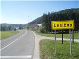 2 2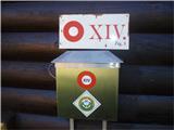 3 3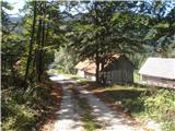 4 4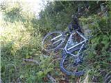 5 5 6 6 7 7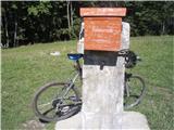 8 8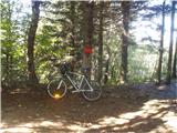 9 9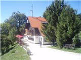 10 10 11 11 12 12 13 13 14 14 15 15 16 16 17 17 18 18 19 19 20 20 21 21 22 22 23 23 24 24 25 25
| (+2) |  | |
|
|
|
|
| bruny12. 09. 2012 23:21:51 |
|
|
|
You must log in to post a comment:
If you do not yet have a username, you must first
register.