Hike.uno
Hike.uno
Login
Login
Username:
Password:
Login
Not registered yet? Registration.
Forgot password?
      
List of forums / Slovenia / Julian Alps / Lipnik - Monte Schenone

Lipnik - Monte Schenone

Print
IgorZlodej4. 11. 2010 19:43:32
Such a nice day had to be utilized. With my colleague we drove to the village of Dunjo and a few km up towards Rudni vrh. We left the car in the hamlet Chiout, then we went along the road to the alpine pasture and saddle Bieliga. From the saddle we turned left towards Lipnik, here and there some snow remnants, otherwise incredibly warm and windless. The higher we go, the nicer the views too. We stayed on the summit almost an hour, then we descended to the lower mulattiera (partly covered with snow), along which we returned to the road and to the starting point.
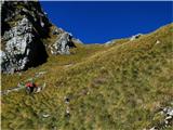
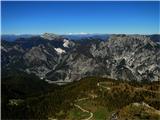
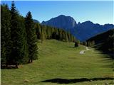
Lipnik - Monte Schenone below Bieliga pasture1
Lipnik - Monte Schenone in the pasture2
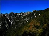
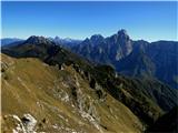
Lipnik - Monte Schenone from Bieliga saddle towards Strma peč3
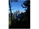
Lipnik - Monte Schenone Montaž and its neighbors were piling up nicely4
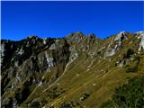
Lipnik - Monte Schenone central ridge of Naborje Mountains5
Lipnik - Monte Schenone right Lipnik, left Dunja peak6
Lipnik - Monte Schenone Mangrt, Razor, Jalovec7
Lipnik - Monte Schenone six days ago everything down here was still under snow8
Lipnik - Monte Schenone what does this remind you of - me of firm breasts with swollen nipple9
Lipnik - Monte Schenone Šinauc10
Lipnik - Monte Schenone Hochalmspitze11
Lipnik - Monte Schenone Krniške skale nad Mokrinami12
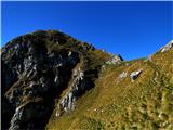
Lipnik - Monte Schenone already almost below the summit13
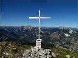
Lipnik - Monte Schenone and on the summit14
Lipnik - Monte Schenone we renounced the summit of Dunja15
Lipnik - Monte Schenone on the descent there was some snow16
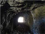
Lipnik - Monte Schenone exit from the small tunnel17
Lipnik - Monte Schenone around every corner something beautiful opened up18
Lipnik - Monte Schenone formerly a tricky passage secured with chains was here, now a nice footbridge19
Lipnik - Monte Schenone not yet a view of Montaž20
Lipnik - Monte Schenone and past the holiday cottage to the starting point21
Lipnik - Monte Schenone from Chiout a nice view of Montaž22
(+3)like
rozka9. 06. 2011 17:25:17
Sometimes you have to change the plan quickly, because in the mountains the weather has the main word. This time too I didn't know wherejezik, but since it's Igor's terrain, I'm not worried, and he always chooses something interestingnasmeh...we drive to the Canal Valley, more precisely to the village of Pietratagliata, across a picturesque bridge, then about 7-8km on a good asphalted road, which we helped clean earliermežikanje of cut trees that had just been felled, and on to the starting point, Planina Poccet. From there we continue a bit on the road, a bit on the path, past the Jeluz shelter, where the cows are grazing at a very nice panoramic spot, today the peaks are in the clouds. We continue on the path that soon turns right at the "saddle", a little more and we're at the top. Views foggy, no rain, but a rain shower from Resia was approaching, so we sit a bit and return the same way back. Weather held, otherwise the path is very nice, interesting and we will have to climb it again in good weather when the views are therenasmeh
Lipnik ridge and Vrh Dunje1
Lipnik visible from the path2
cows at Jeluz shelter3
the highest are shyly hiding today4
path to Lipnik5
the summit is already visible6
a little before the summit7
package of rain over Rezija8
summit9
bottom left planina Poccet-starting point10
bunch of forget-me-nots11
Stram peč12
along the path13
roads are more than suitable also for bike14
like
GITA15. 10. 2011 22:49:56
This wonderful (autumn) hike was "on hold" for a good year...today we finally drive to the Dunjo valley. Just as we park around 9am in the village of Chiout, the sun climbs so high that it spills its light and warmth on this beautiful valley. We head onto the forest road, but don't follow it to the Bieliga saddle, instead after about an hour of walking at the signposts we branch left and continue on path 601, which takes us via the "lower" path to the top of Lipnik. Views to "shout about". We admire Montaž, which from this side shows a completely different "face"...mighty, majestic, hard to access...If I saw it for the first time from this side, I don't know if I'd decide to climb it mežikanje...Mašera says that this sight "in the Julijci has no equal" and that "the view of it in beauty and majesty doesn't lag behind the known image of the Matterhorn at all..."???...
On the summit it was blowing wildly, so after the "photo session" we quickly leave it...we descend along the ridge path and treat ourselves to a long lounging in the shelter from the wind on the warm sun and soft grass... nasmeh...descent continues to the Bieliga saddle and past the same-named alpine pasture to the starting point. In shady spots the frost persisted all day and especially on grassy slopes some care is needed. Larches are golden, another week and they'll be "just right" nasmeh...This was an exceptional day, met no one, well, one chamois, but it wasn't in the mood to pose zadrega...we warmly recommend this path to lovers of beautiful views and solitude...
P.S. Walking on the road can be livened up with some shortcuts, which are quite steep and poorly trodden, but some even marked with cairns.
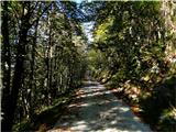
First along the forest road...1
Soon we spot our goal...left Vrh Dunje...2
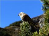
There were plenty of them among the scrub...3
Steep grassy slopes on the southern side of Lipnik...4
Frost has set in...icicles are already forming...5
Up the steep grass...6
...towards the summit...7
But this one mixed up the seasons a bit? :-))8
At the summit...9
Flawless view towards the Karnic Alps, all the way to the tip - queen of the High Tauern...10
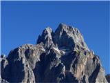
Majestic appearance of Montaž, next to it Viš and Veliki Nabojs like two schoolboys :-))), behind the chain of our giants...11
From the Bieliga saddle there is a nice view of Strma peč...12
Another view of Montaž during descent...13
...and a close-up of its summit part...14
like
IgorZlodej29. 09. 2014 20:33:38
First, Admin could merge these posts so it's not fragmented.
Starting point Planina Poccet, then first to Lipnik summit, short descent to the lower path and to Vrh Dunje, and back. Praise that the path to Vrh Dunje is freshly cleared mežikanje.
Jezul shelter1
from Montaža to Strma peč2
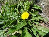
flowers in autumn3
4
5
Dunja summit, behind Ankogel and Hochalmspitze6
Lipnik and mountains above Ukvami, and to the right Dobrač7
part of the road back8
9
Poccet alpine pasture10
entire ridge from Lipnik to Dunja11
(+3)like
klm29. 09. 2014 21:17:43
Yes Igor, would need a mower to mow the tall grass. A bit of joke aside: Obviously today was a nicer atmosphere, at least judging by the photos. The cut juniper branches are only up to Vrh Dunje. Yesterday did the ascent from Prerit and would easily call it marked pathless terrain, especially the last part from Cuel Formian onwards.
like
Edina13. 09. 2015 20:41:36
Path from Planina Poccet without special features, slightly increased caution needed only on descent from upper to lower path, otherwise exceptionally nice; calm, panoramic, colorful and with very different views of the "home" mountains.

http://stezeinsledi.blogspot.si/2015/09/na-grebenu-naborjetskih-gora.html

Safe travelsnasmeh
(+5)like
potepinka31. 08. 2016 22:04:09
Today's day spoiled us with everything: sun and views, also the drive on the road from the village Pietratagliata to the starting point at Planina Poccet passed without any "adrenaline" encounters. From there on, taking steps to the Lipnik summit was pure enjoyment, because the path is really nicely laid out and also well marked. Not much new or different from previous posts to write. This summit really enchants with views. nasmeh
A little above Planina Poccet the path turns from the road into the shade of the forest1
view of Zuc dal Bor with neighbors2
the path is well marked3
when we come out of the forest the entire north side of Lipnik appears4
a really pleasant path for walking5
before the notch6
on the other side of the notch7
view of the traversed section8
the summit is already visible9
on the summit10
Vrh Dunje, Zuc dal Bor, M. Chiavals, …M. Zermula, Konjski Špik, Krniške skale… and more and more…11
views…12
bouquet along the path13
really reminds of what is written in one of the previous posts :)14
(+4)like
rozka16. 08. 2017 22:16:45
Well, let's go for a short one, just for the soul and at the same time for reconnaissancenasmeh...we drove to the village Chiout, where we left the car and continued to the alpine pasture Bieliga. Here we decided to continue all the way to Lipnik. We descended via the mulattiera and made a slight loop tour, then back along the road to the starting point. Nice, solitary and scenic tour, also suitable for bike, as it's the connection road from Kanal valley to Dunjonasmeh

Monday, 14.08.017
morning snapshot1
obviously the path closed?!2
alpine pasture Bieliga3
snapshot4
is there something to do5
Lipnik, Dunje peak in the background6
snapshot7
Lipnik summit8
9
snapshot10
towards Dunja11
towards Poccet pasture12
snapshot13
along the path, Strma peč in the background14
visible mulatiera15
it holds, holds, verified :)16
Along the path17
snapshot18
weekend at an idyllic place19
Chiout village20
(+2)like
velkavrh19. 10. 2017 13:13:38
On Tuesday -17.10.2107 the Škofja Loka retirees climbed to Lipnik (Monte Schenone -1950m).

Lipnik is the penultimate peak on the west of the Naborje Mountains in the Western Julian Alps. To the south it is bare with steep grassy heights descending deep into the Dunja valley. To the north it is densely forested high up. Together with the neighboring Vrh Dunje they reign with a majestic view far around. Somewhat strictly supervising them is the mighty Montaž-already lightly in white attire. I have no map of this Alpine area. Our two maps -Julian Alps-western part and Julian Alps-eastern and western part with Triglav National Park do not cover this area. Need to buy some Italian map. I know where we walked, but probably can't name the pastures we crossed exactly. I checked all articles from this area, but they didn't bring the right answer.

I think we drove from Pietragiate to the alpine pasture Poccet, if that's the correct name. We didn't see the hut-I don't know, probably it's lower where the asphalt ends. Probably we drove right past it. Anyway, we climbed quite a bit on the narrow asphalt road-also through some tunnel to a bend where the road ahead is closed to traffic. Here about seven of us were waiting for transport. There's also some interesting water fountain. Then we went on a path to the right, where we came across a water pipe leading to the fountain. The intake or spring is quite higher. We then crossed this mountain road and turned at the left bend of the road onto the marked path to the right. On the left there were even ruins of long-collapsed buildings. On the right we already saw our goal -the majestic ridge of Lipnik. Now a pleasant path led us somehow along the eastern side of Lipnik to the saddle Clap del Jovel. That's the saddle between Lanež and Lipnik. Here we turn right and to the summit of Lipnik we have surely three quarters of an hour more. The path is steep in places, but surely wide enough. We cross some pre-summit and only an easy ascent to the very summit of Lipnik awaits us, where a cross and a record box greet us. There are even ruins of military objects from WWI. We had wonderful weather and views far around. We returned via another path. Back we went from the saddle Clap del Jovel to the right to the saddle Bieliga-there's the same-named alpine pasture. After the bend you see three buildings of the pasture. It took us some time to reach the second pasture. We were surprised by two huge barns that are just ruins. The third barn still has a roof. Next to it there's also a hut that might be open in summer. There was even a vehicle with visitors standing there. That's Lipaljska planina-Malga San Leopoldo.
End of asphalt - our starting point.1
Already here wonderful views.2
On path 601.3
A bit on the trail, a bit on the mountain road.4
Does anyone know this peak?5
Jeluz shelter (ricovero).6
Here we can quench our thirst.7
Once a mighty building stood here.8
Paths to the saddle that divides Lipnik and Lanež.9
Mecesnov groves along the path.10
Winter didn't catch us.11
At these ruins, back from the road to the path.12
Lipnik showed itself to us from the west.13
Near the saddle.14
We are here.15
Now to Lipnik - that little peak in the middle is our goal.16
17
18
19
20
Lipnik summit.21
22
23
Our guard - Montaž.24
Views that enchant.25
Down there - at the saddle to the right.26
27
Bieliga pasture.28
We didn't go to these huts on the alpine pasture.29
On the Malga San Leopoldo alpine pasture.30
31
32
Those two were also here.33
Saddle above the alpine pasture.34
35
Past this.36
This must be the fire station.37
like
ločanka19. 10. 2017 16:11:15
Velkavrh, picture 5 - Šinaucnasmeh
Monte Schinauz
like
tulipan19. 10. 2017 17:18:25
Brane, buy Tabacco maps, then a lot will be clearer to you. After all, I think you're the guide who is most qualified to make trips successful!
(+1)like
ločanka19. 10. 2017 19:28:22
In the mountain guide Western Julian Alps it is written that Lipnik is distinguished above all by the view, which
offers a unique, stunning view of Montaž. A scene that is a true picture from a fairy tale, for which we find no equal in the Julijci.
Lipnik is especially beautiful in autumn, and if you visit it only once, you really have to do so.

But it seemed even nicer to me, because not only the summit is beautiful, but also the picturesque path that takes you to the top too quickly.
Lipnik really calls for a repeat visit.
towards Krniške skale /Gartnerkofel1
Hochalmspitze from the path2
from Mangart to V.Nabojsa3
View back4
summit of Dunja and Lipnik5
6
7
breathtaking view of Veliki Klek8
9
10
11
rest12
mighty sight of Montaža13
The photographer underestimated our size.14
Another scene from the top.15
Another view towards the Visoke Ture.16
Ankogel from the path, of course from afar.17
Above the plain of San Leopoldo.18
And this Montaž is really mighty.19
Near the saddle Agar.20
(+2)like
velkavrh20. 10. 2017 07:45:08
We'll go -next year there's a guided tour and Vrh Dunje is also included-planned 15.09.2018-third weekend-Saturday in September.
like
dprapr30. 10. 2021 17:33:28
Beautiful viewpoint, especially in autumn.
The road to Planina Poccet is quite adrenaline-pumping.
1
2
3
4
5
6
7
8
(+1)like
dprapr30. 10. 2021 18:56:38
Interesting information. Thanks.
Yes, the road is fine if you don't meet anyone. We were only one car.
But the road is now officially closed on weekdays. Probably due to forestry works being carried out on the pasture.
1
like
GITA30. 10. 2021 19:16:22
Hi Drago, where did you see the notice about until when the road will be closed? We're planning to go up sometime in early November, and if we can, we'd rather catch a nice day during the week than on the weekend...
like
dprapr30. 10. 2021 19:30:25
The notice was only on the triangular road sign, that it's open on Saturdays and Sundays.
like
GITA30. 10. 2021 19:45:07
Thanks...
like
georgia17. 04. 2024 20:26:08
Hi, this peak tempted me.
But I can't find data on how long the trail from pasture Poccet takes and how long from village Chiout? Is it possible to do a circular variant via pastures?

It will come in handy during vacation in Kr. gora, we usually spend more time in mountains on Italian side than Slovenian ... Thanks! nasmeh
like
You must log in to post a comment:
Username:
Password:
Login
If you do not yet have a username, you must first register.
         
Copyright © 2026 Hike.uno, Terms of use, Privacy and cookies