| velkavrh31. 08. 2019 07:05:25 |
As we know, the Košuta Ridge roughly runs from Zajmenove peči, over the highest peak of the Košuta ridge - Veliki vrh, Toplar, Mali and Veliki Kladivo, Tegoška gora, Macesje, Košutnikov turn and Mala Košuta, which roughly concludes the ridge. True, the ridge stretches to Obirski and concludes with Kališnikov and Režovnikov poldnev, which are lower and less known peaks.
As a standalone goal, Macesje has no special prominence and we cross it almost unnoticed when traversing the entire ridge from Veliki vrh to Košutnikov turn. Still, it is a nice and interesting goal. For the whole trip up and down from planina Spodnja Dolga njiva to planina Pungart we will spend a good five hours of locally demanding walking. Start is thus in front of the hut on planina Spodnja Dolga njiva, where we turn left on the marked path to planina Pungart and Košutnikov turn. After crossing the pasture fence the path runs for some time through the forest, at the fork we turn right into the steepness. We overcome the steepness in numerous switchbacks. When we leave the forest border steepness does not relent. Then follows crossing of a long slope, where the pathlet is narrow and precipitous. Locally even grass overgrows it, so even greater caution is needed. Somewhere in the middle of the slope, where we already sensed the ridge path, we climbed straight up the steep slope onto it. But this section needs to be known. Therefore better continue on the path and come around to Ostrvinova škrbina, where we continue across the entire Macesje ridge to the same-named Ostrvinova grapa and škrbina and descend to planina Pungart.
Just like Tegoška gora the Macesje ridge has no real prominence and we pass it on the traverse from Veliki vrh to Košutnikov turn. Despite small prominence it is more interesting than say the Tegoška gora ridge. Viewed from the west it starts with peak Užnik (Larchenberg)-2029m, then comes peak Perilnik (Mittelwand)-200m, follows Macesje - east of Perilnik is (Breitwand or Breikopf)-2124m. The peak next to Košutnikov turn is second in height in the entire Košuta ridge. From Perilnik it is separated by Piksova škrbina (Pischscharte)-2009m, which simultaneously separates it also from Stolp (Pichsturm)-2080m. The last peak in the ridge is Ostrv (Zadnja košuta-Kleiner Koschunikturm/Kainradlturm)-2104m. It looks like a standalone peak, but is not. From Macesje it is separated by distinct Ostrvina grapa and same-named škrbina (Kainradlscharte)-2065m.
I know the entire Košuta ridge in detail and have traversed it completely several times already. Standalone, now the Macesje ridge for the first time.
 1 1 2 2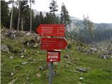 3 3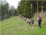 4 4 5 5 6 6 7 7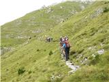 8 8 9 9 10 10 11 11 12 12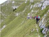 13 13 14 14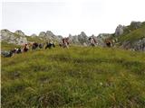 15 15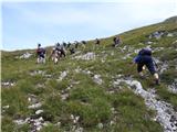 16 16 17 17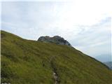 18 18 19 19 20 20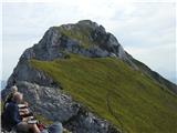 21 21 22 22 23 23 24 24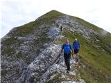 25 25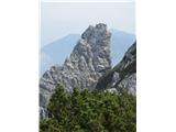 26 26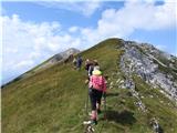 27 27 28 28 29 29 30 30 31 31 32 32 33 33 34 34 35 35 36 36 37 37
| (+5) |  | |
|
|