|
| alfaromeo1556. 01. 2010 20:03:31 |
Is there an online map where you can view a hiking route and plot it
regards, thanks
|
|
|
|
| gasilec6. 01. 2010 20:21:39 |
I recommend "www.geopedia.si", there choose the map "Hiking", most hiking trails in Slovenia are drawn (though not always accurately). Or register (simple process) and draw your own trails, the program automatically shows the elevation profile, plus you can insert photos, comments, descriptions etc. Instructions on the site.
Best regards!
|
|
|
|
| JusAvgustin6. 01. 2010 22:34:22 |
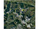
Google Earth has that too... 
 1 1
|
|
|
|
| gasilec7. 01. 2010 13:45:46 |
I partially agree with you, geolog79. Google Earth has a simpler 3D view, Geopedia has more accurate maps, drawn trails and ortho-photos, unfortunately limited to Slovenia only. I use Geopedia for precise route planning, Google Earth for rough trail overview.
|
|
|
|
| lynx7. 01. 2010 14:56:46 |
In Google Earth there are sometimes big glitches and peaks marked multiple times.
|
|
|
|
| jurel8. 01. 2010 07:46:12 |
A good alternative to Google Earth is Gaea plus http://gaeaplus.si/, which covers the area of Slovenia much better (more accurately). It also allows viewing of the completed GPS track.
|
|
|
You must log in to post a comment:
If you do not yet have a username, you must first
register.