|
| brett11. 11. 2020 14:57:06 |
Given the "ideal" weather conditions, I dashed to Travni vrh, which rises on the far western edge of the Logatec municipality. At 930m elevation, you could say it's the highest peak around here, although officially Srnjak at 919m is. I assume Travni vrh is geodesically a few meters outside Logatec municipality, namely in Idrija municipality. Or not?
Anyway: I drove to the starting point on a nicely gravelled road that starts a couple hundred meters off the local Logatec - Hotedršica road. Right after the Hotedršica sign is a bus stop on the left side. Behind it, turnoff to Novi svet settlement: entrance to the street that splits into two forks. Follow the left one, still asphalted. After cca 400m, wooden sign for Travni vrh on a tree. Here I leave asphalt and drive on gravel cca 2km to the Travni vrh sign and parking. From there marked 1h 10min walk.
Footpath super marked, partly trail, partly gravel. Signs for Travni vrh in between. Best do circular version. Real walking to summit 45min and 390m gain. Summit no view - just 18th century border stone. All around beech forest and moss-covered rock boulders. Same by path; sinkholes, skidding pits for timber
By far most interesting spot on otherwise lonely path: Italian army barracks from SHS time and Rapallo border.
Tooth of time + nature doing their work... and that's the charm: mystery, eeriness of the site. If "neighbor" Jakob hadn't told me, you'd first think some medieval monastery: shapes and architecture like that. Really worth visit and exploring! 
 1 1 2 2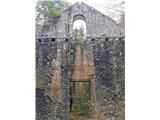 3 3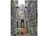 4 4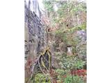 5 5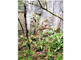 6 6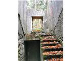 7 7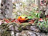 8 8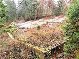 9 9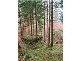 10 10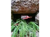 11 11 12 12 13 13") 14 14
| (+6) |  | |
|
|
|
You must log in to post a comment:
If you do not yet have a username, you must first
register.