Starting point: Gozd (891 m)
| Latitude/Longitude: | 46,34100°N 14,32830°E |
| |
Walking time: 2 h
Difficulty: easy pathless terrain
Elevation gain: 700 m
Elevation difference along the route: 700 m
Map: Karavanke - osrednji del 1:50.000
Recommended equipment (summer):
Recommended equipment (winter): ice axe, crampons
Views: 13.683
 | 3 people like this post |
Access to starting point:
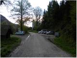
a) Leave the Gorenjska motorway at the Kranj west exit, then follow the signs for Golnik and Križe. Somewhat after the settlement of Senično, a steep road branches off to the right uphill, leading towards Zgornje Vetrno and Gozd. Shortly after the village of Zgornje Vetrno, we reach a marked parking lot on the left side of the road (starting point for the steep path to Kriška gora), but we continue driving along the ascending road, which soon brings us to Zavetišče v Gozdu. We can park at one of the two larger parking lots next to the mentioned shelter, or drive another good 100 m ahead to the parking lot by the church.
b) From the Naklo - Tržič road, in the settlement of Retnje, turn onto the road towards Križev and Golnik. In Križah, at the stop sign turn right towards Golnik, but we continue along the main road to the junction where a steep road branches sharply left, leading towards Zgornje Vetrno and Gozd. Shortly after the village of Zgornje Vetrno, we reach a marked parking lot on the left side of the road (starting point for the steep path to Kriška gora), but we continue driving along the ascending road, which soon brings us to Zavetišče v Gozdu. We can park at one of the two larger parking lots next to the mentioned shelter, or drive another good 100 m ahead to the parking lot by the church.
Route description:
From the parking lot, we first walk to the nearby church of St. Nicholas, then reach a marked junction where the path from Golnik joins from the right. We continue slightly left and proceed with the ascent along the road, which takes us past two consecutive NOB monuments above the village, where the road turns into a wide but steep cart track. After a short ascent, the cart track splits into two parts, and we continue on the left towards Koča na Kriški gori (right to Tolsti vrh). The cart track then passes a water supply facility and a weekend cottage and enters the forest, continuing with a moderate ascent.
A little further on, the signs for Kriška gora direct us right (straight unmarked path to Kriška gora) onto a somewhat rougher cart track, which higher up turns into a fairly steep trail. We continue ascending on a well-maintained path, along which we notice numerous benches and the names on them. Higher up, the path brings us to a pasture fence and then turns left a bit higher, ascending transversely. After a few minutes of traverse ascent, we step out of the forest, where we already see Koča na Kriški gori ahead, just a few dozen easy steps away.
From the hut, we return a few steps back, then continue the path towards Tolsti vrh. The path ahead ascends gently along and on the main ridge of Kriška gora, then gradually moves to the southern slopes. After about 20 minutes of walking from Koča na Kriški gori, we will notice a less trodden path to the left of the marked trail, which disappears after just a few meters. Head to the mentioned path, which, as said, disappears after a dozen steps among the grass. From the point where the path disappears, find the most suitable passage through the bushes and dwarf pines, beyond which we enter an easily passable grassy area. Continue ascending straight up the slope and reach the summit in a few minutes.
Starting point - St. Nicholas 0:05, St. Nicholas - junction above Gozd 0:10, junction above Gozd - fork of Ovčja path 0:10, fork of Ovčja path - Koča na Kriški gori 1:05, Koča na Kriški gori - Vrata 0:30.

Photos:
 1
1 2
2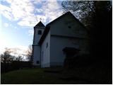 3
3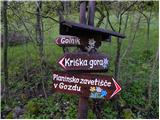 4
4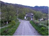 5
5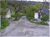 6
6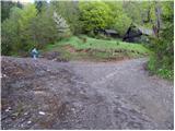 7
7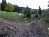 8
8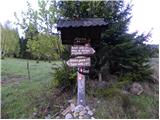 9
9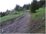 10
10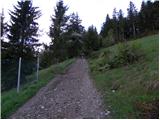 11
11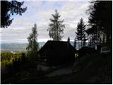 12
12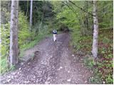 13
13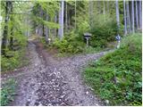 14
14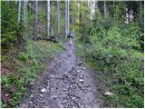 15
15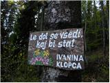 16
16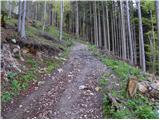 17
17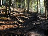 18
18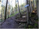 19
19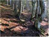 20
20 21
21 22
22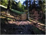 23
23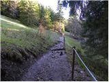 24
24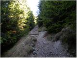 25
25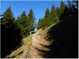 26
26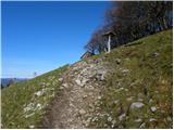 27
27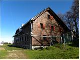 28
28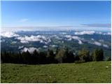 29
29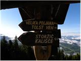 30
30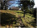 31
31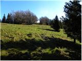 32
32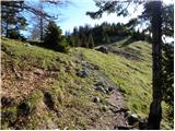 33
33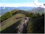 34
34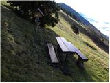 35
35 36
36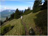 37
37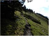 38
38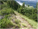 39
39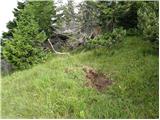 40
40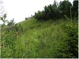 41
41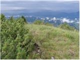 42
42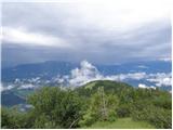 43
43
Discussion about the trip Gozd - Vrata
To post a comment you must log in:
If you do not yet have a username, you must first
register.