Planina Blato - Planina Viševnik (via Krištofojca)
Starting point: Planina Blato (1147 m)
| Latitude/Longitude: | 46,31120°N 13,85010°E |
| |
Route name: via Krištofojca
Walking time: 1 h 40 min
Difficulty: easy marked way
Elevation gain: 478 m
Elevation difference along the route: 510 m
Map: Triglav 1:25.000
Recommended equipment (summer):
Recommended equipment (winter): ice axe, crampons
Views: 8.517
 | 1 person like this post |
Access to starting point:
From the Ljubljana-Jesenice motorway, take the Lesce exit and follow the road towards Bled and further towards Bohinjska Bistrica. Continue driving towards Lake Bohinj (Ribčev laz), where we reach a junction and continue right towards Stara Fužina. In Stara Fužina, at the junction by the chapel, turn sharply left onto the ascending road towards Planina Blato, Planina Vogar and Voje valley. The road then takes us to the toll and parking fee collection point, but we follow it further to the next junction, where we continue left (right to Voje). Then follow the road to the next junction (driving for quite some time), where we turn sharply right towards Planina Blato (straight to Planina Vogar). Follow this road to the parking lot above Planina Blato.
Route description:
From the marked parking lot in front of Planina Blato, return a little back and head onto a wide and initially also steep cart track, along which there are signs for Planina pri Jezeru. After about ten minutes of ascent, we arrive at a marked junction, from where we continue left towards Planina pri Jezeru (slightly right Planina v Lazu and also the steep path towards Planina pri Jezeru).
Continuing on the less steep cart track, which still leads through the forest, a little further on the marked path leading past Kosijev dom on Vogar joins from the left, but we continue right and keep walking along the cart track. Higher up, the path leads through a small narrowing, then crosses quite steep slopes where there is a high risk of slipping in ice and snow, otherwise the path is not demanding. At the end of the steep slope, the aforementioned steep path joins quite unobtrusively from the right, the cart track turns left here and turns into the rather cool Pungrat valley, where we ascend through mostly spruce forest. When the path levels out higher up, the path leading past Planina Vodični vrh joins from the left, but we keep slightly to the right direction and continue walking along the cart track, along which the forest begins to thin. Only a few minutes of easy walking follow and we step onto the pastures of Planina pri Jezeru, where on a small hill stands the Koča na Planini pri Jezeru hut.
At the hut, the path towards Planina v Lazu branches off to the right, but we continue left from the hut and descend to a marked junction, where there are also a few shepherd huts.
We choose the wider right path along which there are signs for Planina Dedno polje and Koča pri Triglavskih jezerih (slightly left Pršivec, Planina Viševnik and Črno jezero).
We also continue ascending along the cart track, which is quite rocky on steep sections, after about ten minutes of ascent we arrive at the place where the path over Krištofojca branches off to the left, leading towards Planina Viševnik.
Continue in the mentioned direction (straight Planina Dedno polje) and for a short time continue along the cart track, which soon turns into a mountain path. The path further leads past several small birches and in a few ascents brings us out of the forest to the edge of Planina Viševnik. Here we join the usual path from Planina pri Jezeru, and with ever better views we quickly arrive at Bregarjevo zavetišče on Planina Viševnik.
Starting point - Planina pri Jezeru 1:00, Planina pri Jezeru - Planina Viševnik 0:40.

The trip can be extended to the following destinations: Planina Blato (5 h 20 min),
The lake Črno jezero (1 h),
Dom na Komni,
Planina Lopučnica,
Planina Dedno Polje,
Planina Ovčarija,
Koča pri Triglavskih jezerih,
Pršivec,
Mala Tičarica,
Slatna,
Velika Tičarica,
Kopica,
Čelo
Photos:
 1
1 2
2 3
3 4
4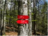 5
5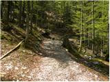 6
6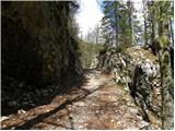 7
7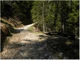 8
8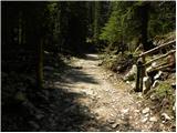 9
9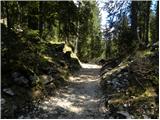 10
10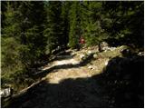 11
11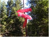 12
12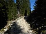 13
13 14
14 15
15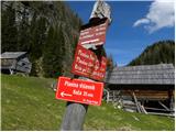 16
16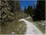 17
17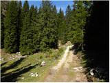 18
18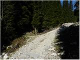 19
19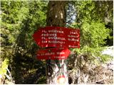 20
20 21
21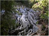 22
22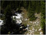 23
23 24
24 25
25 26
26 27
27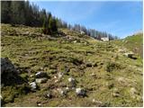 28
28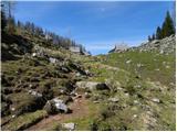 29
29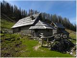 30
30
Discussion about the trip Planina Blato - Planina Viševnik (via Krištofojca)
To post a comment you must log in:
If you do not yet have a username, you must first
register.