Planina Ravne - Lučki Dedec (via Dolga trata)
Starting point: Planina Ravne (1500 m)
| Latitude/Longitude: | 46,34930°N 14,69970°E |
| |
Route name: via Dolga trata
Walking time: 4 h 30 min
Difficulty: partly demanding unmarked way
Elevation gain: 523 m
Elevation difference along the route: 875 m
Map: Kamniške in Savinjske Alpe 1:50.000
Recommended equipment (summer):
Recommended equipment (winter): ice axe, crampons
Views: 4.957
 | 1 person like this post |
Access to starting point:
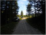
A) First, we drive to Kamnik, then continue driving towards Stahovica and the mountain pass Črnivec. A few hundred meters before the mountain pass Črnivec, we leave the main road which leads towards Gornji Grad and continue driving sharply left in the direction of the mountain pass Volovljek (Kranjski Rak). From the mentioned mountain pass we continue straight (left road which leads to Velika planina, right Štajerski Rak) and start descending towards Luče. Lower down, the road flattens a little and brings us into the Podvolovljek valley. Further on, we first drive past the turn-off of the road which leads into the Lučka Bela valley, then also past the Bar pri Gamsu. After the bar, we need to pay attention, because just a few hundred meters further the road which leads towards the mountain pastures Podvežak and Ravne and the farm Planinšek branches off to the left (at the spot where we leave the main road, there is a road sign approximately 11 km). Further on, we drive on the initially still asphalt road, which then ascends towards the Dleskovška planota plateau. Higher up, the road towards Planinšek branches off to the right, and we continue on the left upper road, which a little further brings us to the next crossroad, where we continue straight in the direction of the mountain pasture Ravne (left mountain pasture Podvežak). Further on a somewhat rougher road, we then follow it to the beginning of the mountain pasture Ravne, where we park in an appropriate place by the road.
From the main road to the mountain pasture Ravne is approximately 10 km.
B) First, we drive to Luče, then continue driving towards Kamnik. When we notice the road sign by the road which shows 10.5 km, we need to pay attention to the right turn-off, because just a little further to the right the road towards the mountain pastures Podvežak and Ravne and the farm Planinšek branches off. Further on, we drive on the initially still asphalt road, which then ascends towards the Dleskovška planota plateau. Higher up, the road towards Planinšek branches off to the right, and we continue on the left upper road, which a little further brings us to the next crossroad, where we continue straight in the direction of the mountain pasture Ravne (left mountain pasture Podvežak). Further on a somewhat rougher road, we then follow it to the beginning of the mountain pasture Ravne, where we park in an appropriate place by the road.
Route description:
At the beginning of the mountain pasture Ravne (also Ravni) we notice wooden mountain signposts for Veliki vrh, Korošica, Molička planina and Dolga trata, which point us left towards the nearby cottage, which is located on the edge of the mountain pasture. We bypass the cottage on the left side, then pass into a narrow belt of forest, where the blazes lead us left. The path ahead leads us across a clearing, across which it ascends transversely into the forest. Further on, we ascend through the forest, where soon we cross a grazing fence. Higher up, the forest begins to thin out, or changes into a belt of dwarf pines. Somewhat less trodden in places, but always nicely followable, the path higher flattens and brings us to the lower edge of the pastures of Dolgih trat. Here the path completely flattens and in a few dozen steps of further walking brings us to the shepherd's hut on Dolgih tratah.
From the shepherd's hut we continue left in the direction of Molička planina, Korošica, Veliki vrh and Zelene trate (slightly right Dleskovec). The path ahead leads us across the pastures of Dolge trate and ascends gently to moderately. Higher up, the path flattens and brings us to a smaller saddle, behind which the path leads us past a watering place for animals. We bypass the watering place on the left side, and the path brings us just a few meters further to a smaller junction, where we continue slightly right in the direction of Veliki vrh and Korošica (straight down Korošica via Vrtač). Further on, the path passes onto the scenic western slopes of Dleskovec, across which it begins to descend transversely towards the junction on Zelenih tratah. After a short descent we arrive at the mentioned junction, from there we continue left in the direction of Korošica (right mountain pasture Ravne via Korit). Just a little further we arrive at the place where the path to Veliki vrh branches off to the right.
We continue straight in the direction of Korošica and Molička planina along the path which occasionally descends slightly and rises again. The path ahead circles the slopes of Veliki vrh and brings us to a junction, where the path to the mentioned peak branches off to the right upwards. Here we continue straight along the path which just a little further brings us to the saddle Prag, where there is the next junction. We continue straight (sharply left mountain pasture Podvežak) along the marked mountain path, which gradually begins to descend. After a good 10 minutes of descent, the path flattens and brings us to a small marsh, behind which we reach the next junction. We continue slightly left in the direction of Korošica (straight Molička planina, right Robanov kot) along a pleasant mountain path which begins to ascend moderately. Higher up, the path turns somewhat to the left, then joins the path from mountain pasture Podvežak. We continue right in the direction of Korošica along the transverse path, along which in a few minutes of further walking we ascend to Sedelce (1900 m), where there is a marked junction.
We continue straight down (left Prag, right Ojstrica via Mala Ojstrica) along the marked path, which begins to descend towards Korošica. After a few minutes of descent, we step onto the extensive grassy slopes of Korošica, across which we then walk in a few minutes to the mountain hut.
From Kocbekov dom we continue left in the direction of Podvolovljek and Kamniška Bistrica along the path which first ascends gently then moderately towards the saddle Prag. After approximately 15 minutes of walking, we step onto the mentioned saddle (we can also reach here directly from Sedelce, so we do not need to descend to Kocbekov dom, which shortens the path by approximately 15 minutes), and we follow the marked path for another few dozen meters to the spot where the signs for Lučki Dedec direct us right onto an unmarked path.
At the spot where we notice the signs for Lučki Dedec we leave the marked path and continue the ascent along an initially well visible trail. The path ahead continues along a small valley, then turns right and ascends steeply. Further on, the trail, along which there are numerous cairns, begins to fade, but in good weather this does not cause orientation problems. This is followed by an ascent across smaller scree terrain, then the path passes onto grassy slopes surrounded by dwarf pines. Here we will already notice one of the three peaks of Lučki Dedec on the right, but we continue straight along the path which brings us to the main ridge. On the ridge we continue slightly left and the path quickly brings us past the second subpeak to a large meadow, across which we ascend in a few steps to the precipitous summit.

Photos:
 1
1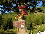 2
2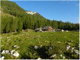 3
3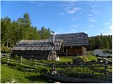 4
4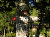 5
5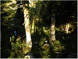 6
6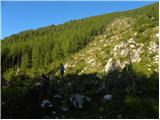 7
7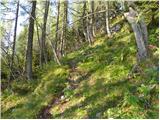 8
8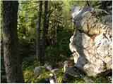 9
9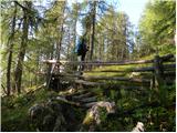 10
10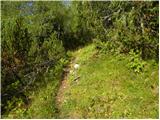 11
11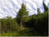 12
12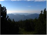 13
13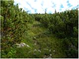 14
14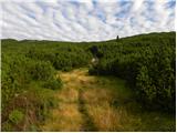 15
15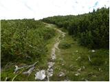 16
16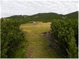 17
17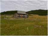 18
18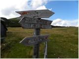 19
19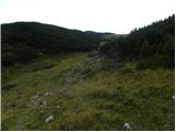 20
20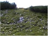 21
21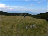 22
22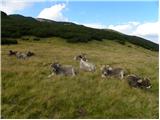 23
23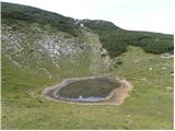 24
24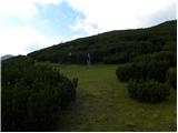 25
25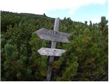 26
26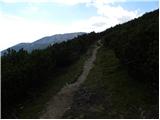 27
27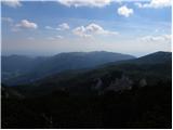 28
28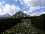 29
29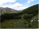 30
30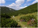 31
31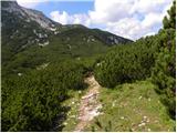 32
32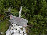 33
33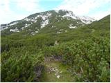 34
34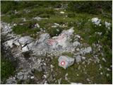 35
35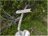 36
36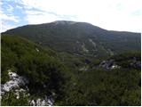 37
37 38
38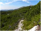 39
39 40
40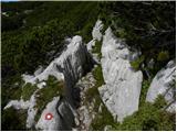 41
41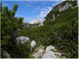 42
42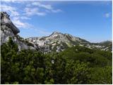 43
43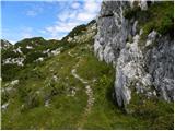 44
44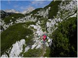 45
45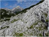 46
46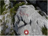 47
47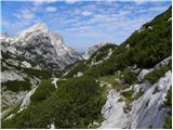 48
48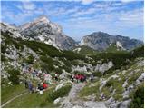 49
49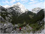 50
50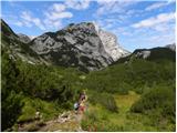 51
51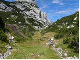 52
52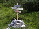 53
53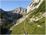 54
54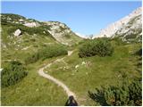 55
55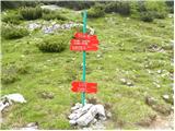 56
56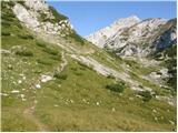 57
57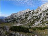 58
58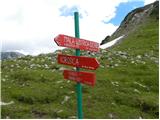 59
59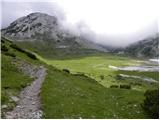 60
60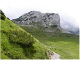 61
61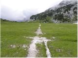 62
62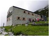 63
63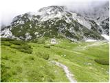 64
64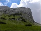 65
65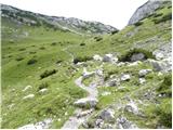 66
66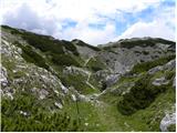 67
67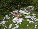 68
68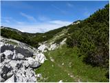 69
69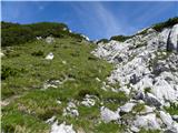 70
70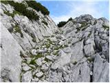 71
71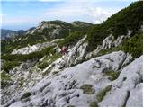 72
72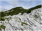 73
73 74
74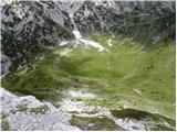 75
75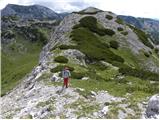 76
76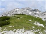 77
77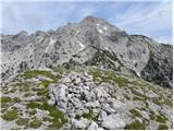 78
78
Discussion about the trip Planina Ravne - Lučki Dedec (via Dolga trata)
To post a comment you must log in:
If you do not yet have a username, you must first
register.