Ravenska Kočna - Goli vrh (austrian way)
Starting point: Ravenska Kočna (1000 m)
| Latitude/Longitude: | 46,38470°N 14,53640°E |
| |
Route name: austrian way
Walking time: 2 h 30 min
Difficulty: easy marked way
Elevation gain: 787 m
Elevation difference along the route: 800 m
Map: Kamniške in Savinjske Alpe 1:50.000
Recommended equipment (summer):
Recommended equipment (winter): ice axe, crampons
Views: 19.568
 | 3 people like this post |
Access to starting point:
From the Gorenjska motorway, Kranj or Preddvor, we drive to Zgornje Jezersko, then approximately 1 km after the Petrol petrol station, we turn right in the direction of Planšarsko jezero and Češka koča. Further on, we drive past the mentioned lake, then the road leads us across a larger meadow, where the asphalt ends and from which a beautiful view opens up on the surrounding mountains, then the road returns into the forest, where it first crosses a torrent. A little further, the road splits, and we continue on the right road (left Gorniški center Davo Karničar and also the footpath to Jenkova planina and former starting point for the mentioned planina), along which we quickly reach a large marked parking lot, where we park.
Route description:
Somewhere in the middle of the large parking lot a passage opens to the left, by which there are mountaineering signposts for Velika Baba, Goli vrh and a sign for the hunting path to Ledine. We start on a cart track which brings us to the edge of a meadow, where on the left side we will notice the Gorniški center. We continue straight to the well-visible signposts at the nearby junction, from which we continue straight in the direction of Velika Baba and Goli vrh (right Ledine). The path ahead still leads on a cart track, which soon turns left, then ascends transversely. Higher, a path from the old starting point joins from the left, i.e. the marked path from Planšarsko jezero. The cart track on which we are walking then turns into a footpath, which ascends relatively steeply through the forest. After approximately an hour and a half of walking, we step out of the forest onto the abandoned and quite overgrown Jenkova planina, where there is also a junction.
We continue straight (left Goli vrh - Slovenian path, right Velika Baba) to the "sign" (after Slovenia's entry into Schengen only a metal pole remains), which marks the border crossing. At the pole we will notice on the left side a smaller wooden cottage, to which only a few steps of walking separate us.
Near the cottage on Jenkova planina we will notice an Austrian directional sign with the inscription "Goli 615", which directs us onto an initially gentle footpath. The path goes into the forest after just a few steps, where in a barely noticeable ascent it crosses several steep slopes that are slippery and dangerous when wet. Somewhat further, the path passes onto the indistinct eastern ridge of Goli vrh, where it begins to ascend ever more steeply. Higher, the path gradually passes from the forest onto the increasingly panoramic slopes of Goli vrh. When we already think that we have only a few steps to the summit, a view opens up on the "main" summit, to which we still have less than 5 minutes of walking.

Photos:
 1
1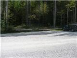 2
2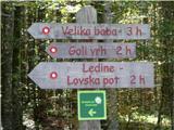 3
3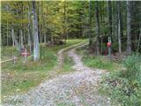 4
4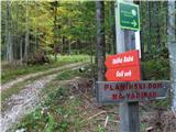 5
5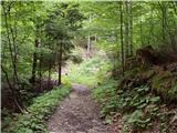 6
6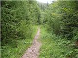 7
7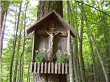 8
8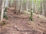 9
9 10
10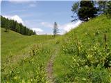 11
11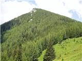 12
12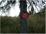 13
13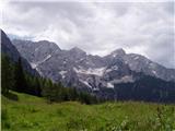 14
14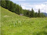 15
15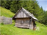 16
16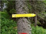 17
17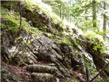 18
18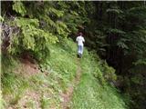 19
19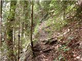 20
20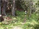 21
21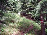 22
22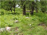 23
23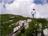 24
24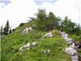 25
25 26
26 27
27
Discussion about the trip Ravenska Kočna - Goli vrh (austrian way)
|
| Gost27. 01. 2008 |
We took 3 hours to the summit, as there was quite a lot of snow and being southern it sank. Strong wind on top today, but good views. Besides our four we met no living soul. Returned via Slovenian route, which was trodden and icy in places.
|
|
|
|
| Tary18. 05. 2013 |
Today we did this hike. On the Austrian path there are quite a few fallen trees across the path. It's not as nicely maintained as the Slovenian one, but still interesting. 
|
|
|
|
| gorskarozica10. 12. 2016 |
Lost women's wristwatch, 10.12.2016 on Goli vrh. If someone finds it, please call me at 031 774 081. Thank you!
|
|
|
|
| anica.zu@gmail.com20. 08. 2019 |
Has anyone been up there recently? Is there perhaps a more recent description for this path?
|
|
|
|
| jana196620. 08. 2019 |
The path hasn't changed much, just that on Jenkovi planini the grass is so high that the hut isn't visible from the path, from there on there are quite a few fallen trees along the path towards the summit, checked on Sunday. The view makes up for it all, nice trip.
|
|
|
To post a comment you must log in:
If you do not yet have a username, you must first
register.