Ribnica na Pohorju - Koča na Pesniku
Starting point: Ribnica na Pohorju (714 m)
| Latitude/Longitude: | 46,53320°N 15,26690°E |
| |
Walking time: 1 h 5 min
Difficulty: easy marked way
Elevation gain: 387 m
Elevation difference along the route: 387 m
Map: Pohorje 1:50.000
Recommended equipment (summer):
Recommended equipment (winter):
Views: 8.270
 | 1 person like this post |
Access to starting point:
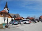
A) From the road Maribor - Dravograd, before the settlement Brezno we turn left in the direction of Podvelka, Ribnica na Pohorju and Ribniška koča. After the bridge over the river Drava we get to Podvelka, and we follow the road further in the direction of Ribnica na Pohorju. After approximately 10 km from the bridge over the river Drava we get to the center of Ribnica na Pohorju, where we go left and then a little further ahead we park on the parking lot in the center of the settlement. The parking lot is located a little ahead from the parish church of St. Jernej.
B) From Dravograd we drive towards Maribor, after Radlje ob Dravi at the roundabout we leave the main road towards Maribor and we continue driving in the direction towards Vuhred, Ribnica na Pohorju and Ribniška koča. After the bridge over the river Drava we get to Vuhred, and we follow the road further in the direction of Ribnica na Pohorju. After approximately 10 km from the bridge over the river Drava we get to the center of Ribnica na Pohorju, where we go right and then a little further ahead we park on the parking lot in the center of the settlement. The parking lot is located a little ahead from the parish church of St. Jernej.
Route description:
From the center of Ribnica na Pohorju we at first continue on an ascending asphalt road, from which we soon go right in the direction of the mountain hut Koča na Pesniku. We quickly get to the foot of the ski slope, where we leave the road and we continue the ascent left by the edge of the ski slope. When we ascend to the top of the ski slope, we cross also a lane of forest and then we reach the macadam road, where the path flattens. We for some time continue on the road which leads through the forest, and higher we get to a crossroad from which we continue straight on a footpath in the direction of the mountain hut Koča na Pesniku. There follows approximately 15 minutes of a moderate ascent and the path brings us out of the forest, where in front of us we already notice the mountain hut, to which we have only a few minutes of easy walking.
The trip can be extended to the following destinations: Ribniška koča
Photos:
 1
1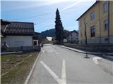 2
2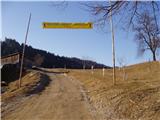 3
3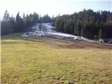 4
4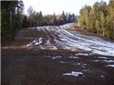 5
5 6
6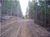 7
7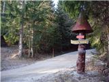 8
8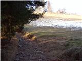 9
9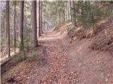 10
10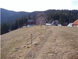 11
11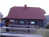 12
12
Discussion about the trip Ribnica na Pohorju - Koča na Pesniku
|
| klavdipo29. 07. 2008 |
I recommend visiting this hut! Extremely friendly caretakers, excellent tea and pleasant surroundings! 
|
|
|
|
| navdušena30. 12. 2018 |
We park in the center of Ribnica na Pohorju, the sign on the tree directs us to the path towards Pesnik.
|
|
|
To post a comment you must log in:
If you do not yet have a username, you must first
register.