Rifugio Dibona - Tre Dita (via Rifugio Giussani)
Starting point: Rifugio Dibona (2083 m)
| Latitude/Longitude: | 46,53260°N 12,07030°E |
| |
Route name: via Rifugio Giussani
Walking time: 2 h 30 min
Difficulty: partly demanding marked way
Elevation gain: 611 m
Elevation difference along the route: 625 m
Map: Tabacco 03 1:25.000
Recommended equipment (summer):
Recommended equipment (winter): ice axe, crampons
Views: 5.879
 | 1 person like this post |
Access to starting point:
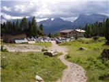
First, we drive to Cortina d'Ampezzo (you can get here via the border crossing Rateče or Predel to Trbiž / Tarvisio and then on the highway in the direction of Udine to the exit Tolmezzo. From Tolmezzo we follow the road in the direction of the village Ampezzo and mountain pass Passo della Mauria. The road then descends and brings us to a crossroad, where we continue left (possible also right) in the direction of Cortina d'Ampezzo. At all next crossroads, we follow the signs for Cortina d'Ampezzo. Or from the Primorska side, where we drive on the highway in the direction of Trst / Trieste. Further, we drive on the Italian highway in the direction of Padova, but only to the highway junction, where we continue in the direction of Veneto and Belluno. Near Belluno the highway ends, and at the next crossroads we continue in the direction of Cortina d'Ampezzo and then we follow the signs for the alpine pass Passo di Falzarego. We then follow this ascending road to the spot, where the road to the mountain hut Rifugio Dibona branches off to the right (the turn-off is at an altitude of approx. 1700 m). The considerably damaged and initially asphalted road brings us higher to a crossroad, where we continue on the left lower road (right mountain hut Duca d'Aosta) and follow it to the parking lot for the Dibona hut.
Route description:
From the parking lot, we continue on a macadam road past a gate. We follow this road to a crossroad with signposts, where we go right on a wide mule track following the signs »Rif. Camillo Giussani«. The wide path then slowly ascends and in the left bend the path from the mountain hut Rifugio Pomedes joins us, a little later from the left also path 404, which crosses the slopes below the south wall of Tofana di Rozes. The mule track then continues ascending on the increasingly steeper slope between Tofana di Rozes and Tofana di Mezzo. We soon come to the abandoned hut Cantore. A short ascent follows alongside the cargo cableway and we are already at the mountain hut Rifugio Giussani.
From the hut, we continue towards the west and after a short ascent over the scree we come to a poorly visible junction. To the left upwards leads the path towards the summit Tofana di Rozes, while we go right and after crossing the scree towards the west we soon reach Tre Dita.
Photos:
 1
1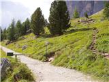 2
2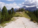 3
3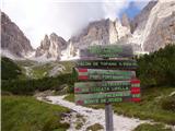 4
4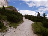 5
5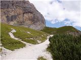 6
6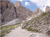 7
7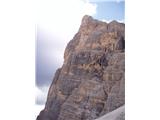 8
8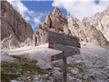 9
9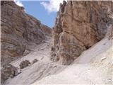 10
10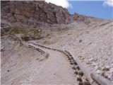 11
11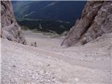 12
12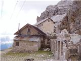 13
13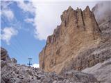 14
14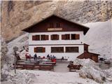 15
15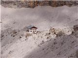 16
16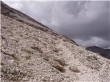 17
17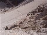 18
18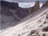 19
19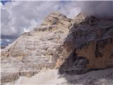 20
20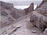 21
21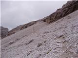 22
22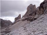 23
23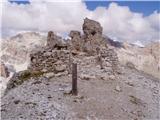 24
24
Discussion about the trip Rifugio Dibona - Tre Dita (via Rifugio Giussani)
|
| VanSims20. 07. 2010 |
So that junction is indeed less visible but well marked!
Already from Rifugio Giussani we are accompanied by two markings: red and blue! That already gives us a hint that two paths are marked. Just before the junction there are inscriptions FERRATA and VETTA on the rock. Then we see that the blue dots turn uphill (Tofana di Rozes), the red ones to the right (Tre Dita)
|
|
|
|
| VanSims20. 07. 2010 |
The road to Rifugio Dibona is now freshly asphalted  but again only up to the crossroads. but again only up to the crossroads.  Further on it's still gravel. But even on that asphalt you meet cars... Further on it's still gravel. But even on that asphalt you meet cars... 
|
|
|
To post a comment you must log in:
If you do not yet have a username, you must first
register.