San Martino - Cima Vezzana (via Rifugio Rosetta)
Starting point: San Martino (1586 m)
| Latitude/Longitude: | 46,26921°N 11,80406°E |
| |
Route name: via Rifugio Rosetta
Walking time: 6 h 20 min
Difficulty: difficult marked way
Elevation gain: 1606 m
Elevation difference along the route: 1970 m
Map: Tabacco 22 1:25.000
Recommended equipment (summer): helmet
Recommended equipment (winter): helmet, ice axe, crampons
Views: 3.793
 | 2 people like this post |
Access to starting point:
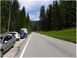
From Nova Gorica, we drive to Italy and continue on the highway towards Venice / Venezia. At the town of Portogruaro, we leave the highway towards Venice and continue right on the highway towards Pordenone. At the next highway junction near the town of Conegliano, we continue right towards the town of Belluno. We follow the highway to the exit for Belluno; after the town of Belluno, we follow the road in the direction of the town of Feltre and then towards the town of Transacqua and the mountain pass Passo Rolle. The ascending road then leads us through the town of San Martino. From the sign that marks the end of the town of San Martino, we continue for approximately 1 km, then on the left side of the road we will notice a smaller parking lot where we park.
Route description:
At the starting point, we will on the right side of the road notice a signpost, which points us right on a footpath towards the mountain pasture Malga Pala. The path quickly brings us into the forest through which it then for quite some time slightly ascends. Later, the path turns to the right and after a short ascent, it brings us to a marked junction.
Left leads the path towards the mountain pass Passo Rolle, and we continue right towards the mountain pasture Malga Pala. The path further crosses slopes towards the southeast and from the path nice views open up towards the town of San Martino and surrounding peaks. After that, the path turns a little to the left and starts ascending a little steeper in zig-zags through the forest. Later, the path becomes slightly less steep and still runs through the forest. Such a path then brings us a little before the mountain pasture to a junction where from the right side a path joins from a somewhat lower starting point in the town of San Martino. From the junction then only a short ascent follows to the hut on the mountain pasture Malga Pala.
On the mountain pasture, we continue right on a gentle road, which soon brings us to a ski slope. Here we continue slightly left and a short ascent follows to the hut Colverde where there is the station of a cable car.
At the hut where there is a junction, we continue following the signs for »Rif. Rosetta«, left upwards leads the path towards the via ferrata Bolver Lugli. The path first leads us through a short and sparse strip of forest, then the increasingly panoramic path ascends for quite some time in zig-zags on slopes below the peaks Croda della Pala and Cima Corona.
Higher, when from the left side the path from the mountain pass Passo Rolle joins, our path turns a little to the right and crosses the slope below the cable car. Further, the path starts ascending a little steeper again, and on some spots it is also slightly exposed. The ascent nevertheless does not cause particular problems, because the path is very well secured, on exposed spots also with a railing. Here we mostly ascend in zig-zags, and from the path we have all the time a nice view on the nearby peak Rosetta and other peaks above the valley Val Cismon. Higher, the path turns left towards the northeast and becomes gradually less steep. Such a path then brings us to the saddle Passo di Rosetta where there is also a marked junction.
Right leads the path towards the peak Rosetta and the upper station of the cable car, and we continue left on a gentle path towards the hut Rosetta, to which there are only a few minutes of easy walking.
From the hut, we continue left following the signs »Cima Vezzana, Biv. Fiamme Gialle«. The path here slightly ascends towards the northwest and then crosses slopes below the peak Cima Corona. Later, from the left a somewhat more demanding and less trodden path joins.
At the junction, the path turns to the right and then ascends mostly over scree all the way to the saddle Passo Bettega.
On the saddle, we continue straight and the path descends slightly through the valley between the peaks Cima Corona and Croda della Pala. Later, the path turns a little to the left and starts descending on a quite steep slope where considerable caution is needed. After the steep descent, the path turns still a little to the left and starts ascending through the valley Valle dei Cantoni. At first, the path runs over scree and is still relatively gentle, later a somewhat steeper ascent follows on a rocky slope. Here the path runs left of a steep gully and is mostly marked with red lines. The slope later becomes less steep again and an ascent to the saddle Passo del Travignolo follows.
On the saddle where there is a junction, we continue right following the signs »Cima Vezzana«, left leads the path towards the bivouac Fiamme Gialle (10 minutes). From the saddle, we start ascending on fairly steep scree upwards. The path then turns to the right and brings us to a smaller saddle below the peak Il Nuvolo. We continue left and then for some time ascend on a rocky slope upwards. In the last part, the path turns a little to the left again and an ascent follows along the panoramic ridge to the summit.

Photos:
 1
1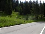 2
2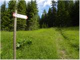 3
3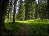 4
4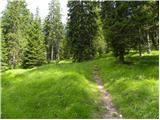 5
5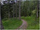 6
6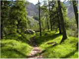 7
7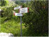 8
8 9
9 10
10 11
11 12
12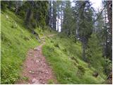 13
13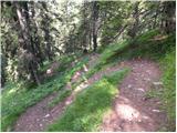 14
14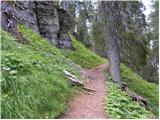 15
15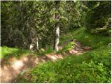 16
16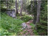 17
17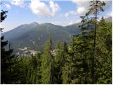 18
18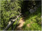 19
19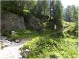 20
20 21
21 22
22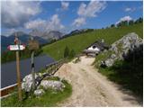 23
23 24
24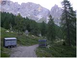 25
25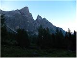 26
26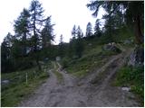 27
27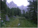 28
28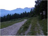 29
29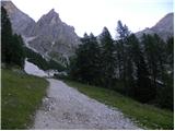 30
30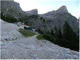 31
31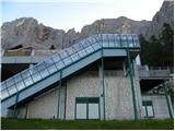 32
32 33
33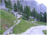 34
34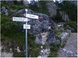 35
35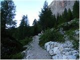 36
36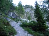 37
37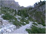 38
38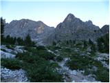 39
39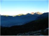 40
40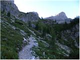 41
41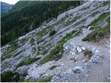 42
42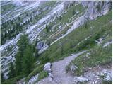 43
43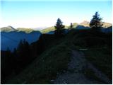 44
44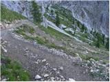 45
45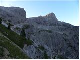 46
46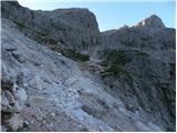 47
47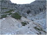 48
48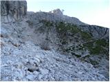 49
49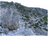 50
50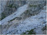 51
51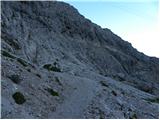 52
52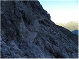 53
53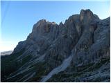 54
54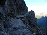 55
55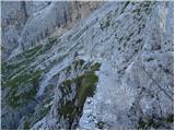 56
56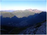 57
57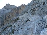 58
58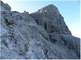 59
59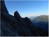 60
60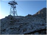 61
61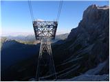 62
62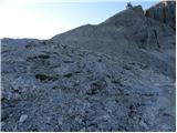 63
63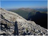 64
64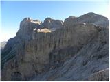 65
65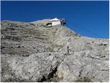 66
66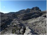 67
67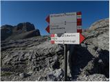 68
68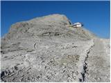 69
69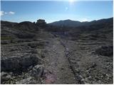 70
70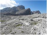 71
71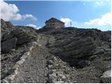 72
72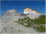 73
73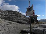 74
74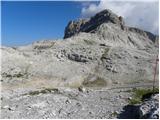 75
75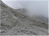 76
76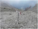 77
77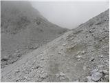 78
78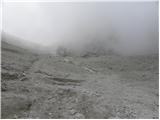 79
79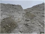 80
80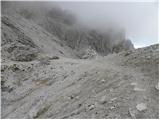 81
81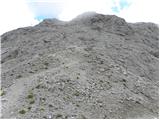 82
82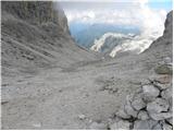 83
83 84
84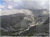 85
85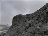 86
86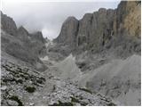 87
87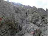 88
88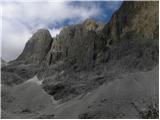 89
89 90
90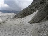 91
91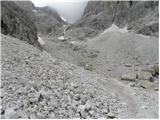 92
92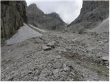 93
93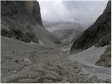 94
94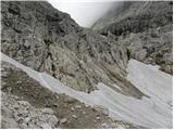 95
95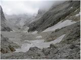 96
96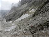 97
97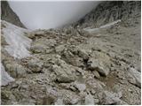 98
98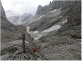 99
99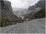 100
100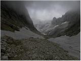 101
101 102
102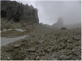 103
103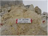 104
104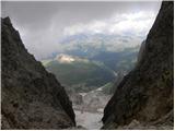 105
105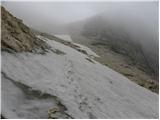 106
106 107
107 108
108 109
109 110
110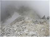 111
111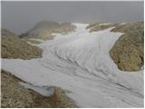 112
112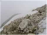 113
113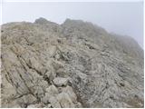 114
114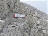 115
115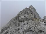 116
116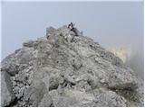 117
117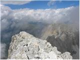 118
118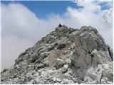 119
119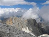 120
120
Discussion about the trip San Martino - Cima Vezzana (via Rifugio Rosetta)
To post a comment you must log in:
If you do not yet have a username, you must first
register.