Trnovec - Osolnik (via Govejski graben)
Starting point: Trnovec (390 m)
| Latitude/Longitude: | 46,12350°N 14,35370°E |
| |
Route name: via Govejski graben
Walking time: 1 h 15 min
Difficulty: easy marked way
Elevation gain: 468 m
Elevation difference along the route: 468 m
Map: Ljubljana - okolica 1:50.000
Recommended equipment (summer):
Recommended equipment (winter): crampons
Views: 6.820
 | 2 people like this post |
Access to starting point:
A) First, we drive to Medvode, then at the Spar store we leave the main road and continue towards the railway station and settlement Sora. In Sora we turn left in the direction of Katarina; when we arrive in the settlement Trnovec, we pay attention to the red signposts for Osolnik, which we notice on the right side of the main road. About 100 meters further ahead, at the turn-off of the macadam road, there are more. We park on the parking lot by the road, between both turn-offs of the paths to Osolnik.
B) From Kranj we drive towards Škofja Loka, from the outskirts of Škofja Loka we then follow the signs for Gorenjo vas. Before the Sten tunnel, from the roundabout we take the exit in the direction of the settlement Sora. We then drive through the settlements Hosta, Pungert, Gosteče and Draga, to the settlement Sora, where we turn right towards Katarina. When we arrive in the settlement Trnovec, we pay attention to the red signposts for Osolnik, which we notice on the right side of the main road. About 100 meters further ahead, at the turn-off of the macadam road, there are more. We park on the parking lot by the road, between both turn-offs of the paths to Osolnik.
C) From Poljanska dolina we drive towards Škofja Loka and then along the bypass and through the Sten tunnel. After the tunnel we turn right and follow the signs for the settlement Sora. We then drive through the settlements Hosta, Pungert, Gosteče and Draga, to the settlement Sora, where we turn right towards Katarina. When we arrive in the settlement Trnovec, we pay attention to the red signposts for Osolnik, which we notice on the right side of the main road. About 100 meters further ahead, at the turn-off of the macadam road, there are more. We park on the parking lot by the road, between both turn-offs of the paths to Osolnik.
Route description:
From the starting point, we head onto the side road in the direction of Osolnik, the Osovnik log cabin and the Dom na Govejku mountain hut. Initially, we ascend along the macadam road, from which a mountain path to Govejek soon branches off to the left; we continue along the road to the right bend, where after crossing the Govejski graben stream we continue left onto the marked mountain path. For some time we ascend beside the stream, then the path turns slightly left and goes onto the slope. There follows a few minutes of steep ascent, then we arrive at a marked junction, where we continue right towards Osolnik (left Govejek). After a short gentle traverse we arrive at the macadam road, which we reach at the intersection; from the intersection we continue on the cart track in the direction of Osolnik. Soon we return to the road, but leave it again when the signs for the Osovnik log cabin direct us right onto a path, along which we quickly ascend to the mentioned log cabin.
At the log cabin we step onto the macadam road, along which in some 10 steps we descend to the road which we left before the log cabin, and continue walking right to a smaller saddle, where we continue left. We ascend along the road past a hayrack, then before the last house we go slightly right onto the ascending cart track, along which with nice views we continue all the way to the nearby little church and to the summit, which is located a little behind the church.
Description and pictures refer to the condition in 2018 (March).

Photos:
 1
1 2
2 3
3 4
4 5
5 6
6 7
7 8
8 9
9 10
10 11
11 12
12 13
13 14
14 15
15 16
16 17
17 18
18 19
19 20
20 21
21 22
22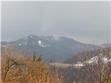 23
23 24
24 25
25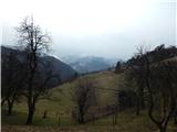 26
26 27
27 28
28 29
29 30
30 31
31 32
32 33
33 34
34 35
35 36
36
Discussion about the trip Trnovec - Osolnik (via Govejski graben)
To post a comment you must log in:
If you do not yet have a username, you must first
register.