Türlwandhütte - Hoher Dachstein (via Hunerscharte)
Starting point: Türlwandhütte (1695 m)
| Latitude/Longitude: | 47,45010°N 13,61762°E |
| |
Route name: via Hunerscharte
Walking time: 5 h 45 min
Difficulty: very difficult marked way
Via ferrata: B
Elevation gain: 1300 m
Elevation difference along the route: 1330 m
Map:
Recommended equipment (summer): helmet, self belay set
Recommended equipment (winter): helmet, self belay set, ice axe, crampons
Views: 10.439
 | 3 people like this post |
Access to starting point:
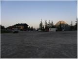
Through the Karawanks Tunnel, we drive into Austria, and then we continue driving on the Tauern highway. Further, we drive through the Katschberg Tunnel and later also the Tauern Tunnel / Tauerntunnel, and we follow the highway towards Salzburg (also Solnograd) only to the exit for Radstadt, Schladming. We continue on the road to the town of Schladming where we then continue left onto the ascending road following the signs for Ramsau. In the town of Ramsau, we continue a good 2 km on the mentioned road, and then we turn right onto a toll road, where the signs for the gondola cable car direct us. We follow this road all the way to the large parking lot in front of the lower station of the gondola cable car.
Route description:
From the parking lot, we continue past the lower cable car station following the signs Südwandhütte. The path first leads on the right side of the cable car through a sparse larch forest, later turns to the left and crosses the slopes towards the west. Soon the path towards the climbing garden (Klettergarten) branches off to the right. We still cross the slopes towards the west and from the left the path from a lower starting point joins us. From the junction, approximately 10 minutes of walking follow on a scenic slope to the hut Südwandhütte.
At the hut, we continue right following the signs Hunerscharte and ascend a short grassy ridge above the hut. The path then brings us to the southern mostly grassy slopes below the summit Scheiblingstein. We cross the slopes in a gentle ascent towards the east and the path brings us into the valley below the gondola cable car. Here the path turns left and starts to ascend up the valley. During the ascent through the valley, we have a nice view towards the peaks Türlspitz, and soon a view towards the summit Hunerkogel also opens up, where the gondola cable car leads. The path further runs on the right side of the valley and starts to ascend somewhat more steeply. Higher up, the path turns slightly to the left and ascends the scree, which brings us to the more demanding part of the path.
The path first ascends along the steel cable, then becomes a shade steeper and some pegs and staples assist us. We continue ascending along the steel cable and soon arrive below the wall of Hunerkogel where to the left branches off the extremely demanding climbing path Skywalk Klettersteig.
Our path here turns to the right and starts steeply ascending along the steel cable with the help of numerous pegs and staples (difficulty B). The path then becomes slightly less steep for a short time (difficulty A/B), then follows another ascent up the steep gully with the help of pegs towards the notch Hunerscharte (B).
On the notch where a view towards the north opens up, we continue left following the signs Bergstation Hunerkogel. First, we ascend along the ridge towards the west, then the path turns right towards the glacier. Here the climbing path to Hunerkogel branches off to the left (difficulty C/D), while we continue on the path that starts gently descending on the glacier. When walking on the glacier, we stick to the marked path, as there are also crevasses on the glacier. After a short descent, the path brings us to a junction, where we continue left and start ascending towards the saddle Gjaidsteinsattel.
On the saddle, we continue right, while to the left there is only a short ascent to the summit of Hunerkogel where the upper station of the gondola cable car is. On the other side of the saddle is a new junction, where the path to Gjaidstein and further to the hut Simony Hütte branches off to the right.
We continue on the marked path on the glacier, which starts to descend gently. Further on, the path turns left and starts ascending again towards the west. The path runs below the slopes of the peak Hohes Dirndl and offers very nice views of the peaks above the glacier. Higher up, where the marked path turns left towards the hut to which there is only a short ascent, we continue straight and leave the marked path.
Here we then head slightly left towards the eastern ridge of the peak Hoher Dachstein. During the ascent on the glacier, we will also cross a glacier crevasse, which is marked with a warning sign. On this section, the glacier is still relatively flat and we soon reach below the rocky slopes of the eastern ridge where we leave the glacier.
To the start of the secured path, we must first climb about 20 meters from the glacier up a fairly steep unsecured slope. On this section, belaying with a rope is recommended. The initial steep section can otherwise be avoided by continuing briefly on the glacier then sharply left and ascending a narrow gully to the secured path. In this section, the glacier is slightly steeper and we cross another smaller crevasse.
When we reach the secured path, we continue ascending quite steeply along the eastern ridge (difficulty up to B). The path then becomes a shade less steep and runs on the right side of the ridge. Later, the path turns right from the ridge and after crossing a ledge joins the path that runs across the glacier.
At the junction, we continue left and start ascending somewhat more steeply again (B). Further on, the path ascends steeply several times with the help of pegs and staples, then we soon reach the summit.

Photos:
 1
1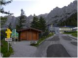 2
2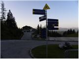 3
3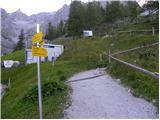 4
4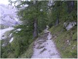 5
5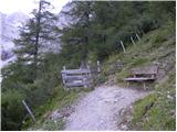 6
6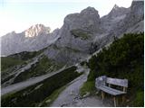 7
7 8
8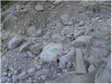 9
9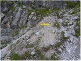 10
10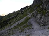 11
11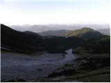 12
12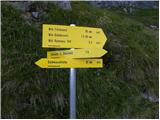 13
13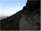 14
14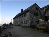 15
15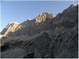 16
16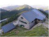 17
17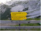 18
18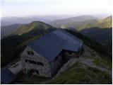 19
19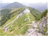 20
20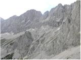 21
21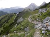 22
22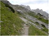 23
23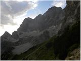 24
24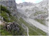 25
25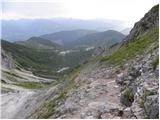 26
26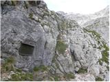 27
27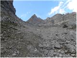 28
28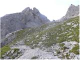 29
29 30
30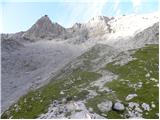 31
31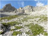 32
32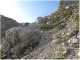 33
33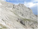 34
34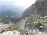 35
35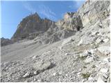 36
36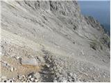 37
37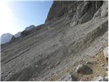 38
38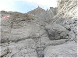 39
39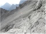 40
40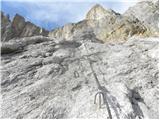 41
41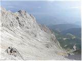 42
42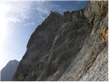 43
43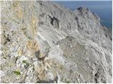 44
44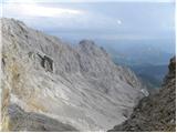 45
45 46
46 47
47 48
48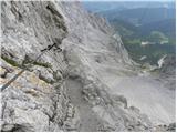 49
49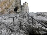 50
50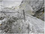 51
51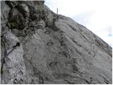 52
52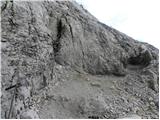 53
53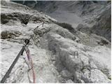 54
54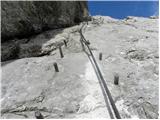 55
55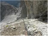 56
56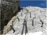 57
57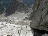 58
58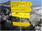 59
59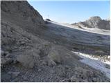 60
60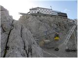 61
61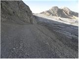 62
62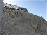 63
63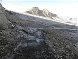 64
64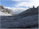 65
65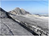 66
66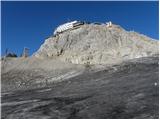 67
67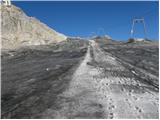 68
68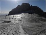 69
69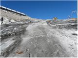 70
70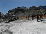 71
71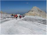 72
72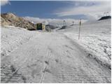 73
73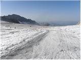 74
74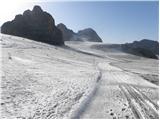 75
75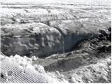 76
76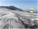 77
77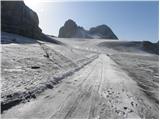 78
78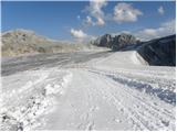 79
79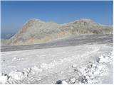 80
80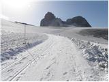 81
81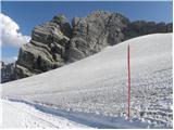 82
82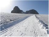 83
83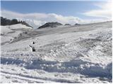 84
84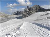 85
85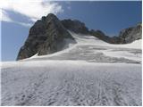 86
86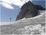 87
87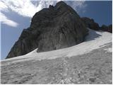 88
88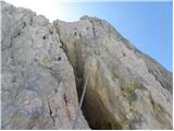 89
89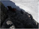 90
90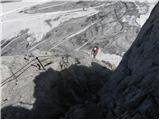 91
91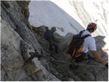 92
92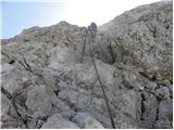 93
93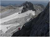 94
94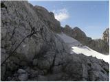 95
95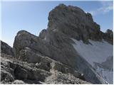 96
96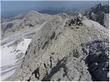 97
97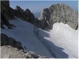 98
98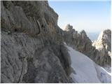 99
99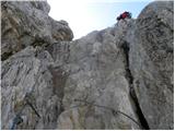 100
100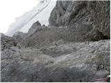 101
101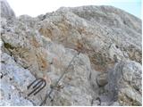 102
102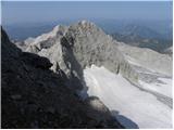 103
103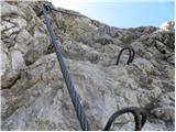 104
104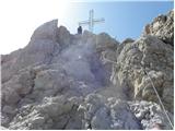 105
105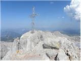 106
106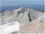 107
107 108
108
Discussion about the trip Türlwandhütte - Hoher Dachstein (via Hunerscharte)
|
| felix20. 08. 2014 |
How long does it take to the summit of Dachstein via the mentioned route from the upper cable car station at Hunerkogel?
Thanks and best regards!
|
|
|
|
| Lunca9. 07. 2017 |
Is the summit quite crowded?
|
|
|
|
| dprapr9. 07. 2017 |
Yes, especially after the Johann via ferrata.
From the upper cable car station there are queues towards the notch below the summit. For cable car access on weekends, booking a ride is recommended.
|
|
|
|
| Lunca9. 07. 2017 |
Oh just one more thing, from that notch below the summit, is there a normal path to the summit?
|
|
|
|
| dprapr9. 07. 2017 |
Yes, the secured one goes along the ridge, the other via the glacier and joins the ridge in the upper part. The other is crumbly and less secured right after the glacier (sometimes extreme steepness!). At least that's how it was a few years ago...
|
|
|
|
| Lunca9. 07. 2017 |
Now really thanks dprapr.
|
|
|
To post a comment you must log in:
If you do not yet have a username, you must first
register.