Unterpirkach - Hochstadelhaus (ÖTK - Klettersteig Pirknerklamm)
Starting point: Unterpirkach (636 m)
Route name: ÖTK - Klettersteig Pirknerklamm
Walking time: 3 h 45 min
Difficulty: very difficult marked way
Via ferrata: C
Elevation gain: 1144 m
Elevation difference along the route: 1144 m
Map: Kompass, Lienzer Dolomiten/Lesachtal 1:50.000
Recommended equipment (summer): helmet, self belay set
Recommended equipment (winter): helmet, self belay set, ice axe, crampons
Views: 2.891
 | 2 people like this post |
Access to starting point:
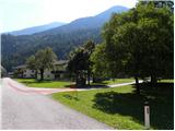
From Ljubljana through the Karawanks Tunnel and then on the highway to Spittal. We continue driving in the direction of Lienz, but drive through the Drau valley to Oberdrauburg, where we turn left in the direction of Kötschach and Plöckenpass. Immediately after the river Drau and railway track we turn right (by the crossroad we notice many signs, among them also for mountain hut Hochstadelhaus), and then on a somewhat narrower road we reach Unterpirkach. Here only a few dozen meters before the bigger chapel, which we notice on the right side, we turn left (here we already see first signs for climbing path) and on an asphalt road we drive only another 100 meters, then signs "OTK-Klettersteig Pirknerklamm" point us to the right on a macadam road, on which we quickly arrive at the parking lot.
Route description:
From the parking lot, we continue on a macadam road which past the house brings us into the forest. We continue on a forest path which runs on the left side of the stream Pirkner Bach. The path soon brings us to a crossing, where signs »Einstieg ÖTK Klettersteig« point us to the right downwards towards the stream where the climbing path starts.
Climbing path all the time runs by the stream and already at the beginning with the help of numerous pegs vertically ascends over the boulder. Further, the path crosses rocky slopes just above the stream and then brings us to steel cable by which we cross the stream on the right side. After a short crossing the path ascends vertically with the help of pegs and brings us to the next bridge, which crosses the stream again on the left side. Above the bridge crossing of the vertical wall to the left follows and then a short ascent on the boulder on which there is a logbook box. Next follows an ascent over a few boulders, and then we cross a short bridge, that runs just by the waterfall. This time as well the bridge is made of only two steel cables. One is intended for walking, the other one for holding and self-belaying. Further, we climb for some time from boulder to boulder, after that the gorge turns slightly to the left. Here we ascend on a rocky slope on the left side of the stream and soon in front of us we notice a dam over which the waterfall Regenbogen Wasserfall falls. With the help of pegs we ascend by the waterfall almost vertically upwards.
Above the waterfall the riverbed of the stream becomes less steep and some walking by the stream follows. We then cross the stream to the right side and continue to walk by the stream. The path then brings us to the last climbing part, where first we cross vertical rocky slope above the stream and then with the help of numerous brackets we ascend right upward by the dam.
Here the climbing path ends and a zigzag ascent through the forest follows. At first, the path is still secured with a steel cable, after that on a less steep slope it brings us to a crossing. To the right leads the path back towards the starting point, to the left leads the path towards the mountain hut Hochstadelhaus.
If we continue towards the mountain hut Hochstadelhaus then we ascend on a narrow footpath through the forest and soon join the normal path towards the mountain hut.
We continue on a well-beaten path, which higher crosses a road (road is closed for public traffic), then returns into the forest and past Hilda's smoking bench brings us again to a forest road. We leave the road immediately, the marked path higher crosses it a few more times, or continues along it briefly. Higher the forest thins out, so nice views open up towards the east, where we clearly see the river Drau and part of the Gailtal Alps. The path higher returns to the road, which we then follow all the way to the mountain hut Hochstadelhaus.

Along the route: Regenbogen Wasserfall (730m)
Photos:
 1
1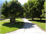 2
2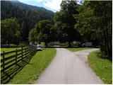 3
3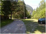 4
4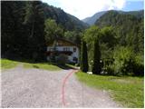 5
5 6
6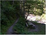 7
7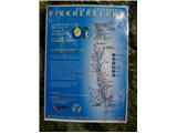 8
8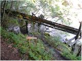 9
9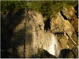 10
10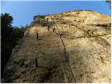 11
11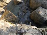 12
12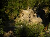 13
13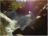 14
14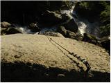 15
15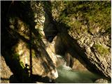 16
16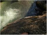 17
17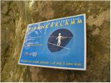 18
18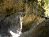 19
19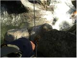 20
20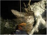 21
21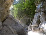 22
22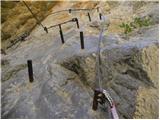 23
23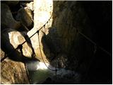 24
24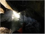 25
25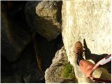 26
26 27
27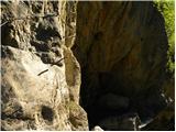 28
28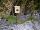 29
29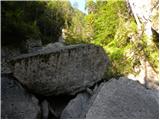 30
30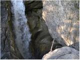 31
31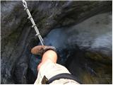 32
32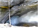 33
33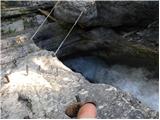 34
34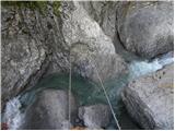 35
35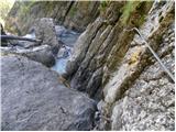 36
36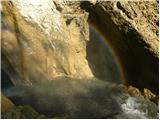 37
37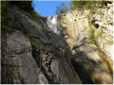 38
38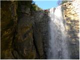 39
39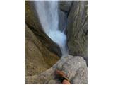 40
40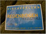 41
41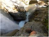 42
42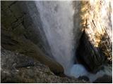 43
43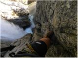 44
44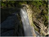 45
45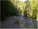 46
46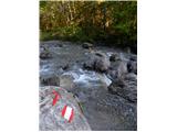 47
47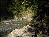 48
48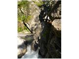 49
49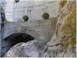 50
50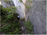 51
51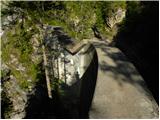 52
52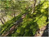 53
53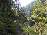 54
54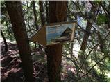 55
55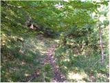 56
56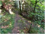 57
57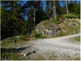 58
58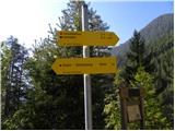 59
59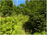 60
60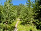 61
61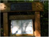 62
62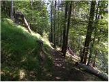 63
63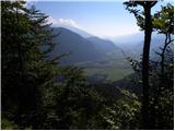 64
64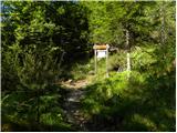 65
65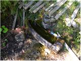 66
66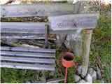 67
67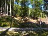 68
68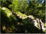 69
69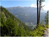 70
70 71
71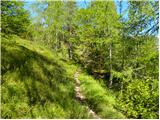 72
72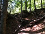 73
73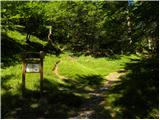 74
74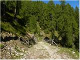 75
75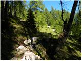 76
76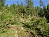 77
77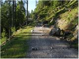 78
78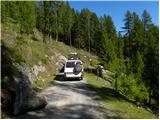 79
79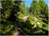 80
80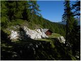 81
81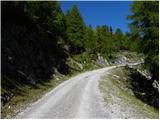 82
82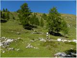 83
83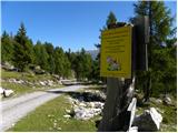 84
84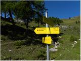 85
85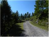 86
86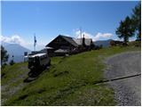 87
87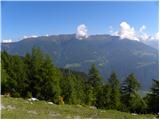 88
88 89
89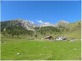 90
90
Discussion about the trip Unterpirkach - Hochstadelhaus (ÖTK - Klettersteig Pirknerklamm)
To post a comment you must log in:
If you do not yet have a username, you must first
register.